 Amalfi Coast fires in Italy
A series of wildfires have been burning on the Amalfi coast in Italy since July, particularly around the area of Mount Vesuvius. The fires in July were examined with our previous Sentinel-2 and Landsat 8 image comparisons, but with the fires now extending into another month, we provide an update on the situation as witnessed by Sentinel-2 and Landsat 8. The Amalfi Coast (Italian: Costiera Amalfitana) is a stretch of coastline on the southern coast of the Salerno Gulf on the Tyrrhenian Sea, located in the Province of Salerno. The Amalfi Coast is a popular tourist destination for the region and Italy as a whole, attracting thousands of tourists annually. In 1997, the Amalfi Coast was listed as a UNESCO World Heritage Site. During the 10th–11th centuries, the Duchy of Amalfi existed on the territory of the Amalfi Coast, centered in the town of Amalfi. The Amalfi coast was later controlled by the Principality of Salerno, until Amalfi was sacked by the Republic of Pisa in 1137. Like the rest of the region, the Amalfi Coast lies in a Mediterranean climate, featuring warm summers and mild winters. It is located on the relatively steep southern shore of the Sorrentine Peninsula, leaving little room for rural and agricultural territories. The coast comprises 11,231 hectares between the Gulf of Naples and the Gulf of Salerno. The only land route to the Amalfi Coast is the 40 kilometre long Strada Statale 163 which runs along the coastline from the town of Vietri sul Mare in the east to Positano in the west. Thirteen municipalities are located on the Amalfi Coast, many of them centered on tourism. More information is available on Wikipedia
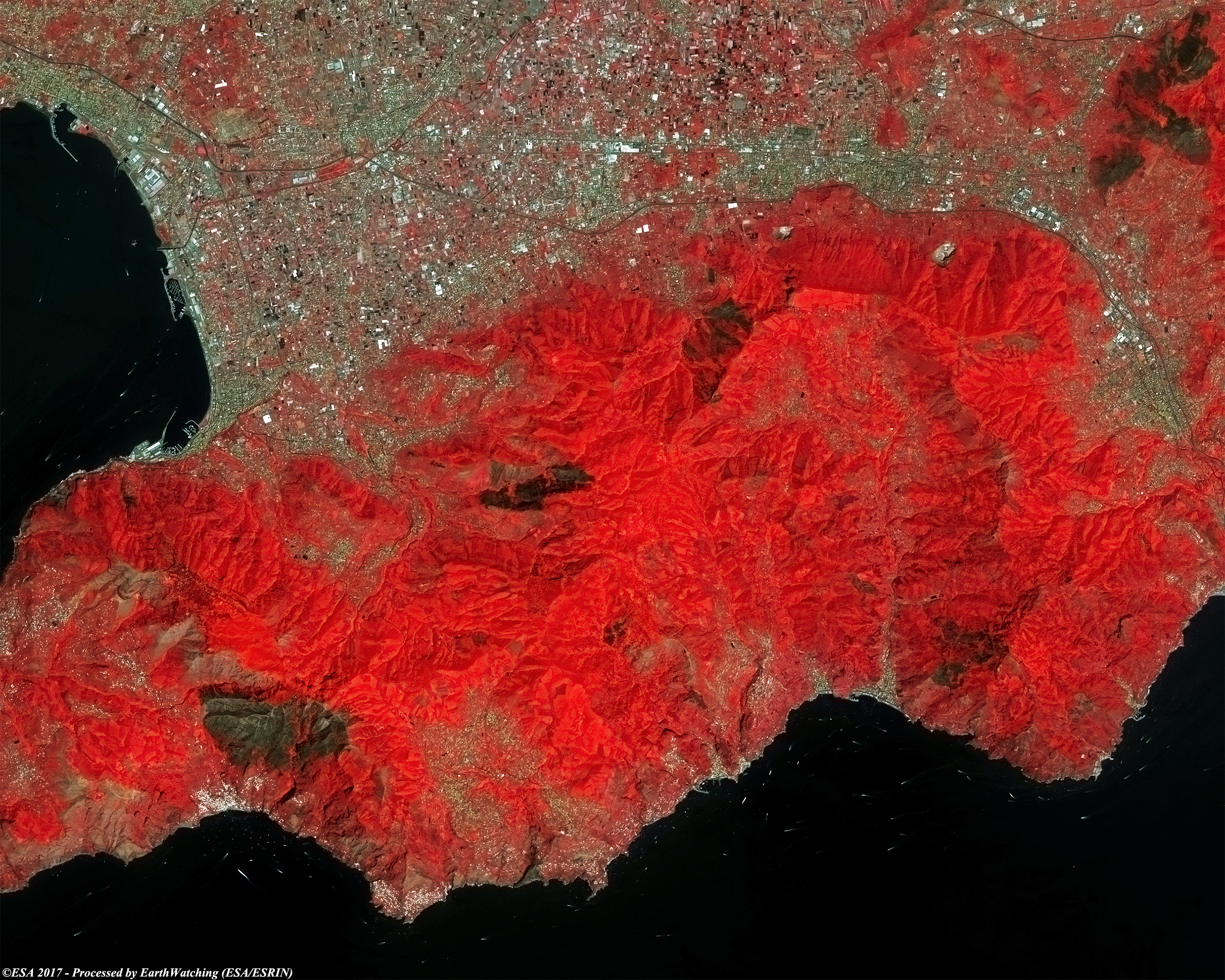
These images acquired by Landsat 8 OLI with a time window of three months, aim to show the large areas destroyed by fires. In the images we can also see other areas along the coast which have been burned. In this comparison the large area burned around Mount Vesuvius in July 2017 can be see at the top left. The band combination used makes the considerable damage to vegetation visible, highlighted in brown. Another aim of these images is to promote the opportunity to download Landsat data through the ESA portals, where images captured every day are made available in near real time to the users and the scientific community. Landsat full resolution data products are freely available for immediate download at: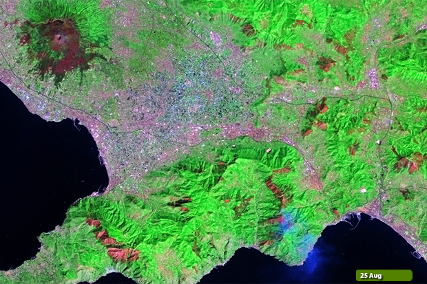 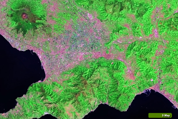 View Landsat 8 OLI large format slider View high resolution image (Before) (JPG 5.7 MB) View high resolution image (After) (JPG 5.7 MB)
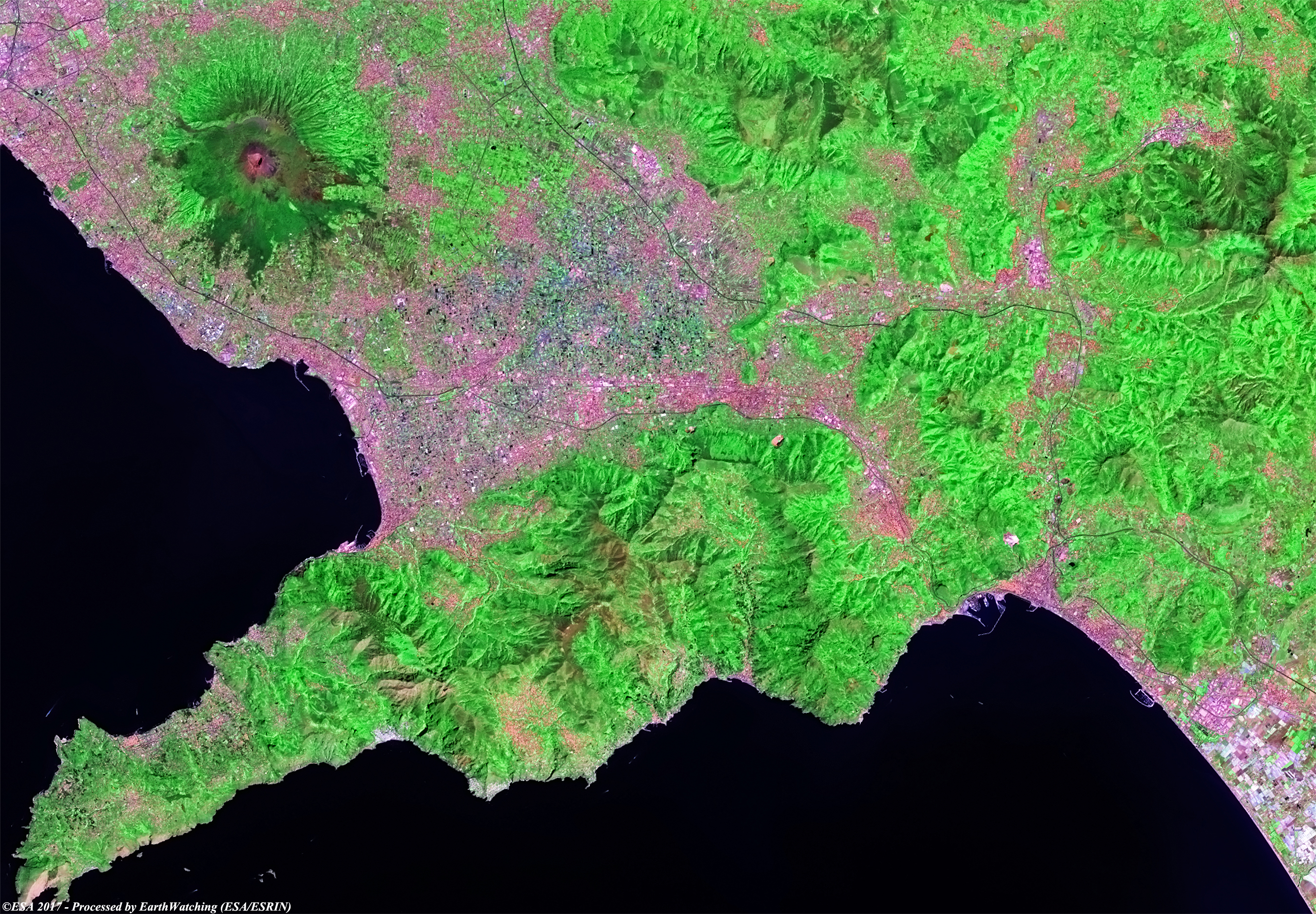
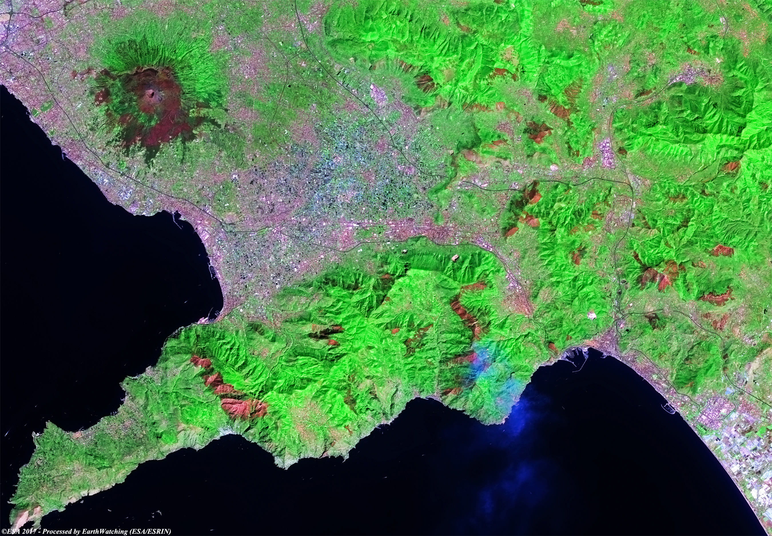
In these Sentinel-2 images acquired through a combination of optical bands in false colour, we aim to focus on the area along the Amalfi coast, and the large areas which have been burned between July and August. In the comparison we can see the areas of forest destroyed by fire (in black) during this small time window. Moreover, by viewing the images in full resolution, it's possible to see the plume over Positano and near Ravello where fires are still burning. With this demonstration of images, we aim to show to the large field of application that the Copernicus satellite family has to offer. 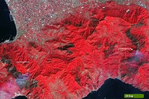 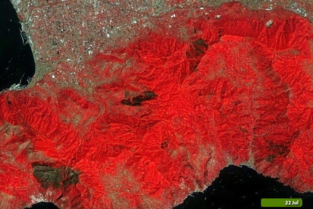 View Sentinel-2 large format slider View high resolution image (Before) (JPG 5.6 MB) View high resolution image (After) (JPG 6.0 MB)
|
||||||||||||||||||||||||||||||||||