 Asset Publisher
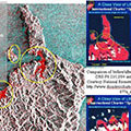
ERS-2 - Ten years in orbit (1995-2005)The ERS-2 satellite was launched on 21 April 1995, as a successor to the ERS-1 satellite. ERS-2 has now been successfully operational for ten years, and the following features highlight some of the applications the mission has been utilised for, as well as some technical details of the satellite. 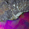
Barcelona and surroundings (Spain)This Advanced Synthetic Aperture Radar (ASAR) multi-temporal colour composite image shows an area of 100 Km swath width over the province of Barcelona, in north-eastern Spain; the capital of Barcelona Province and the autonomous region of Catalonia, a seaport on the Mediterranean Sea between the Llobregat and Besós rivers. 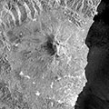
Etna and surroundings (Italy)This Envisat ASAR image, acquired on 21 March 2004, shows Mount Etna, (ancient Aetna), a volcano in southern Italy, on the eastern coast of Sicily. 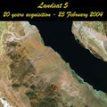
Landsat 5 - 20th Anniversary - March 2004The Landsat 5 satellite was launched on 01 March 1984, and has now been operational for 20 years, still providing new images of our world. 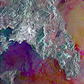
Athens, GreeceAthens is located in southeastern Greece, and is the capital and largest city of the country. 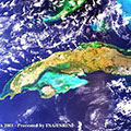
CubaThis Medium Resolution Imaging Spectrometer (MERIS) image centred over the island of Cuba is a mosaic of three images (dates: 28 February (left and right part) - 12 March (central part) 2003). 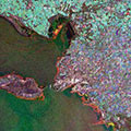
La Rochelle (France)La Rochelle, the capital of the department of Charente-Maritime, lies on an inlet of the Bay of Biscay, opposite the Ile de Ré. It is an important base for Atlantic fishing boats and is served by the major commercial port of La Pallice. 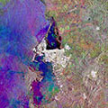
Cartagena (Colombia)Cartagena, the capital of Bolívar, is on an island formed by a shallow extension of the harbour, one of the best in northern South America. 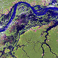
Amazon rainforest (Brazil)This Landsat 7 ETM image of the Amazon rainforest, was acquired on 08 August 1999. 
Strait of Gibraltar (Spain)This SAR multi-temporal image of the Strait of Gibraltar was generated from three separate acquisitions using the European Space Agency's environmental radar satellite ERS-2. |
||