Minimize Browse SAR Events by Year
Minimize 20 Years of SAR

1 September 2008 (from AFP) - Torrential rain and winds from Hurricane Gustav lashed the US Gulf coast early today after nearly two million people fled the killer storm. Hundreds of troops were sent into New Orleans after what is being called the biggest evacuation in US history. "The outer edge of the storm is already over the Mississippi Delta and going in toward New Orleans now, according to radar," National Hurricane Center meteorologist Patricia Wallace told AFP. The eye of the storm was not expected to make landfall until later. At 0600 GMT, the heart of Gustav was 275 kilometers southeast of New Orleans, moving towards the city at 26 km an hour.

Envisat views of Hurricane Gustav

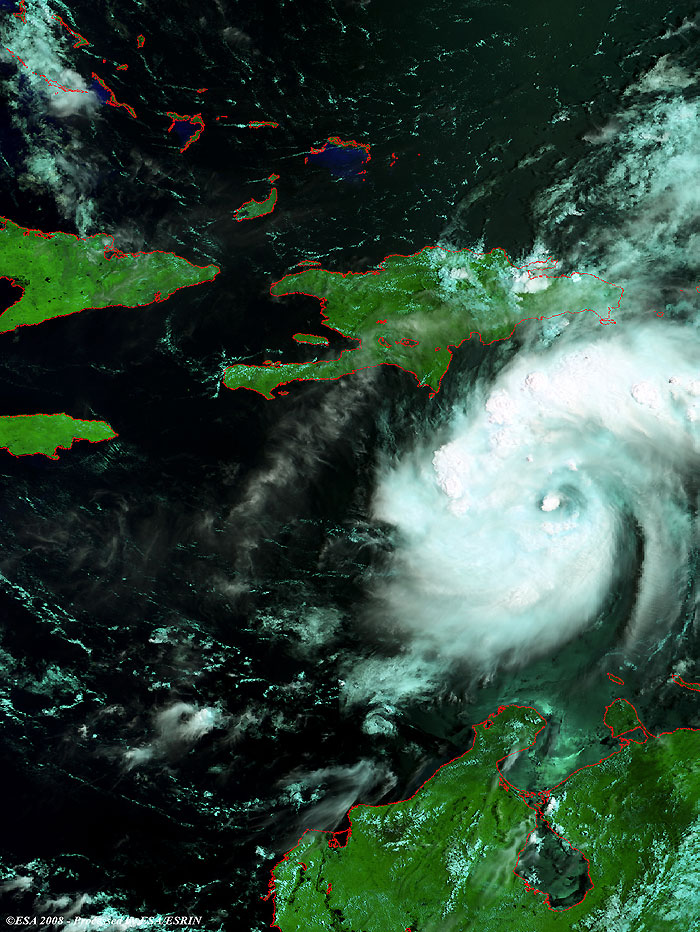
Hurricane Gustav battering the Caribbean Islands while heading toward the Gulf of Mexico.

View large image [JPG 216 KB]
Corresponding swath [GIF 34 KB]
Technical Information
Product: MERIS_RR_1P (1200 metre resolution)
Satellite: Envisat
Instrument: Medium Resolution Imaging Spectrometer (MERIS)
Date of acquisition: 25 Aug 2008
Orbit: 33918
Orbit direction: Descending
Band combination: 11, 14, 3 (RGB)

Hurricane Gustav can still be seen battering the Caribbean Islands in this image, from 28 August.

View large image [JPG 203 KB]
Corresponding swath [GIF 30 KB]
Technical Information
Product: MERIS_RR_1P (1200 metre resolution)
Satellite: Envisat
Instrument: Medium Resolution Imaging Spectrometer (MERIS)
Date of acquisition: 28 Aug 2008
Orbit: 33961
Orbit direction: Descending
Band combination: 11, 14, 3 (RGB)

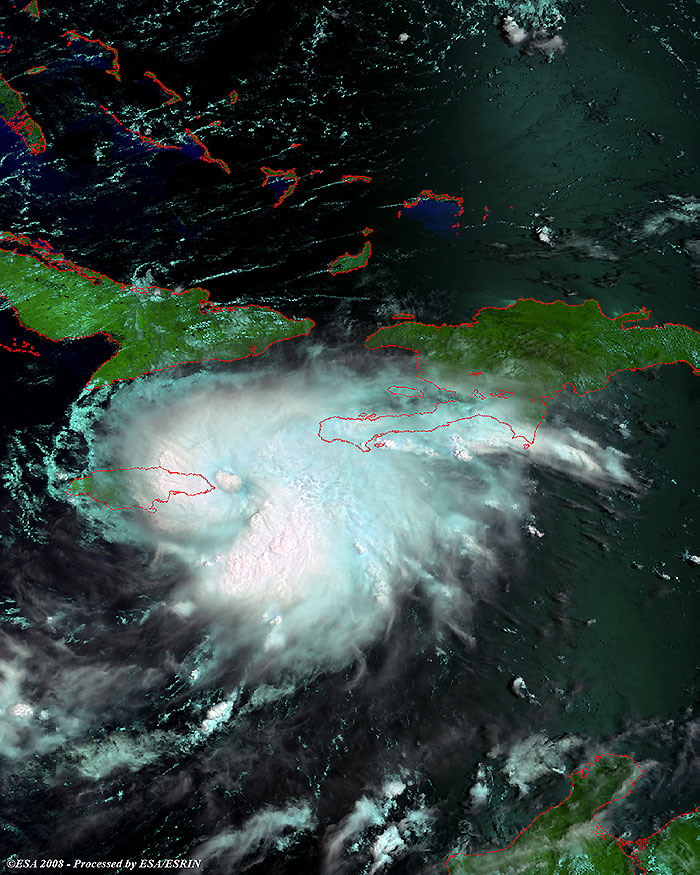
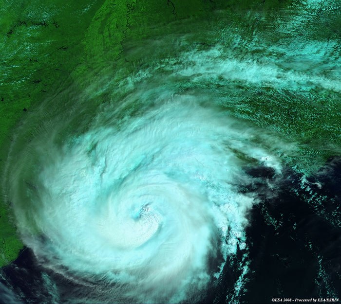
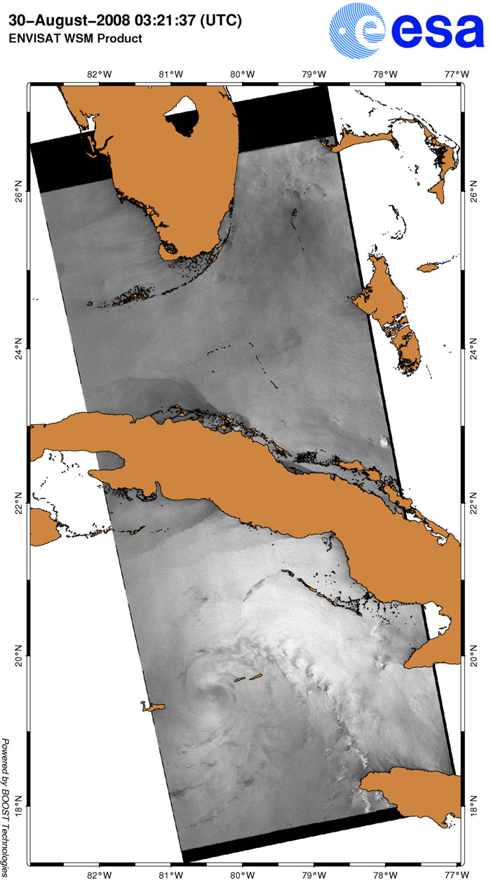
Hurricane Gustav can still be seen battering the Caribbean Islands in this image, from 30 August, but is clearly moving past them.

View large image [JPG 245 KB]
Corresponding swath [GIF 40 KB]
Technical Information
Product: MERIS_RR_1P (1200 metre resolution)
Satellite: Envisat
Instrument: Medium Resolution Imaging Spectrometer (MERIS)
Date of acquisition: 30 Aug 2008
Orbit: 33990
Orbit direction: Descending
Band combination: 11, 14, 3 (RGB)

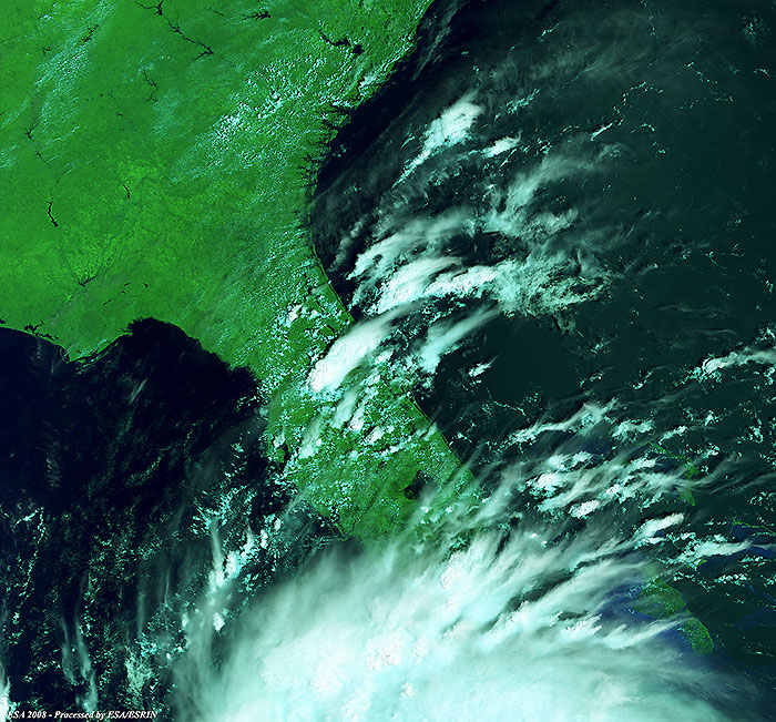
This Full Resolution image presents a magnified view of the above image, focusing on the edge of Hurricane Gustav as it passed Florida.

View large image [JPG 185 KB]
Technical Information
Product: MERIS_FR_1P (300 metre resolution)
Satellite: Envisat
Instrument: Medium Resolution Imaging Spectrometer (MERIS)
Date of acquisition: 30 Aug 2008
Orbit: 33990
Orbit direction: Descending
Band combination: 11, 14, 3 (RGB)

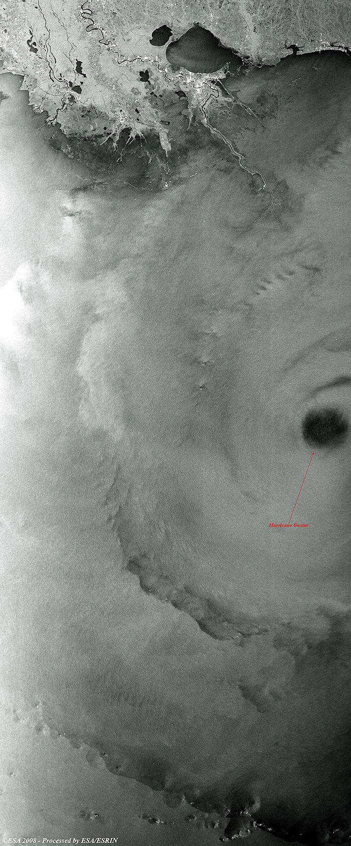
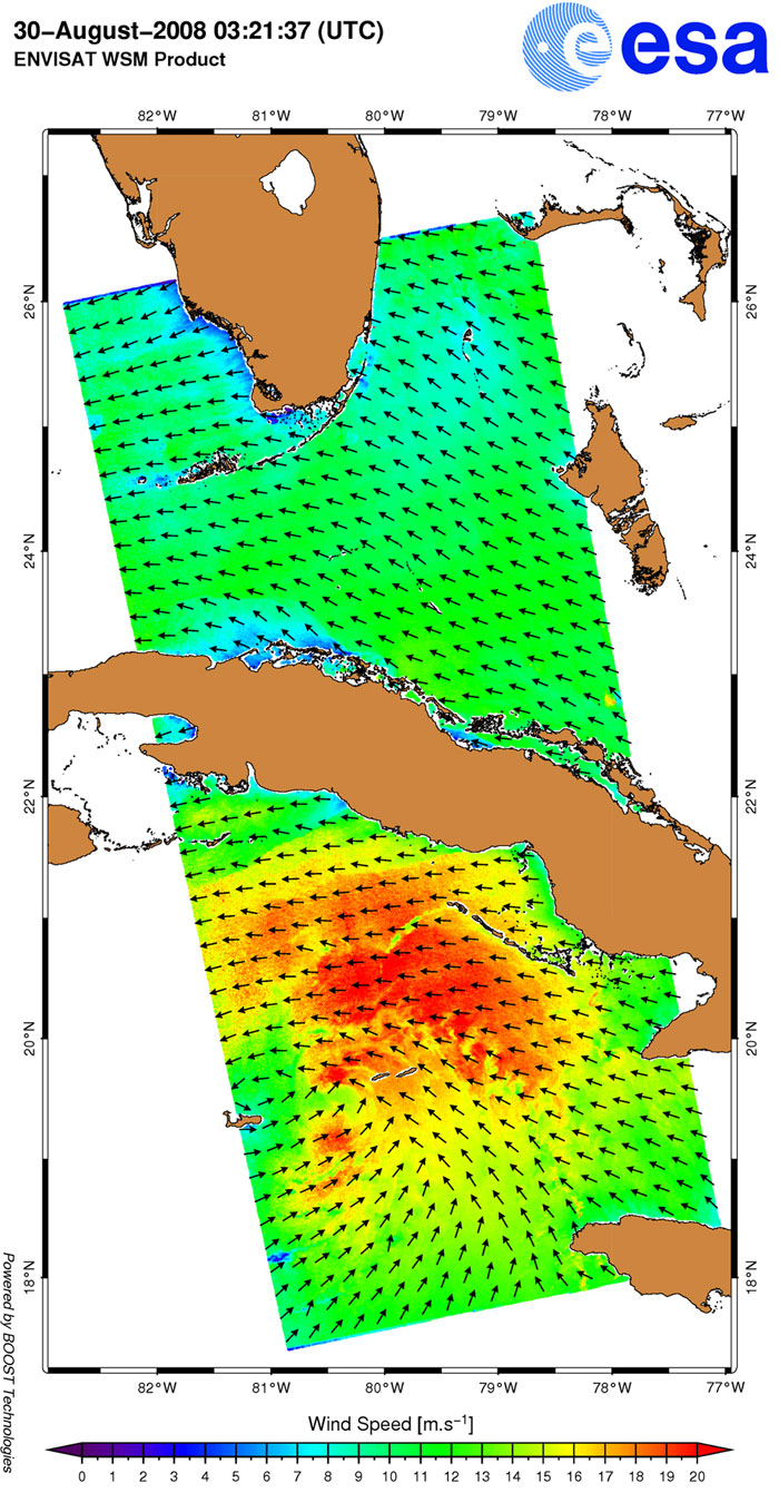
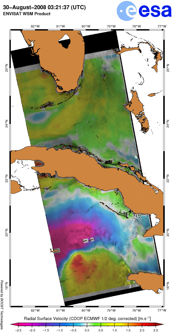
ASAR Wide Swath image showing Hurricane Gustav passing over the Caribbean Sea. Winds, currents and roughness are examined to help predict the hurricane's course.

View large image [JPG 158 KB]
Image interpretation
Technical Information
Product: ASA_WSM_1P (150 metre resolution)
Satellite: Envisat
Instrument: Advanced Synthetic Aperture Radar (ASAR)
Date of acquisition: 30 Aug 2008
Orbit: 33983
Orbit direction: Ascending

ASAR wide swath showing Hurricane Gustav passing over the Caribbean Sea.

View large image [JPG 399 KB]
Technical Information
Product: ASA_WSM_1P (150 metre resolution)
Satellite: Envisat
Instrument: Advanced Synthetic Aperture Radar (ASAR)
Date of acquisition: 01 Sep 2008
Orbit: 34012
Orbit direction: Ascending

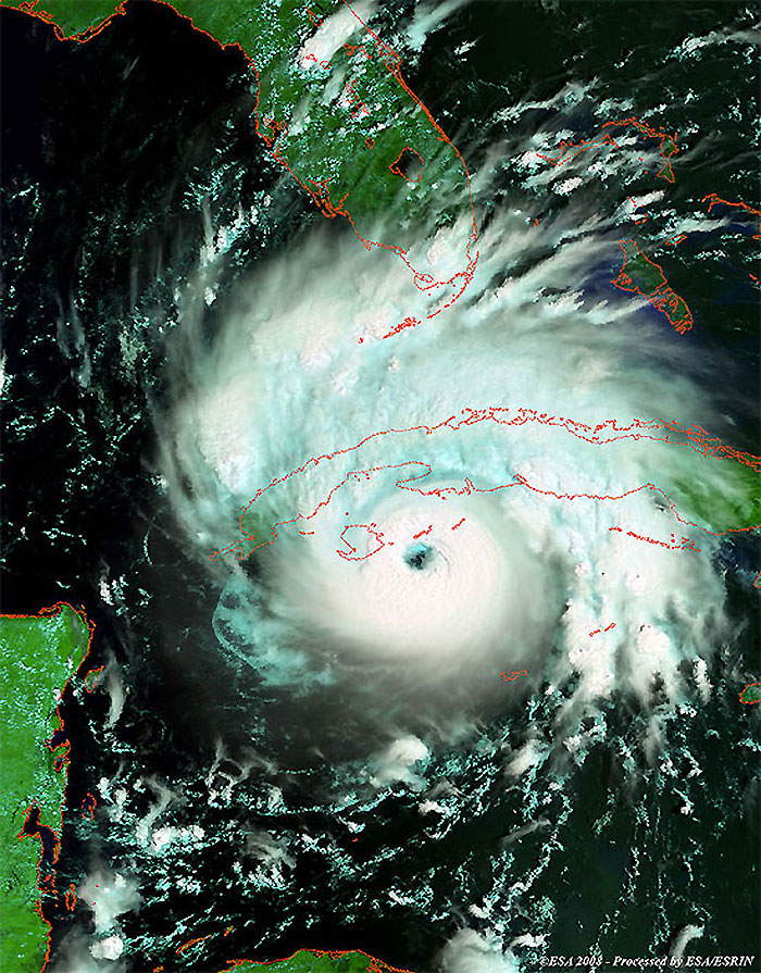
Hurricane Gustav battering the city of New Orleans. MERIS Reduced Resolution image.

View large image [JPG 222 KB]
Corresponding swath [GIF 20 KB]
Technical Information
Product: MERIS_RR_1P (1200 metre resolution)
Satellite: Envisat
Instrument: Medium Resolution Imaging Spectrometer (MERIS)
Date of acquisition: 01 Sep 2008
Orbit: 34019
Orbit direction: Descending
Band combination: 11, 14, 3 (RGB)

This Full Resolution image presents another view of the same area as the above image.

View large image [JPG 114 KB]
Technical Information
Product: MERIS_FR_1P (300 metre resolution)
Satellite: Envisat
Instrument: Medium Resolution Imaging Spectrometer (MERIS)
Date of acquisition: 01 Sep 2008
Orbit: 34019
Orbit direction: Descending
Band combination: 11, 14, 3 (RGB)

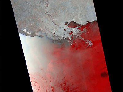
This is a GPOD FAIRE output combining an ASAR WSM product of 01 Sep at 4am with an archive of 28 July (VVpol).

The areas highlighted in red show backscatter increase and blue areas show backscatter drop. Water bodies are in black and white if no change has occurred.

Technical Information
Product: ASA_WSM_1P (150 metre resolution)
Satellite: Envisat
Instrument: Advanced Synthetic Aperture Radar (ASAR)
Date of acquisition: 28 Jul 2008 and 01 Sep 2008
Map of area

Back to top