Forests in lowland Bolivia suffer from severe deforestation caused by different types of agents and land use activities. Three major proximate causes of deforestation have been identified. The largest share of deforestation is attributable to the expansion of mechanised agriculture, followed by cattle ranching and small-scale agriculture. The results suggest that the expansion of mechanized agriculture occurs mainly in response to good access to export markets, fertile soil, and intermediate rainfall conditions. Increases in small-scale agriculture are mainly associated with a humid climate, fertile soil, and proximity to local markets. Forest conversion into pastures for cattle ranching occurs mostly irrespective of environmental determinants and can mainly be explained by access to local markets. Land use restrictions, such as protected areas, seem to prevent the expansion of mechanised agriculture but have little impact on the expansion of small-scale agriculture and cattle ranching. The analysis of future deforestation trends reveals possible hotspots of future expansion for each proximate cause and specifically highlights the possible opening of new frontiers for deforestation due to mechanised agriculture.
|
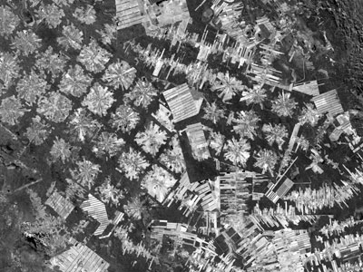
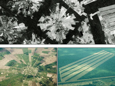
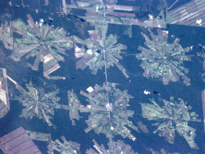
Examples of deforestation |
This image shows an area of tropical dry forest lying east of Santa Cruz de la Sierra, Bolivia. Since the mid-1980s, the resettlement of people from the Altiplano (the Andean high plains) and a large agricultural development effort (the Tierras Baja project) has lead to this area's deforestation. Soybean production began in earnest in the early 1970s following a substantial increase in the crop's world price. The pie or radial patterned fields are part of the San Javier resettlement scheme. At the centre of each unit is a small community that includes a church, bar/café, school, and soccer field. The rectangular, light coloured areas are fields of soybeans cultivated for export, mostly funded by foreign loans. The dark strips running through the fields are windbreaks, which are advantageous because the soils in this area are fine and prone to wind erosion.
|
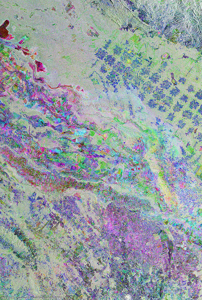
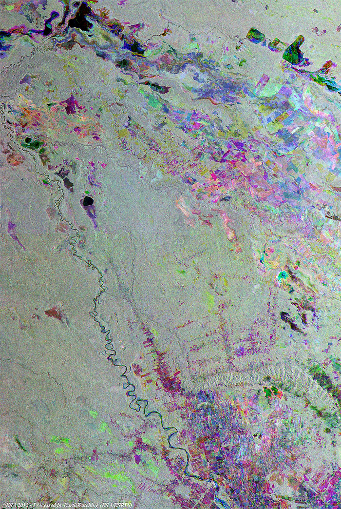
Full multi-temporal image - Track 196 |
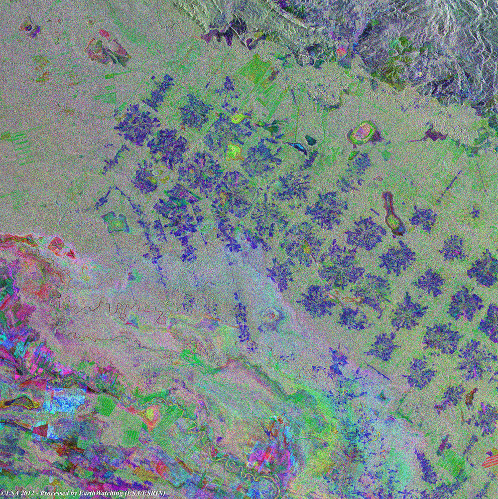
These multi-colour images show the status of deforestation to the east of Santa Cruz de la Sierra, Bolivia. The areas of rainforest where deforestation has occurred is identifiable as large areas in green and blue.
|
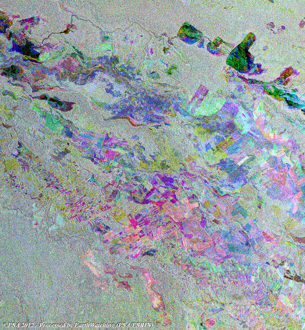
Magnified view of area - Track 196 |
|
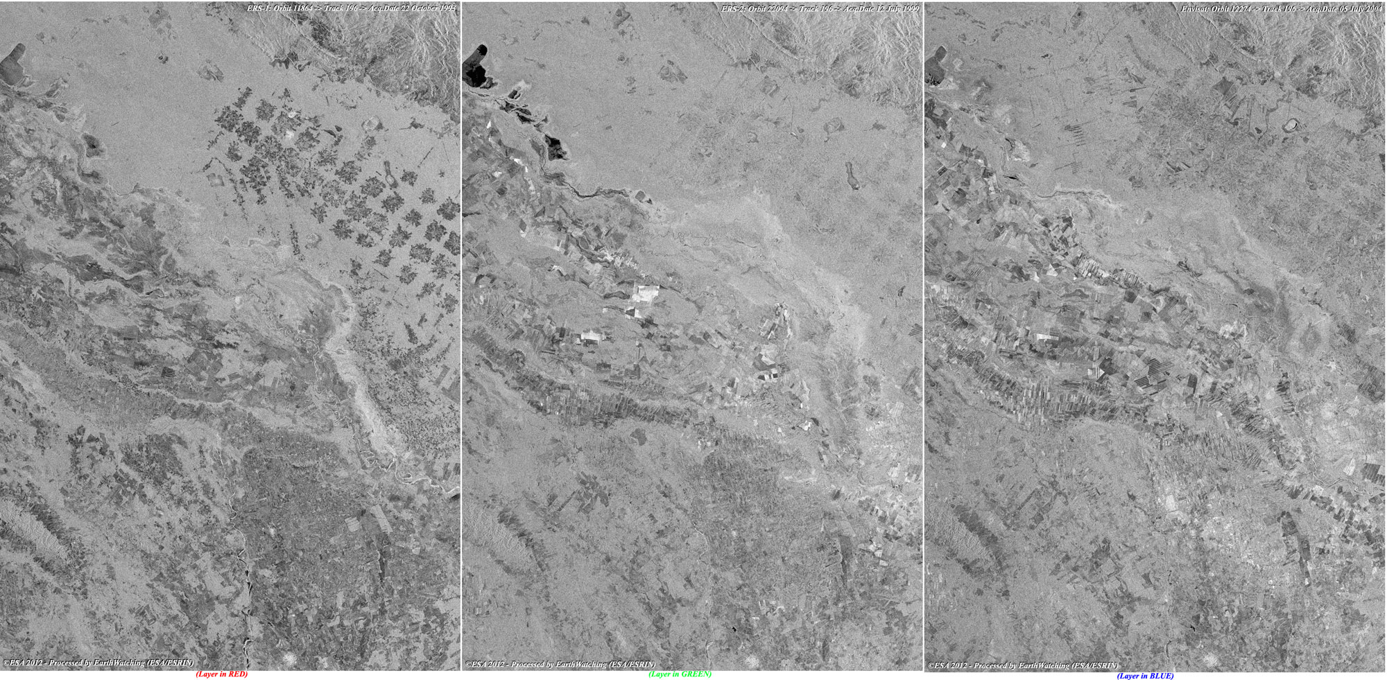
Images used to create the multi-colour merge - Track 196 |
|
Full multi-temporal image - Track 468 |
|
Technical Information |
|
Satellite: |
ERS-2 and Envisat - Synthetic Aperture Radar (SAR) / ASAR_PRI |
|
Instrument: |
Radar (30 metre resolution) |
|
Band combination: |
Multi-temporal image (RGB) |
|
Date of acquisition: |
12 Apr 1997, 26 Feb 2000, 10 Apr 2004 |
|
Orbit number: |
10342, 25372, 11043 |
|
Magnified view of area - Track 468 |
|
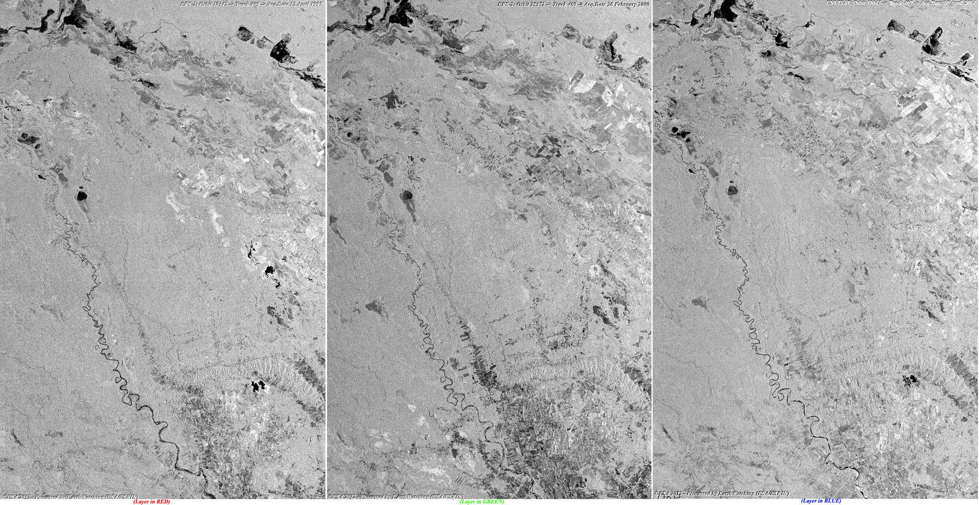
Images used to create the multi-colour merge - Track 468 |
 Browse SAR Events by Year