- All Categories (30)
- News (4)
- Missions (3)
- Events (3)
- Tools (1)
- Activities (4)
- Documents (15)
News - Thematic area articles
How satellite data empower sustainable urban growth
Some 56% of the world's population currently reside in cities and the number of urban inhabitants is expected to double by
News - Success Stories
Heritage data trains neural networks to detect urban sprawl
Since they’ve been trained identically, they can help monitor both current and past urban changes.
Activity - Projects
Dragon 3 Cooperation Programme
Surveying and Mapping China Mirjam Bilker-Koivula, Hannu Ruotsalainen Finnish Geodetic Institute Finland 10677 - GSM4GCM Current
Event - Training
EO Summer School 3
In line with observations it shows anti-cyclonically rotating surface currents and cyclonically rotating bottom currents.
Document - General Reference
Heritage Missions brochure
This brochure describes ESA's Heritage Space Programme and includes infographics describing some of the missions in the programme.
Document - Technical Note
Technical Note on Quality Assessment for Landsat 1-7
Technical Note on Quality Assessment for Landsat 1-7
Event - Workshop
Space and the Arctic 2009 Workshop
possibilities for the future : Volker Liebig, Director of ESA EO Programme Observations of the Arctic - EUMETSAT's Contribution to Current
Mission - Third Party Missions
Enhanced Thematic Mapper Plus (ETM+) Processor Releases
GCP displacement B TM radiometric calibration Update to radiometric calibration strategy for TM reflective bands (Dark Current
Mission - Third Party Missions
Multi Spectral Scanner (MSS) Processor Releases
GCP displacement B TM radiometric calibration Update to radiometric calibration strategy for TM reflective bands (Dark Current
Mission - Third Party Missions
Thematic Mapper (TM) Processor Releases
GCP displacement B TM radiometric calibration Update to radiometric calibration strategy for TM reflective bands (Dark Current
Document - Product Specifications
Landsat-TM-ETM-CEOS-ESA-Products
This document describes the standards used by ESA for the distribution of the TM and ETM+ (Thematic Mapper and Enhanced Thematic Mapper) optical sensor products.
Document - Product Handbook
AVHRR-Handbook.pdf
The AVHRR user handbook provides details about the content of the consolidated and harmonised data set archived at ESA facilities.
Activity - Cal/Val activities
UV nadir viewing galleries
Download chart A new perspective on the current state of the ozone layer derived using the merged total ozone data record
Activity - Quality
EDAP
The following missions are currently being considered as part of the Automatic Identification System (AIS) and Radio Frequency
Document - Product Document
landsat-products-description-document.pdf
LANDSAT Products Description Document
Activity - Quality
SLAP
Currently, in excess of 701,000 Level 1 TM and 84,000 Level 1 ETM+ products have been reprocessed and released under the
Tools - Visualisation
HEDAVI
ESA’s Heritage EO data currently cover more than 30 years of observations and enable the analysis of spatio-temporal dynamics
News - Operational News
Landsat-8 web portal now available on new environment
Reprocessed (Tier 1 and Tier 2) products from Matera and Kiruna stations, May 2013 - December 2018; some time windows are currently
News - Success Stories
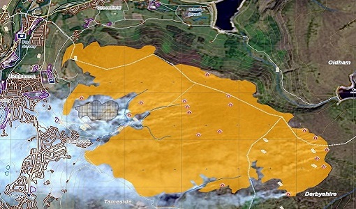
Satellite data allows real-time detection of potential fires
availability, ESA is moving from the classical Landsat 8 L1 production towards the testing of new Real Time processing pilot that currently
Event - Training
Advanced Training Course in Land Remote Sensing 2012
Objectives The objectives of this advanced Dragon training course were: To inform on past, current and future EO satellite
