- All Categories (27)
- News (3)
- Missions (11)
- Events (2)
- Activities (4)
- Documents (7)
Activity - Quality
SCIRoCCo
Author: The SCIRoCCo Team Abstract: The ERS Scatterometers in the Global Climate Observing System report describes the current
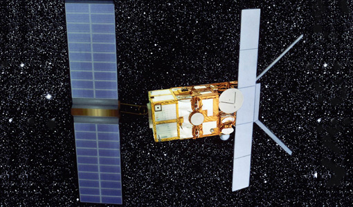
Mission - Heritage Missions

SAR (ERS) Processor Releases
It should be noted that for SAR, each product ordered is processed directly from the raw data, using the current version
News - Data Release news

New reprocessing of datasets celebrates 30 years of ERS
For each surface, the experts will use our current knowledge acquired over 30 years of experience, to improve the ERS altimetric
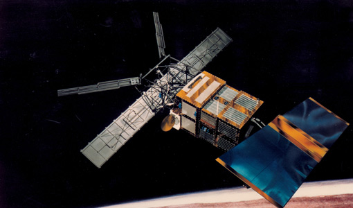
Mission - Heritage Missions
SAR (ERS)
Processor Releases It should be noted that for SAR, each product ordered is processed directly from the raw data, using the current
Document - Proceedings

ERS-Envisat-symposium-proceedings.pdf
This document contains the proceedings of the ERS-Envisat Symposium, which took place in 2000.
Mission - Heritage Missions

ERS Radar Course 1
Therefore, microwaves easily penetrate clouds, and images can be acquired independently of the current weather conditions
Document - Product Readme Note

ERS-WS-SoilMoisture-Readme-ESA-EOPG-EBA-TN-2-issue1.0.pdf
Readme file for ERS-2 Scatterometer Soil Moisture Products
Event - Training

Advanced Training Course in Ocean Remote Sensing 2011
Background and access to current and future Chinese, ESA and TPM satellite missions in ocean remote sensing were presented
Mission - Heritage Missions
Wind Scatterometer (WS) Processor Releases
The current processor software version for the operational ground segment is ASPS v 10.04.
Mission - Heritage Missions

Wind Scatterometer (WS) Quality Control Reports
The data includes instrument working modes, temperatures, currents and voltages of the transmitter and calibration chain,
Activity - Quality
REAPER
data shows a clear improvement in terms of accuracy over the tandem periods between ERS-1, ERS-2 and Envisat missions (currently
Document - Product Document

ERS-1-WSC-FDC-Product-CCT-Format.pdf
This document deals with the Product Specifications for the WSC Fast delivery copy. Valid for data processed up until end of July '95 when there was a switch in format from CEOS to CCSDS.
Document - Product Document
ERS-1-WSC-DWP-Product-CCT-Format.pdf
This document deals with the Product Specifications for the WSC de-aliased Wind Field Pressure Product.
Document - Product Readme Note
ERS_WS_Readme-ENVI-GSOP-EOGD-QD-15-0130_issue1.2.pdf
Product Quality Readme file for ERS-1/2 Wind Scatterometer Products
Event - Training
Advanced Training Course in Land Remote Sensing 2012
Objectives The objectives of this advanced Dragon training course were: To inform on past, current and future EO satellite
News - Success Stories
Trailblazing ERS-2 mission enables climate change applications
Varied elevations of Bachu in western China InSAR is currently one of the most accurate methods to generate digital elevation
Activity - Quality
SEOM CAWA
The product validation and evolution of the algorithm are currently being performed.
Document - Algorithms Theoretical Baseline Document

cawa-algorithm-theoretical-basis-water-vapor.pdf
This document provides information about the physical background, technical structure and the functional principle of the CAWA total column water vapour retrieval as defined within the SEOM CAWA 'advanced Clouds, Aerosols and WAter vapour products for Sentinel-3/OLCI' project.
Document - Algorithms Theoretical Baseline Document
cawa-requirements-baseline.pdf
CAWA (Advanced Clouds, Aerosols and WAter vapour products for Sentinel-3/OLCI) requirements baseline document provides information about the physical background, technical structure and the functional principle of the CAWA total column water vapour retrieval as defined within the CAWA project, which aims to the development and improvement of advanced atmospheric retrieval algorithms for the Envisat/MERIS and Sentinel-3/OLCI mission.
Mission - Heritage Missions
Wind Scatterometer (WS) Cal/Val
ERS-2 Scatterometer: Mission Performances and Current Reprocessing Achievements Calibration strategy for ERS scatterometer