earth online
  • Explore Missions
    • Earth Explorers
    • Heritage Missions
    • Third Party Missions
  • Explore Data
    • All Data
    • Open Data
    • Announcement of Opportunity
    • Project Proposal
    • Sample Data
    • Dashboard
  • Explore Tools
    • Analysis Tools
    • Processing Tools
    • Visualisation Tools
    • Catalogues
    • Apps
  • Explore News & Events
    • All News
    • Data Release News
    • Maintenance News
    • Operational News
    • All Events
    • Events Updates
    • Workshop
    • Conference
  • Explore Learn & Discover
    • Data Application Articles
    • Spotlight on EO Community
    • Gallery
    • FAQ
    • Success Stories
    • Infographics
    • Quality Reports Advanced Search
  • SEE ALL
  • REAPER
  • REAPER
  • Project Documents
  • REAPER
  • Project Documents
More
    • Activities
    • REAPER

    REAPER

    Overview

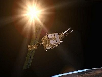
    The REAPER (REprocessing of Altimeter Products for ERS) project covers both the ERS-1 and the ERS-2 altimetry missions.

    Major improvements with respect to the previous ESA RA products format (OPR - Ocean Product - and WAP - Waveform product) have been implemented (e.g. the four Envisat RA-2 retrackers, RA calibration improvement, new reprocessed Precise Orbit Solution, ECMWF ERA-interim model, NICO09 ionospheric correction until 1998, GIM ionospheric correction up to 2003, new SSB, etc.). The assessment of the REAPER data quality versus the ERS OPR and WAP data shows a clear improvement in terms of accuracy over the tandem periods between ERS-1, ERS-2 and Envisat missions (currently assessed periods). However, the REAPER dataset presents some limitations (such as the use of poor MWR Wet tropospheric correction, out of range PTR corrections, etc.) that are fully described in the Product Handbook.

    Intercalibration between ERS-1, ERS-2 and Envisat, between all three radar altimeters and all three microwave radiometers, has led to several improvements, including the incorporation of inter-mission bias corrections. Envisat style retrackers are used in the REAPER processing, allowing easier comparison. REAPER ERS-2 data is cross-calibrated to the released Envisat v2.1 product and the REAPER ERS-1 data to REAPER ERS-2.

    This project is part of ESA's (Multi-)Sensor Timeseries activities. To facilitate the various end-user and science applications, there is a need for the agency to support and maintain the quality aspects across missions with similar sensors. The Sensor Performance, Products and Algorithms (SPPA) team's multi-sensor activities focus primarily on the sensor Fundamental Data Records (FDR), i.e. the level 1 data, on the instrument's core products, as outlined in the Mission Requirements Documents (MRD) of each mission, and on some select additional geophysical parameters that facilitate the improvements of the sensor FDR.


    Contact Information

    If you have any questions about this project, contact:

    Dr. Philippe Goryl
    Email: Philippe.Goryl@esa.int
    Organisation: ESA

    Related Mission

    ERS-1
    ESA's European Remote Sensing (ERS) satellite ERS-1 payload included a synthetic aperture imaging radar, radar altimeter and instruments to measure ocean surface temperature and wind fields.
    find out more
    ERS-2
    ESA's European Remote Sensing (ERS) satellite ERS-2 payload included a synthetic aperture imaging radar, radar altimeter and instruments to measure ocean surface temperature and wind fields.
    find out more


    Data

    Data is available via Fast Registration.

    Tweet
    Share

    Featured

    • Microsoft Office 365 outage - EOHelp service impacted - 13 November - Resolved
      Microsoft Office 365 outage - EOHelp service impacted - 13 November - Resolved
    • CryoSat Ice Baseline-F Near Real Time data products now available
    • New and improved Cryo-TEMPO products for CryoSat
    • New Announcement of Opportunity for thermal infrared imaging from HotSat constellation
    • New EarthCARE Science seminar in November

    Search with keywords

    • Active Remote Sensing
    • Altimeters
    • AMI/SAR
    • ATSR-1
    • ATSR-2
    • ERS
    • ERS-1
    • ERS-2
    • GOME
    • Imaging Radars
    • Imaging Spectrometers/Radiometers
    • Oceans
    • Passive Remote Sensing
    • RA
    • Radar Altimeters
    • Radar Spectrometers
    • Scatterometers
    • Spectrometers
    • Spectrometers/Radiometers
    • Spectrometers/Radiometers
    European Space Agency
    Terms and conditionsCookie NoticePrivacy NoticeContact UsFAQComplaintsLeave feedback