- All Categories (149)
- Data (2)
- News (13)
- Missions (18)
- Events (15)
- Tools (2)
- Activities (9)
- Documents (90)
Mission - Heritage Missions

Wind Scatterometer (WS) Quality Control Reports
The data includes instrument working modes, temperatures, currents and voltages of the transmitter and calibration chain,
Mission - Heritage Missions
Wind Scatterometer (WS) Processor Releases
The current processor software version for the operational ground segment is ASPS v 10.04.
Mission - Heritage Missions
Wind Scatterometer (WS) Cal/Val
ERS-2 Scatterometer: Mission Performances and Current Reprocessing Achievements Calibration strategy for ERS scatterometer
Activity - Cal/Val activities

UV nadir viewing galleries
Download chart A new perspective on the current state of the ozone layer derived using the merged total ozone data record
Document - User Guide

User's Guide to NASDA's SAR products
This document summarises the algorithms to obtain geometric and radiometric information from NASDA's JERS SAR products. It includes a list of the physical information to be derived from the JERS SAR products. Not applicable for JERS SAR data generated by ESA (only for NASDA data).
Document - User Guide
User Guide for JERS-1 SAR data format
This document describes the Computer Compatible Tape (CCT) format and the film format for JERS-1's Synthetic Aperture Radar (SAR) data process in EOC. The EOC's CCT product conforms to the CEOS SAR data products format Standard.
News - Thematic area articles

Transforming space data into climate action
By combining high-quality data from both current and previous missions, scientists are improving their understanding of the
News - Success Stories
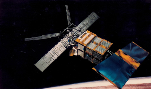
Trailblazing ERS-2 mission enables climate change applications
Varied elevations of Bachu in western China InSAR is currently one of the most accurate methods to generate digital elevation
Document - Proceedings

Third ESA International Conference on Spacecraft Guidance, Navigation and Control Systems
The proceedings from the Third ESA International Conference on Spacecraft Guidance, Navigation and Control Systems, which took place at ESTEC in Noordwijk, the Netherlands, from 26 to 29 November 1996, are presented here.
Document - General Reference

The Earth Observation Handbook, 2010 Update - Key Tables
This is the 2010 update of the CEOS Earth Observation Handbook. You can browse the live database at http://database.eohandbook.com/ or download the printable PDF of key tables based on the 2010 database contents for a handy reference.
Document - Technical Note

Technical Note on Quality Assessment for Landsat 1-7
Technical Note on Quality Assessment for Landsat 1-7
News - Thematic area articles

Space helps monitor Earth’s changing biosphere
Ocean chlorophyll concentrations can change when ocean currents shift, or sea temperature rises - all impacts of climate
Event - Workshop

Space and the Arctic 2009 Workshop
possibilities for the future : Volker Liebig, Director of ESA EO Programme Observations of the Arctic - EUMETSAT's Contribution to Current
Document - Publication - Paper

Smith_Lesson_learned_from_AATSR_and_SLSTR_prelaunch_cal.pdf
EO-Level1-Lessons-Learned-Workshop-presentation
Activity - Quality
SLAP
Currently, in excess of 701,000 Level 1 TM and 84,000 Level 1 ETM+ products have been reprocessed and released under the
News - Infographics
Showcasing success stories from ESA's Heritage Missions
success stories showcased used data from ESA's ERS (European Remote Sensing) and Envisat satellites in combination with current
Activity - Quality
SEOM CAWA
The product validation and evolution of the algorithm are currently being performed.
Event - Workshop

SEASAR 2012
Aouf 14:00 - 14:20 Towards consistent inversion of wind, waves and surface current from SAR Bertrand Chapron (IFREMER, France
Event - Workshop
SEASAR 2006
requirements Formulate recommendations for algorithm and new products development To present ESA studies results on wind, wave and currents