- All Categories (956)
- Data (7)
- News (43)
- Missions (3)
- Events (13)
- Tools (3)
- Activities (4)
- Campaigns (4)
- Documents (879)
NEWS
Discover the latest news on the European Space Agency's Earth Observation activities. Learn all about new data availability and how ESA's missions are performing.
News - Success Stories
 14 May 2019
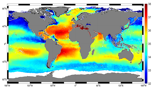
Mapping salty waters
The length and precision with which climate scientists can track the salinity, or saltiness, of the oceans is set to improve dramatically.
News - Events and Proceedings
 21 Oct 2019
Special event for 10th anniversary of SMOS
Earth Explorers for Climate - The contribution from SMOS - an event to mark the 10th anniversary of SMOS mission.
News - Success Stories
1 Apr 2020New life for Landsat historical data
45 years of data, more than 1.8 million images, these are the numbers of an adventure started 48 years ago with the launch of the first Landsat satellite.
News - Data Release news
 12 Feb 2021
New reprocessed Landsat data on a new dissemination server
The full ESA Landsat archive has been reprocessed with the latest version of the processor to provide a homogenous dataset covering MSS, TM and ETM+ data.
News - Infographics
 30 Mar 2021
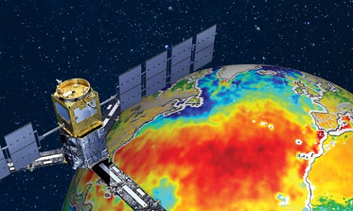
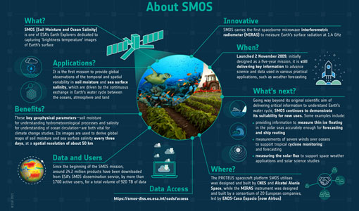
SMOS - ESA's soil moisture and ocean salinity mission
Learn more about the Soil Moisture and Ocean Salinity (SMOS) mission in our latest infographic.
News - Data Release news
 28 May 2021
SMOS level 1 and level 2 products new baseline is now available
New versions of the SMOS processors for level 1 and 2 were deployed in the operational ground segment on 25 May 2021.
News - Data Release news
 3 Aug 2021
New SMOS Level 1 Near Real Time processing baseline released
A new version of the SMOS level 1 Near Real Time processor - version 724 - was deployed in the operational ground segment on 2 August 2021.
News - Data Release news
 3 Aug 2021
New SMOS Level 2 Near Real Time Neural Network Soil Moisture baseline is released
A new version of the SMOS level 2 Near Real Time processor - version 300 - was deployed in the operational ground segment on 2 August 2021.
News - Data Release news
 4 Aug 2021
New SMOS Near Real Time Sea Surface Wind Speed new baseline is released
A new version of the SMOS Sea Surface Wind Speed processor - version 300 - was deployed at IFREMER and ESA operational ground segments on 4 August 2021.
News - General News
21 Dec 2021Updated SMOS documentation available
Updated versions of several SMOS data documents are now available.
News - Data Release news
 18 Jan 2022
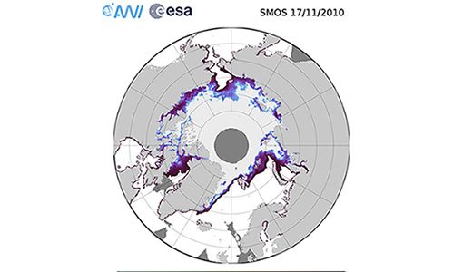
SMOS sea ice thickness reprocessed data now available
The reprocessed SMOS level 3 and 4 sea ice thickness products over the Arctic are now available from the ESA SMOS Dissemination Service.
News - Thematic area articles
 2 Feb 2022
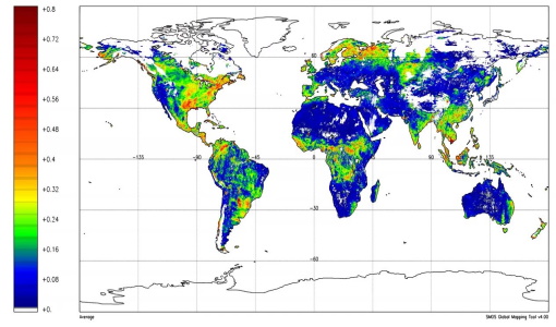
Satellite data boost global understanding of land surface
Understanding our changing land surface is essential in the study of climate change. Satellites are used to monitor changes to the material that covers Earth’s surface, so-called land cover, such as vegetation and water.
News - Data Release news
 24 Mar 2022
SMOS L2 Sea Surface Salinity products documentation updates
SMOS L2 Sea Surface Salinity product validation report is now available.
News - Data Release news
 1 June 2022
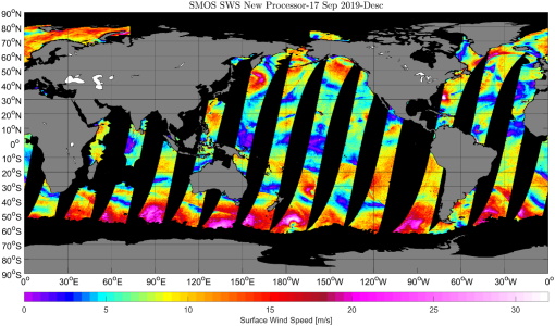
SMOS reprocessed Sea Surface Wind Speed dataset is now available
The entire SMOS L1B archive has been reprocessed with the latest version of the Sea Surface Wind Speed processor V300 which was deployed into the SMOS wind near real time service in August 2021.
News - Events and Proceedings
 6 June 2022
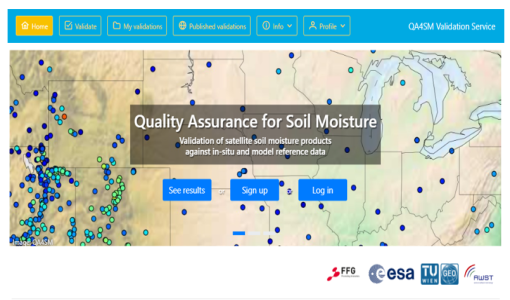
QA4SM Evolution in FRM4SM presented at sixth Soil Moisture Validation Workshop
The use and distribution of EO Soil Moisture (SM) data calls for rigorous, automated quality assessment procedures.
News - Thematic area articles
 30 June 2022
Transforming space data into climate action
ESA’s Earth observation activities are playing a key role in the revitalised global drive to combat climate change.
News - Success Stories
 7 Sept 2022
Satellite data predicts lower wheat crop yield
In a market pressed with short supply of grain the dry spring weather of 2022 was devastating for European wheat production, according to a new drought monitor that draws on data from ESA’s SMOS Earth observation mission
News - General News
 13 Sept 2022
How SNAP facilitates access to ESA Third Party Missions data
The tool – called the Sentinel Applications Platform (SNAP) – incorporates high-quality remote sensing data from numerous missions, including those operated by the agency’s international partners, known as Third Party Missions (TPM).
News - Data Release news
 27 Sept 2022
Full European Landsat data collection now available under the same catalogue
The Full European Landsat data collection, from Landsat-1 to Landsat-8, is now available under the same catalogue
News - Thematic area articles
 29 Sept 2022
How satellite data help to shape society
Data from ESA’s Earth observation archives are improving understanding of the interactions between human activities and the environment, helping to power green economic development and boosting prosperity in Europe and beyond.