- All Categories (112)
- Data (13)
- News (37)
- Missions (5)
- Events (13)
- Tools (10)
- Activities (4)
- Campaigns (11)
- Documents (19)
NEWS
Discover the latest news on the European Space Agency's Earth Observation activities. Learn all about new data availability and how ESA's missions are performing.
News - Success Stories
 13 May 2019
ESA's Earth Explorers surpassing expectations
In this video, learn how each Earth Explorer mission is contributing to Earth science, and changing the way we look at our beloved planet.
News - General News
 13 June 2019
PolSARpro v6.0 (Biomass Edition) software new release
Download the latest version of ESA's Polarimetric SAR data Processing and Educational Toolbox (PolSARpro).
News - Success Stories
1 Apr 2020New life for Landsat historical data
45 years of data, more than 1.8 million images, these are the numbers of an adventure started 48 years ago with the launch of the first Landsat satellite.
News - Data Release news
 15 May 2020
ESA TPM collection ‘Worldview-2 European Cities’ expanded
The WorldView-2 European Cities ESA dataset has been enriched with 3,149 additional products.
News - General News
 29 Sept 2020
ESA’s Earth Observation Catalogue and its services
EO-CAT is the EO Catalogue tool allowing users to search ESA and Third Party Mission collections.
News - General News
 29 Sept 2020
ESA's new DataCube service is now available
ESA is pleased to announce the deployment of a new service, called ESA PDGS-DataCube, enabling multi-temporal and pixel-based access to a subset of the data available in the European Space Agency dissemination services.
News - Data Release news
 15 Dec 2020
New Campaign datasets available
A new set of datasets is available, acquired during airborne campaigns conducted between 2014 and 2019
News - Data Release news
 12 Feb 2021
New reprocessed Landsat data on a new dissemination server
The full ESA Landsat archive has been reprocessed with the latest version of the processor to provide a homogenous dataset covering MSS, TM and ETM+ data.
News - Success Stories
 13 Apr 2021
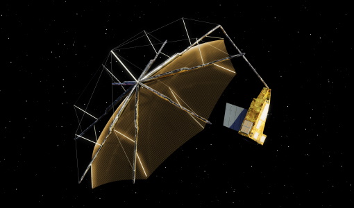
Drone-based Laser Scanning of Tropical Forests for Biomass Cal/Val
ESA’s upcoming mission Biomass will deliver valuable P-band SAR data aimed at forest aboveground biomass (AGB) estimation across the humid tropics.
News - Success Stories
 6 May 2021
ESA's open source computing project for the Biomass mission goes live
The Biomass Product Algorithm Laboratory (BioPAL) is an open-source scientific computing project, which supports the development of ESA’s Biomass mission algorithms coded in Python.
News - Data Release news
24 May 2021EUSI ESA archive collections now open to users
In the Third Party Missions Programme framework, archive collections from GeoEye-1, QuickBird-2 and WorldView (1 to 4) have been opened to users.
News - Infographics
 23 Sept 2021
ESA Third Party Missions timeline
We've released a new timeline to illustrate the history of the ESA Third Party Missions.
News - Infographics
 8 Nov 2021
An overview of ESA's Third Party Missions programme
ESA’s Third Party Missions programme consists of almost 50 satellite missions, which are owned by organisations around the world. ESA has agreements with these organisations to acquire, process, and distribute data from their missions
News - Spotlight on EO community
 18 Nov 2021
Meet a young researcher who combines remote sensing with deep learning techniques
Researcher MSc. Anupama Rajkumar recently investigated whether VHR satellite imagery could be combined with advanced deep learning techniques to automate the detection of waste landfills.
News - Data Release news
 13 Jan 2022
15 cm HD and 30 cm HD products added to EUSI ESA archive collections
Two new products, 15 cm HD and 30 cm HD, have been added to the collections from GeoEye-1, QuickBird-2, and WorldView (1 – 4).
News - Infographics
 28 Jan 2022
Timeline to over 40 years of historical satellite missions
ESA's Heritage Space Programme preserves historical data from over 40 years of Earth observation missions.
News - Thematic area articles
 2 Feb 2022
Satellite data boost global understanding of land surface
Understanding our changing land surface is essential in the study of climate change. Satellites are used to monitor changes to the material that covers Earth’s surface, so-called land cover, such as vegetation and water.
News - Thematic area articles
 2 Mar 2022
How space data are transforming the global food system
European Earth observation activities are accelerating a data-driven transformation in the agriculture sector that is helping farmers adapt to the dual challenges of climate change and population increase.
News - Success Stories
 17 Mar 2022
New open-source Python library improves rapid mapping services
In emergency services, rapid response is paramount. ICube-SERTIT’s Rapid Mapping Service provides near real-time delivery of geo-information to help emergency services respond quickly to disasters such as flooding, fires and landslides. A new Python open-source library, called EOReader, speeds up this mapping response by enabling the easy opening of imagery from multiple satellite sensors, both optical and synthetic aperture radar (SAR).
News - Thematic area articles
 31 Mar 2022
Satellite data central to ocean monitoring
Over 95% of Earth’s water is found in our oceans, and yet sadly, oceans are under stress from climate change and pollution. Monitoring our oceans is vital for Earth’s survival and satellites are the primary means of long-term and independent observation of our vast ocean bodies and their associated coastal zones.