- All Categories (23414)
- Data (23)
- News (82)
- Missions (1)
- Events (10)
- Tools (6)
- Activities (1)
- Campaigns (19)
- Documents (23272)
NEWS
Discover the latest news on the European Space Agency's Earth Observation activities. Learn all about new data availability and how ESA's missions are performing.
News - Infographics
 5 Oct 2022
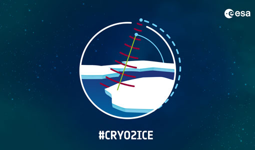
What is CRYO2ICE?
Learn about CRYO2ICE, an innovative campaign producing near simultaneous acquisitions over Antarctica from the CryoSat and ICESAT-2 missions, in this new infographic.
News - Success Stories
 22 Dec 2020
Using Satellite Data to Predict Floods and Droughts
Scientists are turning to remote sensing to fill the in-situ data gap in hydrological data models in some parts of the world.
News - Data Release news
 13 May 2022
Updated CryoSat magnetometer data now available with new baseline 0201
An improved version of the CryoSat magnetic field data is now available on the Swarm Dissemination Server with new baseline 0201.
News - Data Release news
 5 Dec 2019
Updated CryoSat magnetometer data now available
An improved version of the CryoSat magnetic field data (version 0102) is now available in the "#CryoSat-2" folder of the ESA FTP server.
News - Thematic area articles
 30 June 2022
Transforming space data into climate action
ESA’s Earth observation activities are playing a key role in the revitalised global drive to combat climate change.
News - Success Stories
7 Feb 2024Trailblazing ERS-2 mission enables climate change applications
As ESA’s ERS-2 satellite approaches Earth’s atmosphere for reentry, it’s time to reflect on the mission’s great achievements in powering climate-related applications.
News - Data Release news
 7 May 2020
Systematic swath elevation and monthly DEMs over the Greenland Ice Sheet margin from CryoSat
The CryoTEMPO-EOLIS (Elevation Over Land Ice from Swath), the first of the CryoTEMPO products, is now available.
News - Data Release news
 20 Oct 2020
Systematic swath elevation and monthly DEMs over the Antarctica Ice Sheet margin from CryoSat 2
Land-ice is declining globally, raising sea levels worldwide and impacting glacial risks and access to fresh-water in high-mountain glaciers regions.
News - General News
23 Feb 2023Stunning new features for ESA and NASA altimetry portal cs2eo.org
Working with combined ESA and NASA altimetry data is easier than ever thanks to a range of handy new features on cs2eo.org.
News - Operational News
 16 July 2020
SIRAL measurements continue during CRYO2ICE
On 16 July, ESA is kicking off its CRYO2ICE campaign that aims to raise CryoSat-2's orbit by approximately 900 metres, bringing it in sync with NASA's ICESat-2.
News - Events and Proceedings
 20 Mar 2019
Seventh CryoSat Quality Working Group meeting - final report
The 7th CryoSat Quality Working Group (QWG) meeting Summary and Recommendation Report are available to download.
News - Events and Proceedings
21 Apr 2023Scientists to showcase value of Earth observation data at EGU
Remote sensing scientists are getting ready to present innovative and exciting applications of satellite data at the European Geosciences Union general assembly which will take place from 24 to 28 April in Vienna, Austria.
News - Thematic area articles
 16 Aug 2022
Satellites reveal changes to Earth’s icy zones
ESA’s Earth observation activities are helping scientists investigate the influence of climate change on widespread ice-losses across the planet.
News - Thematic area articles
 2 Nov 2022
Satellites investigate Earth’s terrestrial hydrosphere
ESA’s Earth observation satellites are playing a leading role in furthering our understanding of how Earth’s water cycle is being influenced by humankind.
News - General News
 27 Sept 2018
Satellite Radar Altimetry: past and future
Satellite radar altimetry measurements yield a wealth of information that can be used for a wide range of applications.
News - Success Stories
 22 Nov 2022
Robust airborne radar instrument aids CryoSat ice data
During the 12 years that ESA’s ice mission – CryoSat – has been monitoring Earth’s ice masses from space, simultaneous airborne measurements were made by ASIRAS.
News - Success Stories
 21 Dec 2021
Retrieving Snow Depth Over Sea Ice Using Dual-Frequency Altimetric Measurements
A new study from the sea ice team of the Laboratory of Space Geophysical and Oceanographic Studies (LEGOS) in Toulouse has shown that dual-frequency SARAL and CryoSat-2 altimetric measurements can be used to retrieve consistent snow depth data over sea ice in both hemispheres.
News - Thematic area articles
25 Apr 2023Remote sensing data map impacts of natural hazards
As climate change increases the frequency and severity of natural disasters, remote sensing data can warn about extreme events and help tackle emergency situations.
News - Success Stories
 10 Nov 2020
Publication of Coastal Current Intrusions from Satellite Altimetry
A new study entitled “Coastal current intrusions from satellite altimetry” has just been published in the journal Remote Sensing. This study comes from an international collaboration between the European Space Agency (ESA), MIO (Fr), CNR (It) and Serco (It) with the goal of monitoring coastal intrusions into the Gulf of Lion by analyzing multi-mission Satellite Altimetry data with Machine Learning methods
News - General News
8 Feb 2023Pioneering science missions: Summarising ESA’s Earth Explorers
Designed for research purposes, ESA's Earth Explorer missions are dedicated to monitoring parts of Earth’s system. Learn more about the Earth Explorers in this video.