- News & Events
Stunning new features for ESA and NASA altimetry portal cs2eo.org
23 Feb 2023
Working with combined ESA and NASA altimetry data is easier than ever thanks to a range of handy new features on cs2eo.org
Users can now view Sentinel-1 and Sentinel-2 images over regions of interest, and preview GIF images associated with CryoVEx data. A list of RGI and IMBIE polygons, and new cursor coordinate features, make it quicker and easier to identify regions of interest. An experimental quick look IceBridge dataset is also available for time-sensitive applications such as sea ice forecasting.
cs2eo.org, developed by Earthwave and funded through ESA’s CryoSat Mission, is the first port of call to access, compare and download datasets from CryoSat-2, ICESat-2, CRYO2ICE, CryoVEx, Cryo-TEMPO-EOLIS and Operation IceBridge.
The new features will further support, enhance, and simplify research on sea ice and land ice in polar regions.
Alex Horton, CTO of Earthwave, says, “these powerful new features empower cs2eo.org users to better find and understand combined ESA and NASA altimetry datasets. Users can now quickly and accurately define regions of interest to query data and identify key locations in their results. “We’re working hard to provide the best possible user experience, and we’d love to hear from users about new features and functionalities that would be useful to add.”
What are the new features on cs2eo.org?
Earthwave has introduced five major new features on cs2eo.org for the start of 2023 alongside many smaller user experience improvements.
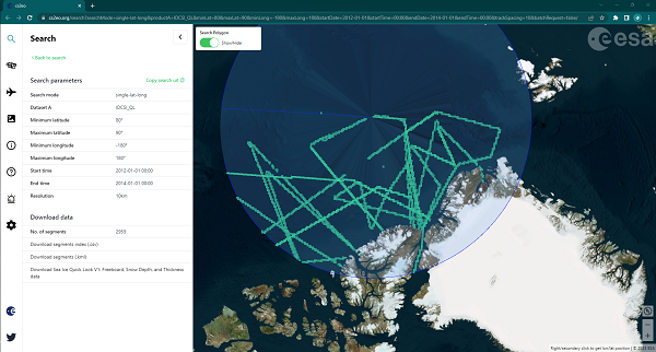
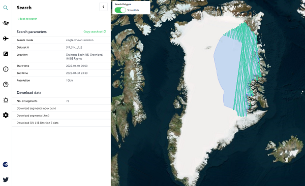
Find known locations fast! Search for data using RGI and IMBIE polygons
cs2eo.org users can now select a polygon from a list of well-known locations to define the area of interest for their query using industry-standard region definitions.
Currently available polygons include a selection of glacier outlines from the Randolph Glacier Inventory (RGI) Version 6, and the IMBIE-3 Antarctica and Greenland drainage basin definitions.
The user may type the name of a glacier, region, or source into the Known Location dropdown to filter the options and view the outline.
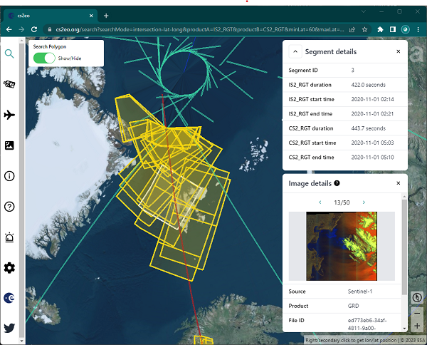
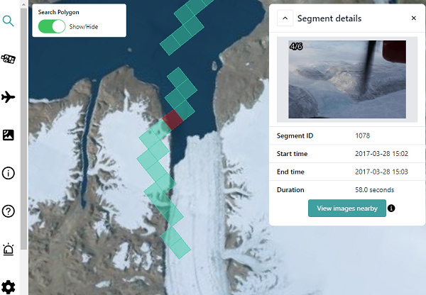
View Sentinel imagery coincident with results
You can now see Sentinel imagery that intersects with CryoSat, ICESat, and CRYO2ICE intersections.
Once search results have been returned, cs2eo.org users are now able to query for Sentinel-1 and Sentinel-2 imagery that was acquired for the spatial region of interest, as close as possible in time.
A reference ID to the full resolution image is also provided with the preview. This empowers the user to quickly view nearby optical and SAR preview images to better understand the queried datasets before downloading them.
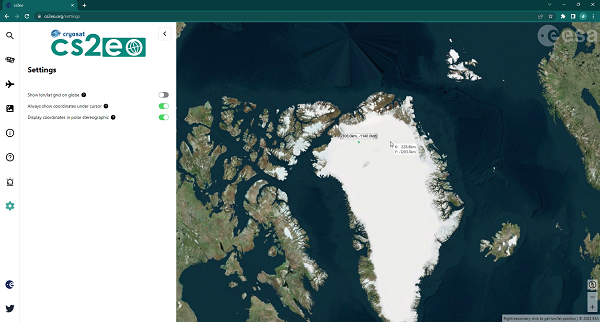
Latitude/longitude helper lines and polar stereographic coordinates
Do you want a quick and simple way to see polar stereographic coordinates? You can now do it easily.
A new user settings tab has been added to the cs2eo.org core application sidebar, which introduces new cursor coordinate features, including:
- lines of constant latitude and longitude that can be added to assist in locating and defining regions of interest.
- coordinates directly under the tip of the cursor which can now be toggled to be shown in real time.
- latitude and longitude can now instead be shown as polar stereographic coordinates: when near the North Pole, coordinates are shown in EPSG:3413. When near the South Pole, coordinates are shown in EPSG:3031.
CryoVEx GIF previews
Preview GIF images are now available for CryoVEx.
Users can quickly view high resolution optical images captured along the nadir and slant sightlines of the airborne CryoVEx campaigns within the specified spatio-temporal filter, and use this to decide whether to download the underlying data. Users may also intersect CryoVEx photographs with other datasets available on cs2eo.org, and use the preview CryoVEx GIFs to better understand the intersecting dataset.
New NASA IceBridge sea ice quick look dataset
A new dataset is available for the NASA IceBridge mission: IceBridge Sea Ice Freeboard, Snow Depth, and Thickness Quick Look, Version 1 (NSIDC-0708).
This quick look product is experimental and designed to be applicable for time-sensitive projects such as sea ice forecasting. As always, these data can be intersected with the other ESA and NASA products on cs2eo.org.