- All Categories (22895)
- Data (60)
- News (77)
- Missions (52)
- Events (28)
- Tools (5)
- Activities (5)
- Documents (22668)
NEWS
Discover the latest news on the European Space Agency's Earth Observation activities. Learn all about new data availability and how ESA's missions are performing.
News - Success Stories
 6 July 2022
WorldView-3 helps to track offshore methane plumes from oil and gas
Scientists have used Earth observation data to reveal enormous methane plumes spilling out from an offshore oil and gas production rig in the Gulf of Mexico. This represents a significant breakthrough in the monitoring of industrial methane emissions from space.
News - Success Stories
 17 May 2022
Vision-1 to enable cutting-edge science and spur innovation
Vision-1 – which is the result of a collaboration between Airbus Defence and Space and Surrey Satellite Technology Ltd. (SSTL) – provides sub-metric imagery to support activities across many industries, including urban planning, agricultural monitoring, land classification, natural resource management and disaster monitoring.
News - Data Release news
 17 May 2022
Vision-1 data now open to users
In the framework of the Third Party Missions programme, ESA is offering, for scientific research and application development, access to archive and new tasking data from the Vision-1 mission upon submission and acceptance of a project proposal.
News - Events and Proceedings
 28 Sept 2022
Very High Resolution data to take centre stage
In the last few years, European New Space providers have helped strengthen the offering of very high resolution remote sensing data products—a designated workshop this November aims to focus on the latest developments in this arena.
News - Data Release news
 12 July 2019
Updated Precise Orbit data (POD) for the full ERS-1 and ERS-2 mission available
The Precise Orbit files (ERS.ORB.POD) for the entire ERS-1 and ERS-2 mission periods have been reprocessed with up-to-date standards.
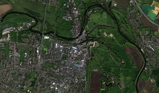
News - Infographics
22 Feb 2023Twin satellites - TerraSAR-X and TanDEM-X
DLR's TerraSAR-X and TanDEM-X are twin satellites flying in close formation to acquire SAR data of unique geometric accuracy. Operating together, the missions deliver data that are used to generate Digital Elevation Models of Earth.
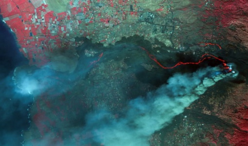
News - Success Stories
7 Feb 2024Trailblazing ERS-2 mission enables climate change applications
As ESA’s ERS-2 satellite approaches Earth’s atmosphere for reentry, it’s time to reflect on the mission’s great achievements in powering climate-related applications.
News - Thematic area articles
29 Aug 2023Tracking the world’s forests from space
As human activities continue to threaten the planet’s forests, data delivered by satellites are boosting global efforts to conserve these crucial natural resources.
News - General News
 29 July 2019
Three new Third Party Missions under evaluation
ICEYE, PlanetScope and Spire under evaluation. Interested users can investigate suitability of the data for scientific and R&D activities.
News - Operational News
 12 Feb 2024
Temporary interruption to Envisat AATSR dissemination service
A planned downtime will affect the access to the ftp dissemination server for the Envisat AATSR data during the period 13-15 February 2024.
News - Data Release news
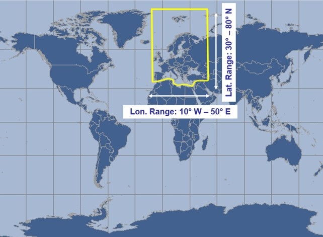
24 June 2021Static Maps for ALOS African coverage available for users
ALOS Africa is a dataset of the best available (cloud minimal, below 10%) African coverage acquired by AVNIR-2 in OBS mode and PRISM in OB1 mode (all Backward, Nadir and Forward views, in separated products), two different collections one for each instrument.
News - Data Release news
 28 July 2022
Spot Extended Area mode added to ICEYE on-demand portfolio
As an evolution of Spot mode, Spot Extended Area products are now available with the same resolution of Spot data (ground resolution of 1 m) but enabling to cover the area of 225 km2 (15 x 15 km) in a single SAR image.
News - Success Stories
14 Feb 2023Space data unearths small-scale mining in Burkina Faso
Satellite data from ESA’s Pléiades Third Party Mission and Copernicus Sentinel-2 were used to demonstrate that deep learning models can accurately and inexpensively identify artisanal and small-scale mining, even in challenging semi-desertic environments.
News - Thematic area articles
30 Jan 2024Space data support Earth’s ecosystems
ESA’s Earth observation (EO) missions are making a critical contribution to monitoring transformations in our planet’s ecosystems, helping track changes in the vegetation, soil, and ocean that affect these systems.
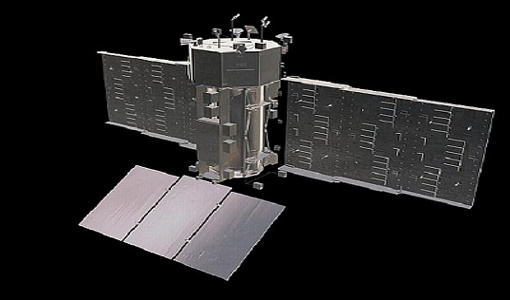
News - Infographics
21 Feb 2024Showcasing the NovaSAR-1 radar satellite
Learn about the NovaSAR-1 mission in our new infographic.
News - Thematic area articles
 2 Nov 2022
Satellites investigate Earth’s terrestrial hydrosphere
ESA’s Earth observation satellites are playing a leading role in furthering our understanding of how Earth’s water cycle is being influenced by humankind.
News - Success Stories
 26 July 2022
SAR synergy data for maritime surveillance
With the aim of safeguarding our oceans, a recent study uses a synergy of synthetic aperture radar (SAR) images to improve maritime surveillance.
News - Success Stories
 11 Feb 2022
SAOCOM the Argentinean constellation with an Italian twist
Composed of two satellites launched in 2018 and 2019 respectively, the SAOCOM satellite mission, managed and operated by Argentina's Space Agency, CONAE, covers an array of applications that greatly benefit Earth observation and disaster monitoring.
News - Data Release news
 3 Dec 2021
SAOCOM data collection now open
SAOCOM data products acquired over the ASI Zone of Exclusivity (European territory and Mediterranean) are available to registered users.
News - Announcement of Opportunity updates
 14 Mar 2023
Researchers called to explore new applications of SAOCOM data
ESA has invited Earth observation experts to devise and propose innovative applications for data delivered by Argentinian remote sensing constellation SAOCOM.