- All Categories (53)
- Data (12)
- News (11)
- Missions (1)
- Events (22)
- Tools (1)
- Activities (4)
- Documents (2)
News - Success Stories
Magnetic magic: 10 reasons to be excited about Swarm
In November 2023, Swarm celebrated an impressive ten years in orbit. In that time, ESA’s magnetic mission has honed in on all sorts of mysteries - from tussling magnetic blobs to animal migration.
Mission - Heritage Missions
MOS-1/1B
MOS-1 and 1B, Japan’s first marine observation satellites, were designed to monitor ocean currents, sea surface temperature, atmospheric water vapour, ocean chlorophyll levels, precipitation, and land vegetation.
News - Infographics
Focusing on Envisat MERIS Full Resolution Level-2 data
ESA's Envisat mission continued and expanded upon the legacy of its predecessors, the ERS (European Remote Sensing) satellites. Operating between 2002 and 2012, the satellite's 10 instruments acquired a decade of data for many applications.
News - Announcement of Opportunity updates

Researchers called to explore new applications of SAOCOM data
ESA has invited Earth observation experts to devise and propose innovative applications for data delivered by Argentinian remote sensing constellation SAOCOM.
Data - Data Description
Envisat AATSR L1B Brightness Temperature/Radiance [ENV_AT_1_RBT]
- AATSR Full Resolution land and ocean cover image of the Iberian Peninsula from 28 October 2006 AATSR Full Resolution land cover image of the Iberian Peninsula from 28 October 2006. The Envisat AATSR Level 1B Brightness Temperature/Radiance product (RBT) contains top of atmosphere (TOA) brightness temperature (BT) values for the infra-red channels and radiance values for the visible channels, on a 1-km pixel grid. Values for each channel and for the nadir and oblique views occupy separate NetCDF files within the Sentinel-SAFE format, along with associated uncertainty estimates. Additional files contain cloud flags, land and water masks, and confidence flags for each image pixel, as well as instrument and ancillary meteorological information. This AATSR product [ENV_AT_1_RBT] in NetCDF format stemming from the 4th AATSR reprocessing, is a continuation of ERS ATSR data and a precursor of Sentinel-3 SLSTR data. It has replaced the former L1B product [ATS_TOA_1P] in Envisat format from the 3rd reprocessing. Users with Envisat-format products are recommended to move to the new Sentinel-SAFE like/NetCDF format products. The 4th reprocessing of Envisat AATSR data was completed in 2022; the processing updates that have been put in place and the expected scientific improvements have been outlined in full in the User Documentation for (A)ATSR 4th Reprocessing Products.
News - Success Stories

Robust airborne radar instrument aids CryoSat ice data
During the 12 years that ESA’s ice mission – CryoSat – has been monitoring Earth’s ice masses from space, simultaneous airborne measurements were made by ASIRAS.
Event - Training

EO Summer School 7
ESA's series of summer schools, on Monitoring of the Earth System, aims to promote the exploitation of Earth observation data.
Event - Training
EO Summer School 6
ESA's series of summer schools, on Monitoring of the Earth System, aims to promote the exploitation of Earth observation data.
Event - Training
EO Summer School 5
ESA's series of summer schools, on Monitoring of the Earth System, aims to promote the exploitation of Earth observation data.
Event - Training
EO Summer School 3
ESA's series of summer schools, on Monitoring of the Earth System, aims to promote the exploitation of Earth observation data.
News - Infographics

The International Charter - Providing satellite data to support disaster response worldwide
Learn about the International Charter Space and Major Disasters in this new infographic.
Activity - General activities
International Charter Space and Major Disasters
Learn about the International Charter Space and Major Disasters, which ESA participate in disaster monitoring.
Activity - Projects

Contribution of Swarm data to the prompt detection of Tsunamis and other natural hazards
The main objective of COSTO (Contribution of Swarm data to the prompt detection of Tsunamis and other natural hazards) project is to better characterise, understand and discover coupling processes and interactions.
News - Infographics

PlanetScope and SkySat - The high-resolution nanosatellite constellation
Find out more about the PlanetScope and SkySat missions in our new infographic.
News - Thematic area articles

Satellite data central to ocean monitoring
Over 95% of Earth’s water is found in our oceans, and yet sadly, oceans are under stress from climate change and pollution. Monitoring our oceans is vital for Earth’s survival and satellites are the primary means of long-term and independent observation of our vast ocean bodies and their associated coastal zones.
News - Success Stories

10 years of Envisat data help to illuminate ocean processes
A decade after Envisat beamed its final image to the planet, the pioneering ESA mission is continuing to foster improved understanding of Earth’s systems.
Event - Workshop

2007 International Geohazards Week
The ESA event was part of the United Nations International Year of Planet Earth, to increase awareness of the importance of Earth sciences for the advancement of sustainable development.
Event - Workshop
Fringe 2003 Workshop
The third ESA International Workshop on ERS SAR Interferometry and its first Workshop on ASAR interferometry: Advances in SAR interferometry from ERS and Envisat missions.
Activity - Projects
Dragon Cooperation Programme
The Dragon Programme focussed on science and applications development in China using mainly data from the ERS and Envisat missions. The Prgramme was a cooperation between ESA and the National Remote Sensing Centre of China.
Activity - General activities
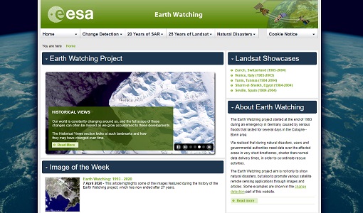
Earth Watching
The Earth Watching project began in 1993 to assist local authorities and to promote the benefits of remote sensing data during natural disasters, but also to promote various satellite remote sensing applications through images and articles.