- All Categories (29)
- Data (5)
- News (11)
- Missions (2)
- Tools (1)
- Documents (10)
Document - User Guide

ResourceSat-1-Data-User-Handbook.pdf
The IRS-P6 Data User’s Handbook is published to provide essential information to the users about the mission - the sensors, orbit and coverage, referencing scheme, data acquisition, products, services and potential applications of the data.
Mission - Heritage Missions
QuickBird-2
QuickBird-2 was an Earth-imaging satellite. When launched in 2001, it was then the highest resolution commercial satellite.
Mission - Heritage Missions
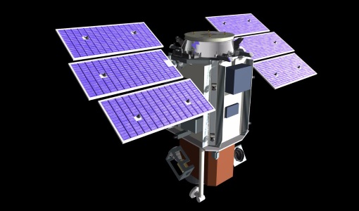
IRS-P6 (ResourceSat-1)
IRS-P6 (also known as ResourceSat-1) launched on 17 October 2003 from Satish Dhawan Space Centre by the Indian PSLV-C5, and came to an end on 30 September 2013.
Data - Fast Registration with approval (Restrained)
Image 2006 European coverage
The Image 2006 collection is a SPOT-4, SPOT-5 and ResourceSat-1 (also known as IRS-P6) cloud free coverage over 38 European countries in 2006 (from February 2005 to November 2007). The Level 1 data provided in this collection originate from the SPOT-4 HRVIR instrument (with 20 m spatial resolution), from SPOT-5 HRG (with 10 m spatial resolution resampled to 20 m) and IRS-P6 LISS III (with 23 m spatial resolution), each with four spectral bands. The swath is of about 60 km for the SPOT satellites and 140 km for the IRS-P6 satellite. In addition to the Level 1, the collection provides the same data geometrically corrected towards a European Map Projection with 25 m resolution. Spatial coverage: Check the spatial coverage of the collection on a map available on the Third Party Missions Dissemination Service.
Data - Project Proposal (Restrained)
QuickBird full archive
QuickBird high resolution optical products are available as part of the Maxar Standard Satellite Imagery products from the QuickBird, WorldView-1/-2/-3/-4, and GeoEye-1 satellites. All details about the data provision, data access conditions and quota assignment procedure are described into the Terms of Applicability available in Resources section. In particular, QuickBird offers archive panchromatic products up to 0.60 m GSD resolution and 4-Bands Multispectral products up to 2.4 m GSD resolution. Band Combination Data Processing Level Resolution Panchromatic and 4-bands Standard(2A)/View Ready Standard (OR2A) 15 cm HD, 30 cm HD, 30 cm, 40 cm, 50/60 cm View Ready Stereo 30 cm, 40 cm, 50/60 cm Map-Ready (Ortho) 1:12,000 Orthorectified 15 cm HD, 30 cm HD, 30 cm, 40 cm, 50/60 cm 4-Bands being an option from: 4-Band Multispectral (BLUE, GREEN, RED, NIR1) 4-Band Pan-sharpened (BLUE, GREEN, RED, NIR1) 4-Band Bundle (PAN, BLUE, GREEN, RED, NIR1) 3-Bands Natural Colour (pan-sharpened BLUE, GREEN, RED) 3-Band Colored Infrared (pan-sharpened GREEN, RED, NIR1) Natural Colour / Coloured Infrared (3-Band pan-sharpened) Native 30 cm and 50/60 cm resolution products are processed with MAXAR HD Technology to generate respectively the 15 cm HD and 30 cm HD products: the initial special resolution (GSD) is unchanged but the HD technique intelligently increases the number of pixels and improves the visual clarity achieving aesthetically refined imagery with precise edges and well reconstructed details.
Data - Project Proposal (Restrained)
ResourceSat-1/IRS-P6 full archive
ResourceSat-1 (also known as IRS-P6) archive products are available as below: Sensor Type Resolution (m) Coverage (km x km) System or radiometrically corrected Ortho corrected (DN) Neustralitz archive Global archive LISS-IV Mono-Chromatic 5 70 x 70 X X 2004 – 2010 2003 - 2013 LISS-III Multi-spectral 20 140 x 140 X X 2004 – 2013 2003 - 2013 AWiFS Multi-spectral 60 370 x 370 X X 2004 – 2013 2003 - 2013 Note: LISS-IV: Mono-Chromatic, the band is selectable. In practice the red is used. For LISS-IV MN and LISS-III ortho corrected: If unavailable, user has to supply ground control information and DEM in suitable quality. For AWiFS ortho corrected: service based on in house available ground control information and DEM. The products are available as part of the GAF Imagery products from the Indian missions: IRS-1C, IRS-1D, CartoSat-1 (IRS-P5), ResourceSat-1 (IRS-P6) and ResourceSat-2 (IRS-R2) missions. 'ResourceSat-1 archive' collection has worldwide coverage: for data acquired over Neustrelitz footprint, the users can browse the EOWEB GeoPortal catalogue to search archived products; worldwide data (out the Neustrelitz footprint) can be requested by contacting GAF user support to check the readiness since no catalogue is not available. All details about the data provision, data access conditions and quota assignment procedure are described in the Terms of Applicability.
Tools - Visualisation
EVDC Orbit Prediction Tool
The EVDC Orbit Prediction and Overpass Tool generates and visualises satellite's overpasses.
Document - Product Document

DigitalGlobe-Advanced-Ortho-Series.pdf
The DigitalGlobe Advanced Ortho Series provides unparalleled coverage, speed, accuracy, and aesthetics resulting in the best quality orthos quickly and easily.
Document - Product Document
DigitalGlobe-GeoStereo.pdf
GeoStereo products are designed for users with advanced image processing capabilities and photogrammetric tools.
Document - Product Document
DigitalGlobe-Standard-Imagery.pdf
DigitalGlobe’s Standard Imagery products are designed for users with knowledge of remote sensing applications and image processing tools that require data of modest absolute geometric accuracy and/or large area coverage.
Document - Product Document
DigitalGlobe-Stereo-Imagery.pdf
Stereo Imagery products are designed for users with advanced image processing capabilities and photogrammetric tools.
Document - Product Document
Image-2006-European-Coverage.pdf
GMES Fast Track Land Service 2006-2008 Orthorectification of SPOT and IRS-P6 products
News - Success Stories

A stroll through Heritage Missions
At ESA's Earth Observation centre—ESRIN—in Frascati, Italy, there is a place where one can walk back in time, to better understand the history and importance of Heritage Missions and their data.
Document - Technical Note

Indian-Data-Terms-Of-Applicability.pdf
This document contains the Terms of Applicability and the Terms and Conditions for accessing the third party mission data from Indian data sources.
Data - Fast Registration with approval (Restrained)
QuickBird-2 ESA archive
The QuickBird-2 archive collection consists of QuickBird-2 products requested by ESA supported projects over their areas of interest around the world. The dataset regularly grows as ESA collects new products over the years. Panchromatic (up to 61 cm resolution) and 4-Bands (up to nominal value of 2.44 m resolution, reduced to 1.63 m when the orbit altitude was lowered to 300 km at the end of the mission) products are available. The 4-Bands includes various options such as Multispectral (separate channel for Blue, Green, Red, NIR1), Pan-sharpened (Blue, Green, Red, NIR1), Bundle (separate bands for PAN, Blue, Green, Red, NIR1), Natural Colour (pan-sharpened Blue, Green, Red), Coloured Infrared (pan-sharpened Green, Red, NIR1), Natural Colour / Coloured Infrared (3-Band pan-sharpened). The processing levels are: STANDARD (2A): normalised for topographic relief View Ready Standard (OR2A): ready for orthorectification View Ready Stereo: collected in-track for stereo viewing and manipulation Map-Ready (Ortho) 1:12,000 Orthorectified: additional processing unnecessary Map-Ready (Ortho) 1:15,000 Orthorectified: additional processing unnecessary Spatial coverage: Check the spatial coverage of the collection on a map available on the Third Party Missions Dissemination Service. The following table summarises the offered product types EO-SIP product type Band Combination Description BGI_PAN_2A Panchromatic (PAN) Panchromatic Standard/Panchromatic Ortho Ready Standard BGI_PAN_MP Panchromatic (PAN) Panchromatic Map Scale Ortho BGI_PAN_OR Panchromatic (PAN) Panchromatic Ortho Ready Stereo BGI_4B__2A 4-Band (4B) 4-Band Standard/4-band Ortho Ready Standard BGI_4B__MP 4-Band (4B) 4-Band Map Scale Ortho BGI_4B__OR 4-Band (4B) 4-Band Ortho Ready Stereo
News - General News

ESA and GAF AG continue to offer free-of-charge access to Third Party Mission data
In January 2021, ESA and GAF AG extended their agreement under ESA’s Third Party Missions programme regarding the provision of IRS data and DSMs until the end of 2021.
News - Data Release news
EUSI ESA archive collections now open to users
In the Third Party Missions Programme framework, archive collections from GeoEye-1, QuickBird-2 and WorldView (1 to 4) have been opened to users.
News - Data Release news

15 cm HD and 30 cm HD products added to EUSI ESA archive collections
Two new products, 15 cm HD and 30 cm HD, have been added to the collections from GeoEye-1, QuickBird-2, and WorldView (1 – 4).
News - Infographics

Timeline to over 40 years of historical satellite missions
ESA's Heritage Space Programme preserves historical data from over 40 years of Earth observation missions.
Document - General Reference

Heritage Missions brochure
This brochure describes ESA's Heritage Space Programme and includes infographics describing some of the missions in the programme.