- All Categories (39)
- Data (3)
- News (10)
- Missions (1)
- Events (7)
- Tools (3)
- Activities (5)
- Documents (10)
Document - Product Readme Note
ERS-WS-SoilMoisture-Readme-ESA-EOPG-EBA-TN-2-issue1.0.pdf
Readme file for ERS-2 Scatterometer Soil Moisture Products
Document - Product Handbook
ERS-Altimeter-and-Orbit-Global-Products-Manual.pdf
This manual covers ERS Altimeter and Orbit products.
Document - Proceedings
ERS-Envisat-symposium-proceedings.pdf
This document contains the proceedings of the ERS-Envisat Symposium, which took place in 2000.
Document - General Reference
Summary-of-the-Ocean-Session.pdf
This document summarises the results of the Ocean Session at the Workshop on Emerging Scatterometer Applications, which took place from 05 to 07 October 1998.
Document - Product Document
ERS-1-WSC-FDC-Product-CCT-Format.pdf
This document deals with the Product Specifications for the WSC Fast delivery copy. Valid for data processed up until end of July '95 when there was a switch in format from CEOS to CCSDS.
Document - Product Document
ERS-1-WSC-DWP-Product-CCT-Format.pdf
This document deals with the Product Specifications for the WSC de-aliased Wind Field Pressure Product.
Document - Conference Presentation - Poster
8-Use_SAR_observing_Polar_lows.pdf
Use of SAR in observing Polar lows Birgitte Furevik (Norwegian Meteorological Inst., Norway)
Event - Workshop
Fringe 2007 Workshop
Fringe 2007 was the third International Workshop on Envisat ASAR interferometry and fifth International Workshop on ERS SAR Interferometry.
Event - Training
Advanced Training Course in Ocean Remote Sensing 2011
Within the framework of the Dragon Programme, a joint collaboration between the European Space Agency (ESA) and the Chinese Ministry of Science and Technology (MOST), ESA and NRSCC are providing a series of advanced thematic training courses on remote sensing applications hosted by university and research institutions in P.R. China.
Event - Training
3rd Advanced Training Course on Land Remote Sensing 2011
This 2011 advanced ESA training course focused on land remote sensing theory and applications.
Event - Training
Advanced Training Course in Land Remote Sensing 2012
The 2012 advanced training course focused on land remote sensing theory and applications.
News - Data Release news
ERS-1 Scatterometer L2 dataset processed with ASPS v10.04 is available online
The reprocessed dataset together with corresponding ERS-2 data is now available.
News - Data Release news
Updated Precise Orbit data (POD) for the full ERS-1 and ERS-2 mission available
The Precise Orbit files (ERS.ORB.POD) for the entire ERS-1 and ERS-2 mission periods have been reprocessed with up-to-date standards.
Activity - Quality
REAPER
The REAPER (REprocessing of Altimeter Products for ERS) project covers both the ERS-1 and the ERS-2 altimetry missions. The project aims to support and maintain data quality.
Document - Product Readme Note
ERS_WS_Readme-ENVI-GSOP-EOGD-QD-15-0130_issue1.2.pdf
Product Quality Readme file for ERS-1/2 Wind Scatterometer Products
Activity - Quality
SCIRoCCo
The SCIRoCCo project is an interdisciplinary cooperation of scatterometry experts aimed at promoting the continuing exploitation of ESA's unique 20 years' worth of ERS Scatterometer data.
Mission - Heritage Missions
ERS
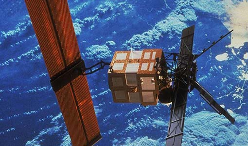
The ERS programme was composed of two missions, ERS-1 and ERS-2, which together observed the Earth for 20 years, from 1991 to 2011.
Data - Fast Registration with immediate access (Open)
ERS-1/2 SCATTEROMETER Ocean Wind field and Sea Ice probability [ASPS20.H/ASPS20.N]
The ASPS Level 2 products contain, for each node: the radar backscattering sigma nought for the three beams of the instrument, the four aliased wind solutions (Rank 1-4 wind vector) and the de-aliased wind vector flag, the sea-ice probability and sea-ice flag, the YAW quality flag. The wind retrieval is performed with the CMOD5N geophysical model function derived by ECMWF to compute the neutral winds rather than 10 m winds. ASPS L2.0 High resolution products are provided with a spatial resolution of 25x25 km and a grid spacing of 12.5 km. ASPS L2.0 Nominal resolution products are provided with a spatial resolution of 50x50 km and a grid spacing of 25 km. One product covers one orbit from ascending node crossing. Please consult the Product Quality Readme file before using the ERS ASPS data.


