- All Categories (46)
- Data (19)
- News (10)
- Missions (1)
- Events (10)
- Tools (1)
- Campaigns (3)
- Documents (2)
Campaign
WaddenSAR
The “WaddenSAR – Airborne bistatic C-band SAR experiment to demonstrate different acquisition geometries” was initiated to support the development of the Earth Explorer 10 Harmony mission.
Data - Campaigns (Open)
WaddenSAR
The “WaddenSAR – Airborne bistatic C-band SAR experiment to demonstrate different acquisition geometries” was initiated to support the development of the Earth Explorer 10 Harmony mission.
News - Operational News

Update for the SMOS Near Real Time Sea Surface Wind Speed Processor configuration
An updated configuration of the SMOS Near Real Time Sea Surface Wind Speed Processor was deployed at the IFREMER and ESA operational ground segment on 4th December 2023.
News - Success Stories
Trailblazing ERS-2 mission enables climate change applications
As ESA’s ERS-2 satellite approaches Earth’s atmosphere for reentry, it’s time to reflect on the mission’s great achievements in powering climate-related applications.
News - Data Release news
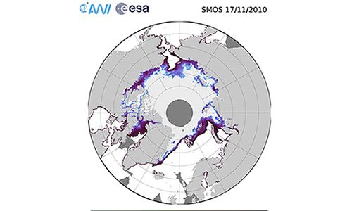
SMOS sea ice thickness reprocessed data now available
The reprocessed SMOS level 3 and 4 sea ice thickness products over the Arctic are now available from the ESA SMOS Dissemination Service.
Tools - Processing

SMOS Artificial Scene Library (ASL)
The ASL function allows users to directly use the L1B product version 7 by mimicking the Gibbs-2 image reconstruction correction algorithm as it is implemented in the level 1 operational processor.
News - Success Stories

Ship trails in the Bay of Biscay observed using PROBA-V imagery
Ship trails have been perceived as convincing evidence of aerosol-cloud interaction. Ship emissions have been proven to contribute by about 1.9% and 2.9% to the increase in the global total and fine-mode aerosol optical thickness (AOT) respectively over a five year period (Peters et al. 20212).
Data - EO Sign In Authentication (Open)
SeaSat ESA archive
This collection gives access to the complete SEASAT dataset acquired by ESA and mainly covers Europe. The dataset comprises some of the first ever SAR data recorded for scientific purposes, reprocessed with the most recent processor. The Level-1 products are available as: SAR Precision Image [SEA_PRI_1P] SAR Single Look Complex Image [SEA_SLC_1P] SAR Ellipsoid Geocoded Precision Image [SEA_GEC_1P] Spatial coverage: Check the spatial coverage of the collection on a map available on the Third Party Missions Dissemination Service.
Event - Workshop

SEASAR 2012
The European Space Agency and the Norwegian Space Centre jointly organised the fourth SAR oceanography workshop, 'SEASAR 2012', entitled 'Advances in SAR Oceanography'.
Event - Workshop

SEASAR 2008
The "Advances in SAR Oceanography from Envisat and ERS missions" was a thematic workshop on SAR remote sensing techniques for oceanography.
News - General News

Satellite Radar Altimetry: past and future
Satellite radar altimetry measurements yield a wealth of information that can be used for a wide range of applications.
News - Success Stories

Satellite data predicts lower wheat crop yield
In a market pressed with short supply of grain the dry spring weather of 2022 was devastating for European wheat production, according to a new drought monitor that draws on data from ESA’s SMOS Earth observation mission
Data - EO Sign In Authentication (Open)
MOS-1/1B ESA System Corrected VTIR Products [VTI_SYC_1P]
The ESA System Corrected (Level 1) MOS-1/1B VTIR Products collection is composed of MOS-1/1B VTIR (Visible and Thermal Infrared Radiometer) data products generated as part of the MOS Bulk Processing Campaign using the MOS Processor v3.02. The products are available in GeoTIFF format and disseminated within EO-SIP packaging. Please refer to the MOS Product Format Specification for further details. The collection consists of data products of the following type: VTI_SYC_1P: System corrected Level 1 MOS-1/1B VTIR products in EO-SIP format. VTIR Instrument Characteristics Band Wavelength Range (µm) Spatial Resolution (km) Swath Width (km) 1 (VIS) 0.5 – 0.7 0.9 1500 2 (TIR) 6.0 – 7.0 2.7 1500 3 (TIR) 10.5 – 11.5 2.7 1500 4 (TIR) 11.5 – 12.5 2.7 1500
Data - EO Sign In Authentication (Open)
MOS-1/1B ESA System Corrected Map-oriented Products [MES_GES_1P]
The ESA System Corrected Map-oriented (Level 1) Products collection is composed of MOS-1/1B MESSR (Multi-spectral Electronic Self-Scanning Radiometer) data products generated as part of the MOS Bulk Processing Campaign using the MOS Processor v3.02. The products are available in GeoTIFF format and disseminated within EO-SIP packaging. Please refer to the MOS Product Format Specification for further details. The collection consists of data products of the following type: MES_GES_1P: Geocoded Ellipsoid System Corrected Level 1 MOS-1/1B MESSR products as generated by the MOS MESSR processor where the generation of MES_GEC_1P products is not possible. These replace the old MES_SYC_1P products. MESSR Instrument Characteristics Band Wavelength Range (nm) Spatial Resolution (m) Swath Width (km) 1 (VIS) 510 – 690 50 100 2 (VIS) 610 – 690 50 100 3 (NIR) 720 – 800 50 100 4 (NIR) 800 – 1100 50 100
Data - EO Sign In Authentication (Open)
MOS-1/1B ESA Orthorectified Map-oriented Products [MES_GEC_1P]
The ESA Orthorectified Map-oriented (Level 1) Products collection is composed of MOS-1/1B MESSR (Multi-spectral Electronic Self-Scanning Radiometer) data products generated as part of the MOS Bulk Processing Campaign using the MOS Processor v3.02. The products are available in GeoTIFF format and disseminated within EO-SIP packaging. Please refer to the MOS Product Format Specification for further details. The collection consists of data products of the following type: MES_GEC_1P: Geocoded Ellipsoid GCP Corrected Level 1 MOS-1/1B MESSR products which are the default products generated by the MOS MESSR processor in all cases (where possible), with usage of the latest set of Landsat improved GCP (Ground Control Points). These are orthorectified map-oriented products, corresponding to the old MOS-1/1B MES_ORT_1P products with geolocation improvements. MESSR Instrument Characteristics Band Wavelength Range (nm) Spatial Resolution (m) Swath Width (km) 1 (VIS) 510 – 690 50 100 2 (VIS) 610 – 690 50 100 3 (NIR) 720 – 800 50 100 4 (NIR) 800 – 1100 50 100
News - Thematic area articles
Monitoring water on Earth's surface
ESA's Earth observation satellites are playing a leading role in furthering our understanding of how Earth's terrestrial hydrosphere is being influenced by humankind.
Data - Project Proposal (Restrained)
IRS-1C/1D Full archive
The following products are available: PAN: Panchromatic, resolution 5 m, Coverage 70 km x 70 km, radiometrically and ortho (DN) corrected, LISS-III: Multi-spectral, resolution 25 m, Coverage 140 km x 140 km, radiometrically and ortho (DN) corrected (ortho delivered without Band 5) WiFS: Multi-spectral, resolution 180 m, Coverage 800 km x 800 km, radiometrically and ortho (DN) corrected. Sensor Type Resolution (m) Coverage (km x km) System or radiometrically corrected Ortho corrected (DN) Global archive PAN Panchromatic 5 70 x 70 X X 1996 – 2007 (IRS-1C) 1998 – 2009 (IRS-1D) LISS-III Multi-spectral 25 140 x 140 X X (without band 5) WiFS Multi-spectral 180 800 km x 800 km X X Note: Whether system corrected or radiometrically corrected products are available depends on sensor and processing centre For PAN and LISS-III ortho corrected: If unavailable, user has to supply ground control information and DEM in suitable quality For WiFS ortho corrected: service based on in house available ground control information and DEM.
Data - EO Sign In Authentication (Open)
IRS-1C/1D European coverage
IRS-1C/1D dataset is composed of products generated by the Indian Remote Sensing (IRS) Satellites 1C/1D PAN sensor. The products, acquired from 1996 to 2004 over Europe, are radiometrically and ortho corrected level 1 black and white images at 5 metre resolution and cover an area of up to 70 x 70 km. Sensor Type Resolution (m) Coverage (km x km) System or radiometrically corrected Ortho corrected (DN) Acquisition in Neustrelitz PAN Panchromatic 5 70 x 70 X X 1996 - 2004 IRS-1C/1D PAN data coverage of Europe acquired between 1996 to 1998. Copyright: 2015 GAF AG IRS-1C/1D PAN data coverage of Europe acquired between 1999 to 2001. Copyright: 2015 GAF AG IRS-1C/1D PAN data coverage of Europe acquired between 2002 to 2004. Copyright: 2015 GAF AG Spatial coverage: Check the spatial coverage of the collection on a map available on the Third Party Missions Dissemination Service.
Data - Data Description
GRACE-A and GRACE-B Level 1B, Level 1B combined and Level 2 Data Products
Level-1A Data Products are the result of a non-destructive processing applied to the Level-0 data at NASA/JPL. The sensor calibration factors are applied in order to convert the binary encoded measurements to engineering units. Where necessary, time tag integer second ambiguity is resolved and data are time tagged to the respective satellite receiver clock time. Editing and quality control flags are added, and the data is reformatted for further processing. The Level-1A data are reversible to Level-0, except for the bad data packets. This level also includes the ancillary data products needed for processing to the next data level. The Level-1B Data Products are the result of a possibly destructive, or irreversible, processing applied to both the Level-1A and Level-0 data at NASA/JPL. The data are correctly time-tagged, and data sample rate is reduced from the higher rates of the previous levels. Collectively, the processing from Level-0 to Level-1B is called the Level-1 Processing. This level also includes the ancillary data products generated during this processing, and the additional data needed for further processing. The Level-2 data products include the static and time-variable (monthly) gravity field and related data products derived from the application of Level-2 processing at GFZ, UTCSR and JPL to the previous level data products. This level also includes the ancillary data products such as GFZ's Level-1B short-term atmosphere and ocean de-aliasing product (AOD1B) generated during this processing. GRACE-A and GRACE-B Level-1B Data Product: Satellite clock solution [GA-OG-1B-CLKDAT, GB-OG-1B-CLKDAT, GRACE CLKDAT]: Offset of the satellite receiver clock relative to GPS time, obtained by linear fit to raw on-board clock offset estimates GPS flight data [GA-OG-1B-GPSDAT, GB-OG-1B-GPSDAT, GRACE GPSDAT]: Preprocessed and calibrated GPS code and phase tracking data edited and decimated from instrument high-rate (10 s (code) or 1 s (phase)) to low-rate (10 s) samples for science use (1 file per day, level-1 format) Accelerometer Housekeeping data [GA-OG-1B-ACCHKP, GB-OG-1B-ACCHKP, GRACE ACCHKP]: Accelerometer proof-mass bias voltages, capacitive sensor outputs, instrument control unit (ICU) and sensor unit (SU) temperatures, reference voltages, primary and secondary power supply voltages (1 file per day, level-1 format) Accelerometer data [GA-OG-1B-ACCDAT, GB-OG-1B-ACCDAT, GRACE ACCDAT]: Preprocessed and calibrated Level-1B accelerometer data edited and decimated from instrument high-rate (0.1 s) to low-rate (1s) samples for science use (1 file per day, level-1 format) Intermediate clock solution [GA-OG-1B-INTCLK, GB-OG-1B-INTCLK, GRACE INTCLK]: derived with GIPSY POD software (300 s sample rate) (1 file per day, GIPSY format) Instrument processing unit (IPU) Housekeeping data [GA-OG-1B-IPUHKP, GB-OG-1B-IPUHKP, GRACE IPUHKP]: edited and decimated from high-rate (TBD s) to low-rate (TBD s) samples for science use (1 file per day, level-1 format) Spacecraft Mass Housekeeping data [GA-OG-1B-MASDAT, GB-OG-1B-MASDAT, GRACE MASDAT]: Level 1B Data as a function of time GPS navigation solution data [GA-OG-1B-NAVSOL, GB-OG-1B-NAVSOL, GRACE NAVSOL]: edited and decimated from instrument high-rate (60 s) to low-rate (30 s) samples for science use (1 file per day, level-1 format) OBDH time mapping to GPS time Housekeeping data [GA-OG-1B-OBDHTM, GB-OG-1B-OBDHTM, GRACE OBDHTM]: On-board data handling (OBDH) time mapping data (OBDH time to receiver time Star camera data [GA-OG-1B-SCAATT, GB-OG-1B-SCAATT, GRACE SCAATT]: Preprocessed and calibrated star camera quaternion data edited and decimated from instrument high-rate (1 s) to low-rate (5 s) samples for science use (1 file per day, level-1 format) Thruster activation Housekeeping data [GA-OG-1B-THRDAT, GB-OG-1B-THRDAT, GRACE THRDAT]: GN2 thruster data used for attitude (10 mN) and orbit (40 mN) control GN2 tank temperature and pressure Housekeeping data [GA-OG-1B-TNKDAT, GB-OG-1B-TNKDAT, GRACE TNKDAT]: GN2 tank temperature and pressure data Oscillator frequency data [GA-OG-1B-USODAT, GB-OG-1B-USODAT, GRACE USODAT]: derived from POD product GRACE-A and GRACE-B Combined Level-1B Data Product Preprocessed and calibrated k-band ranging data [GA-OG-1B-KBRDAT, GB-OG-1B-KBRDAT, GRACE KBRDAT]: range, range-rate and range-acceleration data edited and decimated from instrument high-rate (0.1 s) to low-rate (5 s) samples for science use (1 file per day, level-1 format) Atmosphere and Ocean De-aliasing Product [GA-OG-1B-ATMOCN, GB-OG-1B-ATMOCN, GRACE ATMOCN]: GRACE Atmosphere and Ocean De-aliasing Product. GRACE Level-2 Data Product: GAC [GA-OG-_2-GAC, GB-OG-_2-GAC, GRACE GAC]: Combination of non-tidal atmosphere and ocean spherical harmonic coefficients provided as average over certain time span (same as corresponding GSM product) based on level-1 AOD1B product (1file per time span, level-2 format) GCM [GA-OG-_2-GCM, GB-OG-_2-GCM, GRACE GCM]: Spherical harmonic coefficients and standard deviations of the long-term static gravity field estimated by combination of GRACE satellite instrument data and other information for a dedicated time span (multiple years) and spatial resolution (1 file per time span, level-2 format) GAB [GA-OG-_2-GAB, GB-OG-_2-GAB, GRACE GAB]: Non-tidal ocean spherical harmonic coefficients provided as average over certain time span (same as corresponding GSM product) based on level-1 AOD1B product (1file per time span, level-2 format) GAD [GA-OG-_2-GAD, GB-OG-_2-GAD, GRACE GAD]: bottom pressure product - combination of surface pressure and ocean (over the oceans, and zero over land). Spherical harmonic coefficients provided as average over certain time span (same as corresponding GSM product) based on level-1 AOD1B product (1file per time span, level-2 format) GSM [GA-OG-_2-GSM, GB-OG-_2-GSM, GRACE GSM]: Spherical harmonic coefficients and standard deviations of the static gravity field estimated from GRACE satellite instrument data only for a dedicated time span (e.g. weekly, monthly, multiple years) and spatial resolution (1 file per time span, level-2 format).
Data - Fast Registration with immediate access (Open)
ERS-1/2 Radar Altimeter REAPER Sensor Geophysical Data Record - SGDR [ERS_ALT_2S]
This is a RA Geophysical Data Record (GDR) product containing radar range, orbital altitude, wind speed, wave height and water vapour from the ATSR/MWR as well as geophysical corrections. The REAPER (REprocessing of Altimeter Products for ERS) product is generated by applying a similar processing as for Envisat RA-2 on the Level 1b consolidated waveforms using 4 different re-trackers, RA calibration improvement, new precise orbit solution (POD), new ionospheric corrections (NICO09 until 1998 and GIM up to 2003), ECMWF ERA-interim model and updated SSB tables. This product contains two data rates: a low rate of 1 Hz and a high rate of 20 Hz. Most 1 Hz data is also represented at 20 Hz, while microwave radiometer (ATSR/MWR) data and the atmospheric and geophysical corrections are only given at 1 Hz. The REAPER GDR (ERS_ALT_2_) is a global product including data over ocean, ice and land. It should be noted that this product differs from the Envisat RA2 in the following ways: The product format; which is NetCDF (more details can be found in the Product Handbook, and not PDS The product is delivered based on orbit acquisition and not per pass (pole-to-pole). This product is extended through Envisat RA-2 data.