- Campaigns
- WaddenSAR
WaddenSAR
Overview
What was the purpose of the campaign?
The “WaddenSAR – Airborne bistatic C-band SAR experiment to demonstrate different acquisition geometries” was initiated to support the development of the Earth Explorer 10 Harmony mission. Harmony will consist of two passive SAR satellites that will fly in a re-configurable formation with Sentinel-1 and will largely augment the Sentinel-1 capabilities. The main objective of the campaign was to demonstrate the Harmony mission concept and information products on surface currents and sea state. The idea was to collect bistatic C-band data from an airborne formation consisting of two aircraft.
More specifically, the objectives of the WaddenSAR campaign were:
- Acquisition of multistatic SAR data in formation flight of two airplane over different areas of interest including water and land.
- Data acquisition over an ocean site with strong current and wind dynamics and gradients.
- Observations under different current and wind regimes to qualitatively demonstrate the measurement capability.
- Acquisition/analysis of ground-truth data and models for validation of the airborne results.
- Validation and establishment of the equivalence between monostatic and bistatic C-band data for the geometries and applications of interest.
- Validation of the theoretical bistatic electromagnetic forward models at C-band for the geometries of interest for Harmony.
What was the outcome of the campaign?
The WaddenSAR campaign was carried out by MetaSensing and was supported by Deltares, an independent institute for applied research in the field of water and subsurface in the Netherlands, the Royal Netherlands Institute for Sea Research, and the Technical University of Delft.
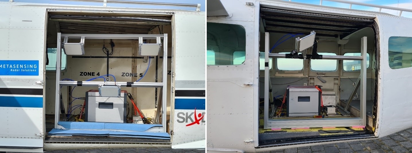
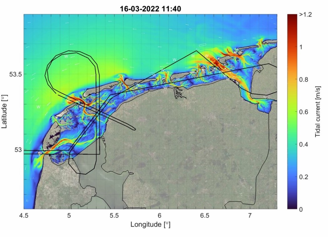
The campaign took place in mid-March 2022 over the Dutch Wadden Sea starting from Texel. Two airborne SAR systems, installed on two Cessna airplanes, collected relevant Harmony-like C-band bistatic full polarimetric and interferometric data during two 4-5-hour-long flights on 14 March 2022 and 16 March 2022. The SAR bistatic data collected during the airborne campaign have been processed and calibrated up to Single Look Complex (coregistered and geolocated) images.

Deltares supported the campaign using a tide-only implementation of its depth-averaged DCSM-FM 100m model to make animations of current patterns in the Wadden Sea, so that the WaddenSAR team could explore conditions that should be captured by the flight lines and plan the mission to coincide with the most interesting phase of the tide. In addition, EO viewers were provided, so that further intelligence on water masses could be acquired, in addition to in-situ hydro-meteo measurements of waves and water levels for interpretation of signals or verification of retrievals.
Overall, the WaddenSAR airborne campaign is an exciting example of how advanced radar technology can be used to study and protect our planet's most fragile ecosystems. The campaign highlights the importance of international collaboration and investment in scientific research to address the challenges posed by climate change and other global environmental threats.
Download the WaddenSAR Final Report
| Year | 2022 |
| Geographic location | Wadden Sea & North Sea, Netherlands |
| Field of Application | Bistatic SAR, ocean surface currents, Harmony |
| Data Size | 0.98 TB |
| Release Date | March 2023 |
Digital Object Identifier: European Space Agency, 2019, WaddenSAR – Airborne bistatic C-band SAR experiment to demonstrate different acquisition geometries https://doi.org/10.57780/esa-8375f33
Data
The campaign data is available online via FTPS upon submission of a data access request. An active EO Sign In account is required to submit the request.
The data can be downloaded via an FTP client (e.g., FileZilla or WinSCP) using the option "Implicit FTP over TLS".
For further information about the EO Sign In Service you can visit TellUs.
Should you need support please contact EOHelp.