- All Categories (236)
- Data (87)
- News (76)
- Missions (9)
- Events (24)
- Tools (2)
- Activities (1)
- Campaigns (19)
- Documents (18)
News - Success Stories

1 km resolution aerosol optical thickness retrieved from PROBA-V
The ESA SPAR@MEP project aims to deliver a long-term data record (LTDR) of aerosol optical properties and surface reflectance from SPOT-VGT and PROBA-V observations.
Event - Conference

15 Years of Progress in Radar Altimetry Symposium
A Symposium on "15 Years of Progress in Radar Altimetry" and the annual meeting of the Ocean Surface Topography Science Team, the International Doris Service Workshop and the ARGO Workshop.
Document - Conference Presentation - Poster

1_Polarimetric_Soil_Moisture_Retrieval_Vegetated_Soils_in_TERENO.pdf
Polarimetric Decompositions for Soil Moisture Retrieval from Vegetated Soils in TERENO Observatories T. Jagdhuber [German Aerospace Center - DLR]
Document - Conference Presentation - Poster
1_POLinSAR2013_compact_v1.pdf
Time Series Decomposition Analysis for Compact Polarimetry S.R. Cloude [AEL Consultants - UK]
Document - Conference Presentation - Poster
1_PolinSAR2013_HJ.pdf
Interpretation Pol-InSAR Vegetation Signatures at X-Band H.J. Joerg [German Aerospace Center - DLR]
Document - Conference Presentation - Poster
2_Charbonneau_compact_pol.pdf
RCM Compact Polarimetry Applied to Watershed Study F. J. Charbonneau [Natural Resources Canada]
Event - Workshop

2nd CHRIS PROBA Workshop
This 2004 workshop was on the treatment of Compact High Resolution Images Spectrometer (CHRIS) data.
Event - Conference
3rd ERS Symposium
The ESA Directorate for Observation of the Earth and its Environment held the 3rd ERS Symposium, in 1997, where many of the results from the ERS-1 and ERS-2 missions were presented and discussed by the scientific community.
Event - Workshop
4th CHRIS PROBA Workshop
Workshop on the treatment of Compact High Resolution Images Spectrometer (CHRIS) data.
News - Operational News
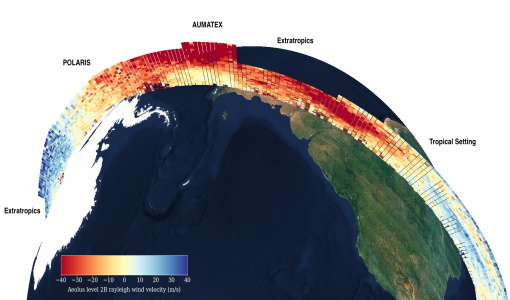
A Guide to Aeolus Range Bin Settings
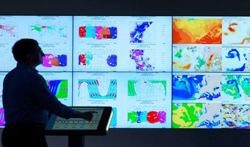
After almost two years in space, Aeolus' near-real time observations have been assimilated into the Numerical Weather Prediction models of several European meteorological services, and have proven crucial during the COVID-19 pandemic, which led to a sharp decrease in meteorological observations.
Event - Training

Advanced Training Course in Land Remote Sensing 2012
The 2012 advanced training course focused on land remote sensing theory and applications.
Mission - Earth Explorers

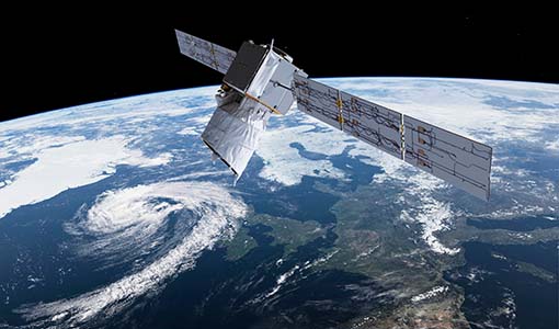
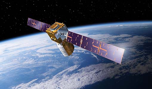
Aeolus
The Aeolus mission which was launched into space on 22 August 2018 and was retired on 30 April 2023, provided global observations of wind profiles from space to improve the quality of weather forecasts, and to advance our understanding of atmospheric dynamics and climate processes.
News - Infographics
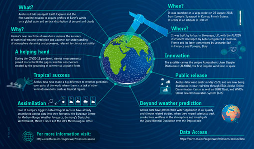
Aeolus - ESA's mission dedicated to winds, aerosols and clouds
Learn more about ESA's youngest Earth Explorer - the Aeolus mission - in our latest infographic
Event - Workshop
Aeolus Cal/Val and Science Workshop
The ESA organised Aeolus Cal/Val virtual workshop was a forum for reporting on the mission status and product evolution, for informing and coordinating mission Cal/Val activities.
News - General News
Aeolus data and lessons learned: what happens next for ESA’s wind mission?
The Aeolus satellite returned to Earth on 28 July 2023, in an assisted reentry that marked the end of nearly five years in space. For scientists working with Aeolus data, however, the mission lives on.
News - Success Stories
Aeolus Data Now in Use by Four of Europe’s Biggest Meteorological Services
European meteorological services are now benefiting from the use of operational Aeolus data in their forecasts.
News - Data Release news
Aeolus data now publicly available
Last week marked an exciting milestone for Aeolus. On 12 May, its wind data became publicly available.
News - Success Stories
Aeolus enhances volcanic ash forecasts for aviation safety
A new study, using wind data from ESA’s Aeolus mission, highlights the importance of using satellite missions like Aeolus to improve volcanic ash forecasting and ensure aviation safety in the future.
Data - Data Description
Aeolus Level 2C assisted wind fields resulting from NWP (Numerical Weather Prediction) assimilation processing
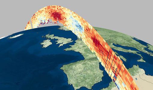
The Level 2C wind product of the Aeolus mission provides ECMWF analysis horizontal wind vectors at the geolocations of assimilated L2B HLOS wind components. The L2C can therefore be described as an Aeolus-assisted horizontal wind vector product. The L2C is a distinct product, however the L2C and L2B share a common Earth Explorer file template, with the L2C being a superset of the L2B. The L2C consists of extra datasets appended to the L2B product with information which are relevant to the data assimilation of the L2B winds.
News - Operational News
Aeolus NRT FM-A public data available after instrument switch over
The Aeolus ALADIN FM-A instrument switch-on and its commissioning have been successfully completed.