- All Categories (1123)
- Data (14)
- News (59)
- Missions (3)
- Events (22)
- Tools (11)
- Activities (1)
- Campaigns (3)
- Documents (1010)
Document - Conference Presentation - Poster
05_OCT2013 SMOS_NREUL_partI.pdf
The SMOS mission Dr. Nicolas Reul (IFREMER, France)
Document - Conference Presentation - Poster
10_Lopez_VAS.pdf
SMOS Validation and Retrieval Team Readiness Review Workshop 2009 Posters and Presentations - SMOS Validation Rehearsal Campaign at the VAS site (E.Lopez)
News - Data Release news
14 years of reprocessed SMOS Freeze/Thaw soil status products are now available
14 years of reprocessed SMOS Freeze/Thaw soil status products are now available from the SMOS dissemination service
Event - Workshop
2nd SMOS for Space Weather Workshop
The Second Workshop on SMOS for Space Weather will take place on 27 October 2023, hosted by the Space Weather Group of the University of Alcala, Alcalá de Henares (Madrid, Spain).
News - Events and Proceedings
2nd SMOS for Space Weather Workshop
The 2nd Workshop on SMOS for Space Weather will take place on 27th October 2023, hosted by the Space Weather Group of the University of Alcala, Alcalá de Henares (Madrid, Spain).
Event - Conference
2nd SMOS Science Conference
The conference focused on the applications of SMOS data, including operational services, the development of novel data products, the synergistic use of SMOS data with other data sources and the potential of SMOS data for the generation of long-term data sets.
Event - Training
3rd Advanced Training Course on Land Remote Sensing 2011
This 2011 advanced ESA training course focused on land remote sensing theory and applications.
Event - Training
3rd Advanced Training Course on Ocean Remote Sensing 2013
The 3rd Advanced Training Course on Ocean Remote Sensing was held from 23 to 27 September 2013 in Cork, at the National Maritime College of Ireland.
Document - Conference Presentation - Poster
8-Use_SAR_observing_Polar_lows.pdf
Use of SAR in observing Polar lows Birgitte Furevik (Norwegian Meteorological Inst., Norway)
Event - Training
Advanced Ocean Synergy Training Course
This ESA course was devoted to training the next generation of Earth Observation scientists to exploit data from ESA and Third Party Mission instruments for ocean science and application development.
Event - Training
Advanced Training Course in Land Remote Sensing 2012
The 2012 advanced training course focused on land remote sensing theory and applications.
Document - Proceedings
Advances-in-Atmospheric-Science-and-Applications.pdf
Proceedings in Advances in Atmospheric Science and Applications held in 18-22 June 2012 in Bruges, Belgium.
News - Spotlight on EO community
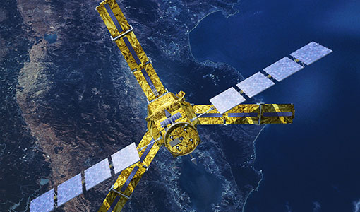
An overview of the SMOS mission
In this video, Klaus Scipal - Biomass and SMOS Mission Manager - talks about ESA's Soil Moisture and Ocean Salinity mission.
Document - General Reference
Application-of-satellite-remote-sensing-to-developing-countries.pdf
This booklet is a preliminary copy of the first set of viewgraphs being prepared by Satellite Observing Systems (SOS) for ESA to support Agencies activities for promoting the use of Earth observation data from space in various environmental disciplines and applications for developing countries.
Event - Workshop
Applications of the ERS Along Track Scanning Radiometer Workshop 1999
The workshop on ERS mission's Along Track Scanning Radiometer (ATSR) instrument gathered researchers and specialists working on different applications of the mission.
Document - General Reference
ARTEMIS-Data-Relay-Payload-Data-Book.pdf
This document is intended as a guide to the user community wishing to avail themselves of the services provided by the data relay system, which is based on the ARTEMIS satellite located over Europe. This document describes the services that data relay can offer and the interface requirements applicable to the UST and the UET.
Document - General Reference
ARTEMIS-Moving-Forward-a-New-Generation-of-Communications.pdf
This brochure presents an overview of the telecommunications satellite, Artemis.
Document - General Reference
ARTEMIS-Paving-the-way-for-Europes-future-data-relay-land-mobile-and-Navigation-Services.pdf
This brochure provides an overview of Artemis, ESAs telecommunications satellite.
Data - EO Sign In Authentication (Open)
AVHRR Level-1B Local Area Coverage Imagery
This collection is composed of AVHRR L1B products (1.1 km) reprocessed from the NOAA POES and Metop AVHRR sensors data acquired at the University of Dundee and University of Bern ground stations and from the ESA and University of Bern data historical archive. The product format is the NOAA AVHRR Level 1B that combines the AVHRR data from the HRPT stream with ancillary information like Earth location and calibration data which can be applied by the user. Other appended parameters are time codes, quality indicators, solar and satellite angles and telemetry. Two data collections cover Europe and the neighbouring regions in the period of 1 January 1981 to 31 December 2020 and the acquired data in the context of the 1-KM project in the ‘90s. During the early 1990’s various groups, including the International Geosphere-Biosphere Programme (IGBP), the Commission of the European Communities (CEC), the Moderate Resolution Imaging Spectrometer (MODIS) Science Team and ESA concluded that a global land 1 KM AVHRR data set would have been crucial to study and develop algorithms for several land products for the Earth Observing System. USGS, NOAA, ESA and other non-U.S. AVHRR receiving stations endorsed the initiative to collect a global land 1-km multi-temporal AVHRR data set over all land surfaces using NOAA's TIROS "afternoon" polar-orbiting satellite. On 1 April 1992, the project officially began up to the end of 1999 with the utilisation of 23 stations worldwide plus the NOAA local area coverage (LAC) on-board recorders. The global land 1-km AVHRR dataset is composed of 5 channels, raw AVHRR dataset at 1.1 km resolution from the NOAA-11 and NOAA-14 satellites covering land surfaces, inland water and coastal areas. Global Land 1 km AVHRR Data Set Project HRPT Ground Station Network (as of 1 April 1992) and Acquisition Areas for LAC Recorded Data Spatial coverage: Check the spatial coverage of the collection on a map available on the Third Party Missions Dissemination Service: AVHRR L1B 1.1 KM AVHRR L1B LAC Out-of-Europe.
Document - Product Handbook
AVHRR-Handbook.pdf
The AVHRR user handbook provides details about the content of the consolidated and harmonised data set archived at ESA facilities.
