- All Categories (24)
- Data (1)
- News (11)
- Events (10)
- Activities (1)
- Documents (1)
News - Infographics
Showcasing success stories from ESA's Heritage Missions
Find out how ESA's Heritage Space Programme data continue to help, even decades after they finished operations, in our latest infographic.
Document - Product Handbook
SAR Tropical Oceanic Phenomena Handbook
ERS SAR Tropical Oceanic Phenomena Handbook.
News - Thematic area articles
Tracking the world’s forests from space
As human activities continue to threaten the planet’s forests, data delivered by satellites are boosting global efforts to conserve these crucial natural resources.
News - Thematic area articles
Remote sensing data map impacts of natural hazards
As climate change increases the frequency and severity of natural disasters, remote sensing data can warn about extreme events and help tackle emergency situations.
News - Events and Proceedings
Scientists to showcase value of Earth observation data at EGU
Remote sensing scientists are getting ready to present innovative and exciting applications of satellite data at the European Geosciences Union general assembly which will take place from 24 to 28 April in Vienna, Austria.
News - Thematic area articles
Monitoring water on Earth's surface
ESA's Earth observation satellites are playing a leading role in furthering our understanding of how Earth's terrestrial hydrosphere is being influenced by humankind.
News - Thematic area articles
Global understanding of Earth's land surfaces greatly boosted by satellite data
ESA perform land surface monitoring with a range of instruments onboard satellites acquiring optical and radar data. Collections of data from these missions are freely available for research purposes.
News - Thematic area articles
Satellites investigate Earth’s terrestrial hydrosphere
ESA’s Earth observation satellites are playing a leading role in furthering our understanding of how Earth’s water cycle is being influenced by humankind.
News - Success Stories
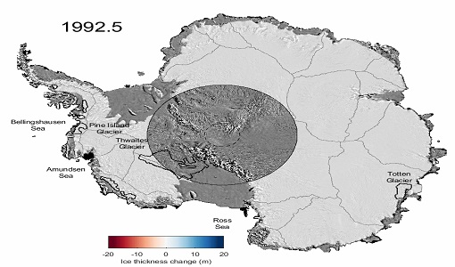
Decades of satellite data reveal the risks of climate tipping points
Decades-long time series that draw on ESA’s Earth observation archives are enabling scientists to uncover the threat of sudden and potentially irreversible changes to the icy parts of the planet.
Event - Training
EO Summer School 6
ESA's series of summer schools, on Monitoring of the Earth System, aims to promote the exploitation of Earth observation data.
Event - Training
EO Summer School 5
ESA's series of summer schools, on Monitoring of the Earth System, aims to promote the exploitation of Earth observation data.
Event - Training
EO Summer School 4
ESA's series of summer schools, on Monitoring of the Earth System, aims to promote the exploitation of Earth observation data.
News - Thematic area articles
Transforming space data into climate action
ESA’s Earth observation activities are playing a key role in the revitalised global drive to combat climate change.
News - Spotlight on EO community
Introducing Mirko Albani
In this short introduction, ESA's Heritage Missions Programme Manager describes what he likes most about ESA's long term archive of satellite mission data and his role in the programme.
News - Thematic area articles
Satellite data boost global understanding of land surface
Understanding our changing land surface is essential in the study of climate change. Satellites are used to monitor changes to the material that covers Earth’s surface, so-called land cover, such as vegetation and water.
Activity - Projects
Dragon 2 Cooperation Programme
The Dragon 2 Programme focussed on the exploitation of ESA, ESA's Third Party Missions and Chinese Earth observation data for science and applications development in land, ocean and atmospheric applications.
Event - Workshop
Fringe 1996 Workshop
The workshop on ERS SAR Interferometry was open to scientists and students working in the field of Synthetic Aperture Radar (SAR) interferometry and its applications.
Event - Conference
Envisat Symposium 2007
The Envisat Symposium provided a forum for investigators to present results of on-going research projects and activities using Envisat, ERS and ESA Third Party missions.
Event - Workshop
Space and the Arctic 2009 Workshop
Temperatures in the Arctic are rising at an unprecedented rate. This workshop looked at the needs and challenges of working and living in the rapidly changing Arctic and explore how space-based services might help to meet those needs.
Event - Training
4th Advanced Training Course in Land Remote Sensing
ESA organised the 4th Advanced Training Course in Land Remote Sensing which took place in Athens, Greece from 1 to 5 July 2013


