- All Categories (939)
- News (26)
- Missions (2)
- Events (16)
- Activities (2)
- Campaigns (2)
- Documents (891)
Event - Workshop

2nd MERIS/AATSR User Workshop
The workshop addressed the utilisation of MERIS and AATSR data for remote sensing of open oceans, coastal waters, land surfaces and atmospheric processes.
Event - Conference
2nd SMOS Science Conference
The conference focused on the applications of SMOS data, including operational services, the development of novel data products, the synergistic use of SMOS data with other data sources and the potential of SMOS data for the generation of long-term data sets.
Event - Workshop
2nd Space for Hydrology Workshop
The workshop aimed to assess the current stage of knowledge and activities in space-based hydrological observations and to exchange knowledge and know how with hydrologists and researchers.
Event - Training

3rd Advanced Training Course on Land Remote Sensing 2011
This 2011 advanced ESA training course focused on land remote sensing theory and applications.
Event - Meeting

3rd Sentinel-2 Validation Team Meeting
This Sentinel-2 Validation Team (S2VT) meeting was the third edition of a meeting series, initiated in 2016. The S2VT is organised under the auspices of ESA, CNES, and ENSEEIHT.
Event - Training
Advanced Ocean Synergy Training Course
This ESA course was devoted to training the next generation of Earth Observation scientists to exploit data from ESA and Third Party Mission instruments for ocean science and application development.
Event - Training
Advanced Training Course in Land Remote Sensing 2012
The 2012 advanced training course focused on land remote sensing theory and applications.
News - Spotlight on EO community

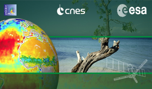
An overview of the SMOS mission
In this video, Klaus Scipal - Biomass and SMOS Mission Manager - talks about ESA's Soil Moisture and Ocean Salinity mission.
Document - General Reference

ARTEMIS-Data-Relay-Payload-Data-Book.pdf
This document is intended as a guide to the user community wishing to avail themselves of the services provided by the data relay system, which is based on the ARTEMIS satellite located over Europe. This document describes the services that data relay can offer and the interface requirements applicable to the UST and the UET.
Document - General Reference
ARTEMIS-Moving-Forward-a-New-Generation-of-Communications.pdf
This brochure presents an overview of the telecommunications satellite, Artemis.
Document - General Reference
ARTEMIS-Paving-the-way-for-Europes-future-data-relay-land-mobile-and-Navigation-Services.pdf
This brochure provides an overview of Artemis, ESAs telecommunications satellite.
Document - General Reference
Candidate-Earth-Explorers-in-Assessment-Phase.pdf
This flyer gives a quick overview on the candidate Earth Explorers missions in assessment phase.
Document - General Reference
CEOS 2004
The Committee on Earth Observation Satellites (CEOS) was created in 1984, in response to a recommendation from a Panel of Experts on Remote Sensing from Space, under the aegis of the Economic Summit of Industrialised Nations Working Group on Growth, Technology and Employment. This brochure provides an overview of CEOS as of 2004.
Document - General Reference
CEOS-Annual-Report-2000-2001-Special-Biennial-Edition.pdf
This publication marks the inaugural edition of the CEOS Annual Report. The CEOS Annual Report will convey the main highlights, activities, and accomplishments of the Committee on Earth Observation Satellites (CEOS) during the previous year. Because no report was issued in 2000, this inaugural edition of the CEOS Annual Report is a special biennial version, covering both the years 2000 and 2001.
Document - Product Cal/Val Plan/Report

CEOS-Committee-on-Earth-Observation-Satellites-Working-Group-on-Calibration-and-Validation.pdf
International collaboration on calibration and validation through the CalNal Working Group has been one of the signal successes of the CEOS organisation. The Working Group has created a mechanism for the sharing of effort in CALN AL between cooperating agencies, for the management of coherent programmes and campaigns and for the pooling of engineering and scientific information about the process of Earth observation through a variety of techniques. The success of the meeting of the SAR subgroup reported here is further evidence of the success of the coordinated approach adopted through CEOS.
Document - General Reference
CEOS-Sustainable-Development-The-Space-Contribution-Paper.pdf
This Fact Sheet examines the Committee on Earth Observation Satellite's (CEOS) activities in the field of sustainable development through the use of space technology.
Event - Workshop
CEOS-WGCV ACIX II CMIX Atmospheric Correction Inter-comparison Exercise Cloud Masking Inter-comparison Exercise 2nd workshop
The CEOS-WGCV ACIX II 2nd workshop took place at Esrin, Rome in Italy from 3 December - 5 December 2019.
Document - Product Cal/Val Plan/Report
CEOS-Working-Group-Calibration-and-Validation.pdf
This document describes the Committee on Earth Observation Satellite's involvement in Calibration and Validation activities for Earth Observation satellites.
Document - General Reference
CEOS-Yearbook-1997-Towards-an-integrated-global-observing-strategy.pdf
This document discusses the need for observations of planet Earth and its environment - both global observations, such as might be required to fulfil the needs of international climate treaties, and regional, national and local observations in support of specific environment, development and other issues. A large number of geophysical measurements are required whose spatial and temporal resolutions and accuracies depend on the specific application under consideration.
Document - General Reference
Coastal-Altimetry-and-CoastAlt.pdf
This flyer describes the ESA funded CoastAlt project, whose main objective was to contribute to the transition of pulse-limited coastal altimetry toward a mature, pre-operational phase.