- All Categories (105)
- Data (5)
- News (14)
- Missions (4)
- Events (18)
- Tools (3)
- Activities (3)
- Documents (58)
News - General News
ESA's improved Earth system data records: what is in store for the future?
Fundamental Data Records (FDRs) are instrumental in advancing our understanding of Earth systems and for addressing societal challenges effectively. These long-term records contain uncertainty-quantified, calibrated and geo-located multi-instrument/multi-platform satellite sensor data spanning several decades to support climate-related applications.
News - Success Stories
Long-term satellite data show wind farms can affect local air currents
Decades of satellite data have allowed for the first long-term study of the impact of offshore wind farms on downstream wind flow in coastal areas.
Tools - Catalogues
FedEO
FedEO is a data catalogue that provides a unique entry point to a number of scientific catalogues and services for, but not limited to, European and Canadian missions.
Tools - Catalogues
EO CAT
EO CAT is a data catalogue, offering a Next Generation Earth Observation system designed to manage end-user Earth Observation services.
Data - EO Sign In Authentication (Open)
ICEYE ESA archive
The ICEYE ESA archive collection consists of ICEYE Level 1 products requested by ESA supported projects over their areas of interest around the world. The dataset regularly grows as ESA collects new products over the years. Three different modes are available: Spot: With a slant resolution of 50 cm in range by 25 cm in azimuth that translated into the ground generates a ground resolution of 1 m over an area of 5 km x 5 km. Due to multi-looking, speckle noise is significantly reduced Strip: The ground swath is 30 x 50 km2 and the ground range resolution is 3 m Scan: A large area (100 km x 100 km is acquired with ground resolution of 15 m). Two different processing levels: Single Look Complex (SLC): Level 1A geo-referenced product and stored in the satellite's native image acquisition geometry (the slant imaging plane) Ground Range Detected (GRD): Level 1B product; detected, multi-looked and projected to ground range using an Earth ellipsoid model; the image coordinates are oriented along the flight direction and along the ground range; no image rotation to a map coordinate system is performed, interpolation artefacts not introduced. The following table defines the offered product types: EO-SIP Product Type Mode Processing level XN_SM__SLC Strip Single Look Complex (SLC) - Level 1A XN_SM__GRD Strip Ground Range Detected (GRD) - Level 1B XN_SL__SLC Spot Single Look Complex (SLC) - Level 1A XN_SL__GRD Spot Ground Range Detected (GRD) - Level 1B XN_SR__GRD Scan Ground Range Detected (GRD) - Level 1B As per ESA policy, very high-resolution data over conflict areas cannot be provided.
Event - Conference
Dragon 3 2014 Symposium
The Dragon 3 2014 Symposium was part of the Dragon 3 Programme, focussed on exploitation of ESA, ESA's Third Party Missions and Chinese Earth observation data for geo-science and applications development in land, ocean and atmospheric applications.
Event - Conference
Dragon 3 2015 Symposium
The Dragon 3 2015 Symposium was part of the Dragon 3 Programme, focussed on exploitation of ESA, ESA's Third Party Missions and Chinese Earth observation data for geo-science and applications development in land, ocean and atmospheric applications.
Event - Conference
Dragon 3 2016 Symposium
The Dragon 3 2016 Symposium served as the close of the Dragon 3 Cooperation Programme (2012 to 2016) and formal kick off for Dragon 4 Cooperation projects.
Activity - Projects
Dragon 3 Cooperation Programme
The Dragon 3 Programme focussed on the exploitation of ESA, ESA's Third Party Missions and Chinese Earth observation data for geo-science and applications development in land, ocean and atmospheric applications.
Document - Proceedings
EO-Summer-School-4-Remote-sensing-of-sea-ice.pdf
This presentation from ESA's EO Summer School 4 describes the remote sensing of sea ice from the air and satellites
Event - Training
EO Summer School 4
ESA's series of summer schools, on Monitoring of the Earth System, aims to promote the exploitation of Earth observation data.
Event - Training
EO Summer School 3
ESA's series of summer schools, on Monitoring of the Earth System, aims to promote the exploitation of Earth observation data.
News - Thematic area articles
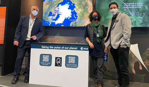
Space helps monitor Earth’s changing biosphere
Earth’s biosphere is continually changing. Through its pioneering Earth observation missions, ESA is making critical contributions to monitor these changes and their impacts on Earth’s water and carbon cycles.
News - Events and Proceedings
Data preservation takes centre stage at Living Planet Symposium
Against the backdrop of the famed Rhine River, world-class scientists and Earth observation data-users are gathered this week in the historical city of Bonn, at the Living Planet Symposium (LPS).
News - Data Release news
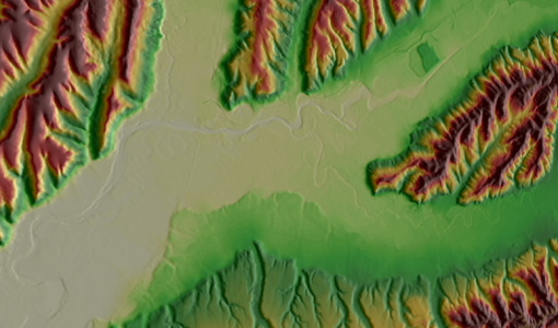
TerraSAR-X/TanDEM-X WorldDEM data now available to users
WorldDEM products have been added to the TerraSAR-X/TanDEM-X offering and are now available to users for research and application development following submission of a project proposal subject to evaluation and acceptance by ESA and the data owner.
Activity - Projects
Dragon 2 Cooperation Programme
The Dragon 2 Programme focussed on the exploitation of ESA, ESA's Third Party Missions and Chinese Earth observation data for science and applications development in land, ocean and atmospheric applications.
News - Success Stories
COP26 fuels interest in satellite data
As COP26 stimulates action to reduce global warming, the essential role of satellite data in understanding and monitoring climate change is apparent.
News - Success Stories
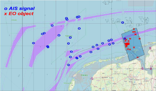
Earth Observation data to improve navigation risk modelling and shipping routes
With the increased frequency of shipping activities, such as tourism and transport of freights, navigation safety has become a major concern. Even if new technologies have already supplied aids to pilots for navigation risk reduction, the International Maritime Organisation (IMO) reports that the majority of accidents could have been avoided by providing suitable input to the navigation decision-making process — this is where Earth Observation data can represent complementary information, to improve traffic monitoring and guidance along safe routes.
Document - Technical Note
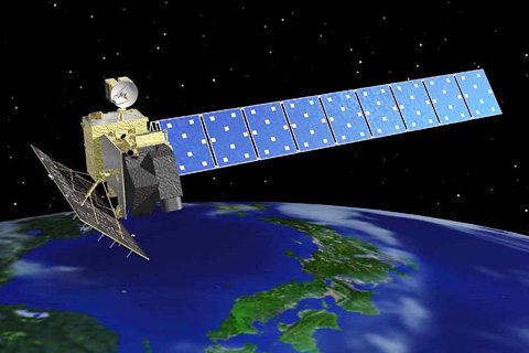
ALOS-PALSAR-processor-software-release-note.pdf
This document is the software release note for ALOS PALSAR processor version 5.04 and includes history of all updates to the previous versions of the processor.
News - Data Release news
ALOS PALSAR Ice Polar Year Antarctica dataset now available
ALOS PALSAR IPY Antarctica dataset is now available to the scientific community through an improved service: it is possible to easily select and download the products from an online map of Antarctica.


