- All Categories (71)
- News (7)
- Missions (2)
- Events (9)
- Tools (2)
- Activities (2)
- Documents (49)
News - General News
ESA's improved Earth system data records: what is in store for the future?
Fundamental Data Records (FDRs) are instrumental in advancing our understanding of Earth systems and for addressing societal challenges effectively. These long-term records contain uncertainty-quantified, calibrated and geo-located multi-instrument/multi-platform satellite sensor data spanning several decades to support climate-related applications.
News - Maintenance News
ESA Data Dissemination Maintenance - 18 January 2024
A planned software maintenance activity will affect ESA's GOCE data dissemination service on 18 January 2024.
Event - Workshop
1st International GOCE User Workshop
The workshop provided a forum for presentations and discussions on the development, use and exploitation of GOCE Level 2 (global and regional) geoid products and Level 3 (science and application) data products.
Document - Proceedings
EO-Summer-School-6-ESA-explorer-mission-GOCE-earth-gravity-from-space.pdf
This presentation from ESA's EO Summer School 6 presents the ESA explorer mission GOCE earth gravity from space
Event - Conference
Living Planet Symposium 2022
Learn about the 2022 edition of ESA's Living Planet Symposium.
News - Thematic area articles
Transforming space data into climate action
ESA’s Earth observation activities are playing a key role in the revitalised global drive to combat climate change.
News - Events and Proceedings
Data preservation takes centre stage at Living Planet Symposium
Against the backdrop of the famed Rhine River, world-class scientists and Earth observation data-users are gathered this week in the historical city of Bonn, at the Living Planet Symposium (LPS).
News - Spotlight on EO community
Interviewing Mirko Albani
ESA’s Heritage Space Programme Manager describes the goals of the programme, some of the challenges involved in preserving and improving 40 years of historical Earth observation data, and his passion for curating this long-term archive.
Activity - Projects
Dragon 2 Cooperation Programme
The Dragon 2 Programme focussed on the exploitation of ESA, ESA's Third Party Missions and Chinese Earth observation data for science and applications development in land, ocean and atmospheric applications.
Event - Workshop
2nd International GOCE User Workshop
This workshop provided a forum for presenting progress on the development of the GOCE mission's payload, ground segment and data products.
Event - Workshop
3rd International GOCE User Workshop
This workshop focussed on the oceanographic applications, such as absolute dynamic topography, of GOCE data in conjunction with other space-borne data, such as radar altimetry, and in-situ data and models.
News - Success Stories
ERS Heritage Data allow for 30 years of science
At their time of launch thirty years ago, the two ERS satellites were the most sophisticated Earth observation spacecraft ever developed and launched by Europe.
News - Infographics
ERS - ESA’s first Earth observation satellites
To mark the 30th anniversary of ERS, we've released a new infographic summarising the mission.
Tools - Apps
Heritage Missions app for iOS
Download the Heritage Missions application to discover what the missions were about, how it worked and what the elements of the space and ground segment that make these missions unique.
Tools - Apps
Heritage Missions app for Android
Download the Heritage Missions application to discover what the missions were about, how it worked and what the elements of the space and ground segment that make these missions unique.
Mission - Earth Explorers
GOCE
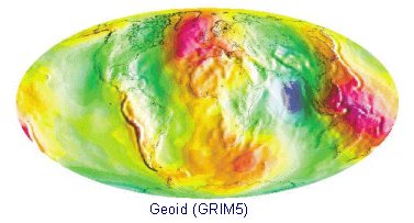
ESA's Gravity field and Ocean Circulation Explorer (GOCE) mission mapped Earth's geoid very accurately, opening a window into Earth's interior structure as well as the currents circulating within the depths of its oceans.
Mission - Heritage Missions
ERS
The ERS programme was composed of two missions, ERS-1 and ERS-2, which together observed the Earth for 20 years, from 1991 to 2011.
Activity - Quality
SCIRoCCo
The SCIRoCCo project is an interdisciplinary cooperation of scatterometry experts aimed at promoting the continuing exploitation of ESA's unique 20 years' worth of ERS Scatterometer data.
Event - Training
Advanced Training Course in Land Remote Sensing 2012
The 2012 advanced training course focused on land remote sensing theory and applications.
Event - Training
3rd Advanced Training Course on Land Remote Sensing 2011
This 2011 advanced ESA training course focused on land remote sensing theory and applications.


