- All Categories (41367)
- Data (61)
- News (156)
- Missions (20)
- Events (60)
- Tools (7)
- Activities (10)
- Campaigns (13)
- Documents (41040)
DATA
Discover and download the Earth observation data you need from the broad catalogue of missions the European Space Agency operate and support.
Data - Campaigns (Open)
PhotoProxy 2019
The Photosynthetic-Proxy Experiment campaign address relevant open aspects that are related to the quantitative assessment of vegetation photosynthesis and vegetation stress from space.
Data - Campaigns (Open)
SnowLab-NG
The overall objective of the SnowLab-NG activity was to provide a comprehensive multi-frequency, multi-polarisation, multi-temporal dataset and active and passive microwave measurements over snow-covered grounds.
Data - Campaigns (Open)
FLEXSense 2019
The FLEXSense 2019 campaign activities were undertaken in Germany and Italy with the goal of providing a complete set of high-resolution experimental data, including all relevant elements required for the preparation of the FLEX satellite mission.
Data - Campaigns (Open)
AfriSAR 2015
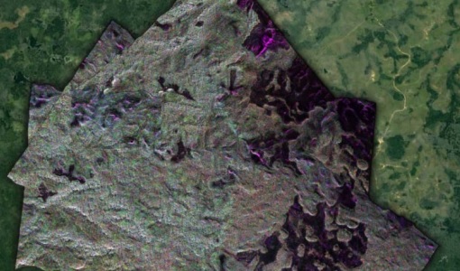
During the AfriSAR 2015 campaign, shared between ONERA (dry season, July 2015) and DLR (wet season 2016), Pol-InSAR and TomoSAR airborne data set were collected over four test sites over Africa, therefore covering different forest structures.
Data - Campaigns (Open)
BioSAR 2007
The BioSAR campaign aimed to support geophysical algorithm development, calibration/validation and the simulation of future spaceborne Earth Observation missions.
Data - Campaigns (Open)
BioSAR 2008
The main objective of BioSAR-2 (BioSAR 2008) campaign was to record SAR data over boreal forests with topographic effects to investigate the effect on biomass retrieval.
Data - Campaigns (Open)
AGRISAR 2006
The AGRISAR 2006 campaign, carried out between 18 April and 2 August 2006, was established to address important specific programmatic needs of Sentinel-1 and -2.
Data - Campaigns (Open)
AgriSAR 2009
The AgriSAR 2009 campaign was defined to leverage the RADARSAT-2 mission to better understand and demonstrate the potential for GMES land monitoring user services, particularly in agriculture.
Data - Campaigns (Open)
AIRFIRE
The fires observational campaign was performed during summer 2006 and dedicated to the study of fire emission in the spectral region VNIR-SWIR.
Data - EO Sign In Authentication (Open)
Envisat ASAR AP Single-Look Complex L1 [ASA_APS_1P]
This product is a complex, slant-range, digital image generated from Level 0 data collected when the instrument is in Alternating Polarisation mode. (7 possible swaths). It contains two CO-registered images corresponding to one of the three polarisation combination submodes (HH and VV, HH and HV, VV and VH). In addition, the product uses the Range Doppler algorithm and the most up to date processing parameters available at the time of processing. It can be used to derive higher level products for SAR image quality assessment, calibration and interferometric applications, if allowed by the instrument acquisition. A minimum number of corrections and interpolations are performed on the data in order to allow the end-user maximum freedom to derive higher level products. Complex output data is retained to avoid loss of information. Absolute calibration parameters are available depending on external calibration activities and are provided in the product annotations. Spatial Resolution: Approximately 8m slant range x approximately 4m azimuth.
Data - EO Sign In Authentication (Open)
Envisat ASAR AP Medium Resolution L1 [ASA_APM_1P]
This ASAR Alternating Polarization Medium Resolution Image product has been generated from Level 0 data collected when the instrument was in Alternating Polarisation Mode. The product has lower geometric resolution but higher radiometric resolution than ASA_APP and contains one or two co-registered images corresponding to one of the three polarisation combination sub modes (HH and VV, HH and HV, VV and VH). This product has been processed using the SPECAN algorithm and contains radiometric resolution good enough for ice applications and covers a continuous area along the imaging swath. The ASAR AP L0 full mission data archive has been bulk processed to Level 1 (ASA_APM_1P) in Envisat format with the IPF-ASAR processor Version 6.03. Spatial Resolution: 150 m ground range x 150 m azimuth.
Data - EO Sign In Authentication (Open)
Envisat ASAR AP Precision L1 [ASA_APP_1P]
This ASAR Alternating Polarisation Mode Precision product is generated from Level 0 data collected when the instrument is in Alternating Polarisation Mode (7 possible swaths). The product contains two CO-registered images corresponding to one of the three polarisation combination submodes (HH and VV, HH and HV, VV and VH). This is a stand-alone multi-look, ground range, narrow swath digital image generated using the SPECAN algorithm and the most up to date auxiliary information available at the time of processing. Engineering corrections and relative calibration (antenna elevation gain, range spreading loss) are applied to compensate for well-understood sources of system variability. Generation of this product uses a technique to allow half the looks of an image to be acquired in horizontal polarisation and the other half in vertical polarisation and processed to 30-m resolution (with the exception of IS1). Absolute calibration parameters are available depending on external calibration activities and are provided in the product annotations. Spatial Resolution: 30 m ground range x 30 m azimuth.
Data - Fast Registration with immediate access (Open)
Envisat ASAR Wave SLC and Cross-Spectra Imagettes L1 [ASA_WVI_1P]
This is the basic Level 1B ASAR Wave Mode product, including up to 400 single-look, complex, slant range, imagettes generated from Level 0 data and up to 400 imagette power spectra computed using the cross-spectra methodology. The auxiliary parameters used are the most up-to-date at the time of processing. A minimum number of corrections and interpolations are performed in order to allow the end-user maximum freedom to derive higher level products. Complex output data is retained to avoid loss of information. Absolute calibration parameters, when available (depending on external calibration activities), are provided in the product annotations. Imagette power spectrum is equivalent to the ERS UWA (Near Real Time) product with revisited algorithm (cross-spectra) taking into account the higher quality of the SLC imagette. Note that starting from an SLC imagette, the generation of an ERS UWA-type product might be ensured by a simple look detection and summation. This product provides a continuation of the ERS-SAR wave mode data. Imagette Spatial Resolution: 20 m ground range x 20 m azimuth. Cross Spectra Output: Wavelength range from 20 to 1000 m in 24 logarithmic steps.
Data - Data Service Request (Restrained)
Envisat ASAR WS L0 [ASA_WS__0P]
The WS Mode Level 0 product consists of time-ordered AISPs collected while the instrument was is in Wide Swath Mode. The echo samples in the AISPs have been compressed to 4 bits per sample using FBAQ. This is a high-rate, wide swath (ScanSAR) mode so data is only acquired for partial orbit segments and is composed from five image swaths (SS1 to SS5). The Level 0 product is produced systematically for all data acquired within this mode. The objective of this product is to offer Level 0 data for possible image processing on another processing site. It includes mandatory information for SAR processing. Data Size: 400 km across track x 400 km along track.
Data - Fast Registration with immediate access (Open)
GOME Total Column Water Vapour Climate product
The GOME Total Column Water Vapour (TCWV) Climate product was generated by the Max Planck Institute for Chemistry (MPIC), and the German Aerospace Center (DLR) within the ESA GOME-Evolution project. It is a Level 3 type product containing homogenized time-series of the global distribution of TCWV spanning over more than two decades (1995-2015). The data is provided as single netCDF file, containing monthly mean TCWV (units kg/m2) with 1-degree resolution, and is based on measurements from the satellite instruments ERS-2 GOME, Envisat SCIAMACHY, and MetOp-A GOME-2. Details are available in the paper by Beirle et al, 2018. Please also consult the GOME TCWV Product Quality Readme file before using the data.
Data - Fast Registration with immediate access (Open)
ERS-2 GOME Total Column Amount of Trace Gases Product
GOME Level 2 products were generated by DLR on behalf of the European Space Agency, and are the end result of the Level 1 to 2 reprocessing campaign of GOME Level 1 version 4 data with Level 2 GOME Data Processor (GDP) version 5.0 (HDF-5 format). The GOME Level 2 data product comprises the product header, total column densities of ozone and nitrogen dioxide and their associated errors, cloud properties and selected geo-location information, diagnostics from the Level 1 to 2 algorithms and a small amount of statistical information.
Data - Fast Registration with immediate access (Open)
Envisat ASAR Wave Imagette Cross Spectra L1 [ASA_WVS_1P]
The ASAR Wave product is extracted from the combined SLC and Cross Spectra product, ASA_WVI_1P, which is generated from data collected when the instrument was in Wave Mode using the Cross Spectra methodology. The product is meant for Meteo users. The spatial coverage is up to 20 spectra acquired every 100 km, with a minimum coverage of 5km x 5km. The file size has a maximum of 0.2 Mbytes. Auxiliary data include Orbit state vector, Time correlation parameters, Wave Processing parameters ADS, Wave Geolocation ADS, SQ ADS. The product provides a continuation of the ERS-SAR wave mode data. Output: Wavelength range from 20 to 1000 m in 24 logarithmic steps.
Data - Fast Registration with immediate access (Open)
Envisat ASAR WM Ocean Wave Spectra L2 [ASA_WVW_2P]
The ASAR Wave Mode product is created by inverting the cross-spectra which is computed from inter-look processing of the SLC wave imagettes in order to derive the directional ocean product ocean wave spectra. Auxiliary ADSs included with the product remains the same as for the ASAR Wave Mode Cross-Spectra product. The output follows the format of the Envisat ASAR Level 1B Wave Mode Imagette Cross-Spectra (ASA_WVS_1P) product. This is done in order to be compatible with the ground segment products of Envisat ASAR. This product provides a continuation of the ERS-SAR wave mode data. Output: Wavelength range from 20 to 1000 m in 24 logarithmic steps.
Data - Fast Registration with immediate access (Open)
Envisat GOMOS Level 2 - Atmospheric constituents profiles - User Friendly Product [GOMOS_UFP]
This data product describes atmospheric constituents profiles: In particular the vertical and line density profiles of ozone, NO2, NO3, O2, H2O, air, aerosols, temperature, turbulence. Coverage is as follows: Elevation range: +62 deg to +68 deg Azimuth range: +90 deg to +190 deg (with respect to the flight direction) The GOMOS data are now also available as user friendly products in the NetCDF4-format. These products are occultation based (dark and bright) and include all GOMOS Level 2 constituent profiles (O3, NO2, NO3, O2, H2O, air and aerosols) and HRTP profiles with all the essential parameters as in the original Envisat data set format.
Data - Fast Registration with immediate access (Open)
Envisat GOMOS Geolocated Calibrated Transmission Spectra and Photometer Fluxes [GOM_TRA_1P]
This data product describes the geolocated and calibrated transmission spectra products, containing the full transmission and the covariance spectra needed for Level 2 processing. Coverage is as follows: Elevation range: +62 deg to +68 deg Azimuth range: +90 deg to +190 deg (with respect to the flight direction). The file size is 1 MB per occultation, depending on the duration of the occultation.


