- All Categories (24407)
- Data (25)
- News (71)
- Missions (4)
- Events (12)
- Tools (6)
- Activities (2)
- Campaigns (4)
- Documents (24283)
DATA
Discover and download the Earth observation data you need from the broad catalogue of missions the European Space Agency operate and support.
Data - EO Sign In Authentication (Open)
Land Ice Thematic Data Product [ALT_TDP_LI]
This is the Land Ice Thematic Data Product (TDP) V1 resulting from the ESA FDR4ALT project and containing estimates of ice sheet surface elevation and associated uncertainties. The collection covers data for three different missions: ERS-1, ERS-2 and Envisat, and based on Level 1 data coming from previous reprocessing (ERS REAPER and the Envisat V3.0) but taking into account the improvements made at Level 0/Level 1 in the frame of FDR4ALT (ALT FDR). The Land Ice TDP focuses specifically on the ice sheets of Greenland and Antarctica, providing these data in different files. For many aspects, the Land Ice Level 2 and Level 2+ processing is very innovative: Improved relocation approach correcting for topographic effects within the beam footprint to identify the Point of Closest Approach Homogeneous timeseries of surface elevation measurements at regular along-track reference nodes. The FDR4ALT products are available in NetCDF format. Free standard tools for reading NetCDF data can be used. Information for expert altimetry users is also available in a dedicated NetCDF group within the products. Please consult the FDR4ALT Product User Guide before using the data. The FDR4ALT datasets represent the new reference data for the ERS/Envisat altimetry missions, superseding any previous mission data. Users are strongly encouraged to make use of these datasets for optimal results.
Data - EO Sign In Authentication (Open)
Inland Waters Thematic Data Product [ALT_TDP_IW]
This is the Inland Waters Thematic Data Product (TDP) V1 resulting from the ESA FDR4ALT project and containing improved Water Surface Height (WSH) data record from the ERS-1, ERS-2 and Envisat missions estimated using the ICE1 retracking range for its better performance on the hydro targets. The FDR4ALT products are available in NetCDF format. Free standard tools for reading NetCDF data can be used. Information for expert altimetry users is also available in a dedicated NetCDF group within the products. Please consult the FDR4ALT Product User Guide before using the data. The FDR4ALT datasets represent the new reference data for the ERS/Envisat altimetry missions, superseding any previous mission data. Users are strongly encouraged to make use of these datasets for optimal results.
Data - Sample Data (Open)

CryoSat Data Samples
Download CryoSat data samples from Baseline-B, C, and D products.
Data - Campaigns (Open)

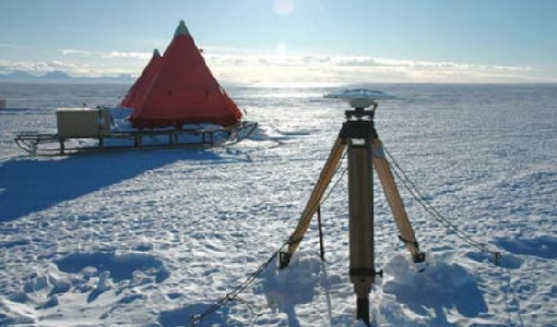
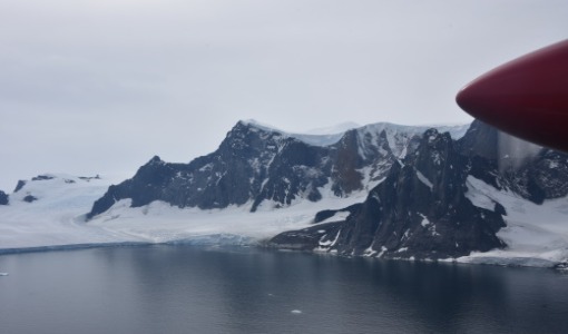
CryoVExAnt 2010/2011
The CryoVEx 2010/2011 Antartic campaign was carried out in Dronning Maud Land from 11 November 2010 to 20 February 2011.
Data - Campaigns (Open)
CryoVExAnt 2008/2009
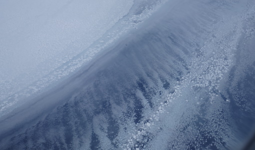
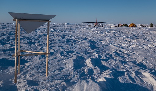
The key objective of the CryoSat Validation Experiment Antarctica (CryoVExAnt) campaign is a better approximation of the error range of the elevation obtained from SAR-processed altimetric radar returns and its sensitivity to surface roughness.
Data - Fast Registration with approval (Restrained)
ALOS PALSAR products
The dataset contains all ESA acquisitions over the ADEN zone (Europe, Africa and the Middle East) plus some products received from JAXA over areas of interest around the world. Further information on ADEN zones can be found in this technical note. ALOS PALSAR products are available in following modes: Fine Beam Single polarisation (FBS), single polarisation (HH or VV), swath 40-70 km, resolution 10 m, temporal coverage from 02/05/2006 to 30/03/2011 Fine Beam Double polarisation (FBD), double polarisation (HH/HV or VV/VH), swath 40-70 km, resolution 10 m, temporal coverage from 02/05/2006 to 30/03/2011 Polarimetry mode (PLR), with four polarisations simultaneously: swath 30 km, resolution 30 m, temporal coverage from 26/08/2006 to 14/04/2011 ScanSAR Burst mode 1 (WB1), single polarisation: swath 250-350 km, resolution 100 m, temporal coverage from 12/06/2006 to 21/04/2011. Following processing levels are available: RAW (Level 1.0): Raw data generated by every downlink segment and every band. Divided into an equivalent size to one scene SLC (Level 1.1): Slant range single look complex product. Not available for WB1 GDH (Level 1.5): Ground range Detected, Normal resolution product GEC (Level 1.5): Geocoded product. The table summarises the ALOS PALSAR offer. Instrument mode Product type Processing level description JAXA processing level equivalent Fine Beam Single polarisation (HH or VV) FBS_RAW_0P Raw data generated by every downlink segment and every band. Divided into an equivalent size to one scene 1.0 FBS_GDH_1P Ground range Detected, Normal resolution product 1.5 FBS_GEC_1P Geocoded product 1.5 FBS_SLC_1P Slant range single look complex product 1.1 Fine Beam Double polarisation (HH/HV or VV/VH) FBD_RAW_0P Raw data generated by every downlink segment and every band. Divided into an equivalent size to one scene 1.0 FBD_GDH_1P Ground range Detected, Normal resolution product 1.5 FBD_GEC_1P Geocoded product 1.5 FBD_SLC_1P Slant range single look complex product 1.1 Polarimetry mode (4 polarisation) PLR_RAW_0P Raw data generated by every downlink segment and every band. Divided into an equivalent size to one scene 1.0 PLR_GDH_1P Ground range Detected, Normal resolution product 1.5 PLR_GEC_1P Geocoded product 1.5 PLR_SLC_1P Slant range single look complex product 1.1 ScanSAR Burst mode 1 (single polarisation) WB1_RAW_0P Raw data generated by every downlink segment and every band. Divided into an equivalent size to one scene 1.0 WB1_GDH_1P Ground range Detected, Normal resolution product 1.5 WB1_GEC_1P Geocoded product 1.5
Data - Open access (Open)
CryoSat products
CryoSat's primary payload is the SAR/Interferometric Radar Altimeter (SIRAL) which has extended capabilities to meet the measurement requirements for ice-sheet elevation and sea-ice freeboard. CryoSat also carries three star trackers for measuring the orientation of the baseline. In addition, a radio receiver called Doppler Orbit and Radio Positioning Integration by Satellite (DORIS) and a small laser retroreflector ensures that CryoSat's position will be accurately tracked. More detailed information on CryoSat instruments is available on the CryoSat mission page. The following CryoSat datasets are available and distributed to users: Level 1B and L2 Ice products: NRT, LRM, SAR and SARIn Consolidated Level 2 (GDR): (LRM+SAR+SARIN) consolidated ice products over an orbit Intermediate Level 2 Ice products: LRM, SAR and SARIn L1b and L2 Ocean Products: NOP, GOP and IOP Cryo-TEMPO Land Ice Cryo-TEMPO Winter Sea Ice Cryo-TEMPO Summer Sea Ice Cryo-TEMPO Coastal Ocean Cryo-TEMPO Polar Ocean Cryo-TEMPO Inland Waters Cryo-TEMPO EOLIS Point Products Cryo-TEMPO EOLIS Gridded Products CryoSat Quaternions Product. Detailed information concerning each of the above datasets is available in the CryoSat Products Overview. CryoSat Ice and Ocean products CryoSat Level 1B altimetric products contain time and geo-location information as well as SIRAL measurements in engineering units. Calibration corrections are included and have been applied to the window delay computations. In Offline products, geophysical corrections are computed from Analysis Auxiliary Data Files (ADFs), whereas in FDM products corrections are computed for Forecast ADFs. All corrections are included in the data products and therefore the range can be calculated by taking into account the surface type. The Offline Level 2 LRM, SAR and SARIn ice altimetric products are generated 30 days after data acquisition and are principally dedicated to glaciologists working on sea-ice and land-ice areas. The Level 2 FDM products are near-real time ocean products, generated 2-3 hours after data acquisition, and fulfill the needs of some ocean operational services. Level 2 products contain the time of measurement, the geo-location and the height of the surface. IOP and GOP are outputs of the CryoSat Ocean Processor. These products are dedicated to the study of ocean surfaces, and provided specifically for the needs of the oceanographic community. IOP are generated 2-3 days after data sensing acquisition and use the DORIS Preliminary Orbit. GOP are typically generated 30 days after data sensing acquisition and use the DORIS Precise Orbit. Geophysical corrections are computed from the Analysis ADFs, however following the oceanographic convention the corrections are available but not directly applied to the range (as for FDM). CryoSat Ice and Ocean products can be accessed through ftp://science-pds.cryosat.esa.int/ via an FTP client and HTTPS under the folders named “SIR_” followed by the data product type and the processing level (e.g., SIR_SAR_L2 for Level 2 SAR data). Additionally, data can be downloaded from all the other services listed in the How to Access Data section. Cryo-TEMPO Products The CryoSat ThEMatic PrOducts (Cryo-TEMPO) projects aim to deliver a new paradigm of simplified, harmonized, and agile CryoSat-2 products, that are easily accessible to new communities of non-altimeter experts and end users. The Cryo-TEMPO datasets include dedicated products over five thematic areas, covering Winter Sea Ice, Summer Sea Ice, Land Ice, Polar Ocean, Coastal Ocean and Inland Water. The standard Cryo-TEMPO products include fully-traceable uncertainties and use rapidly evolving, state-of-the-art processing dedicated to each thematic area. Throughout the project, the products will be constantly evolved, and validated by a group of Thematic Users, thus ensuring optimal relevance and impact for the intended target communities. More information on the Cryo-TEMPO products can be found in the Product Handbook and on the Project Website. The products can be accessed through ftp://science-pds.cryosat.esa.int/ via an FTP client and HTTPS under the folders named “TEMPO_POCA_(SI/LI/PO/CO/IW)", where the last two letters are the initials of the thematic area (e.g., SI stands for Sea Ice). Cryo-TEMPO EOLIS The CryoTEMPO-EOLIS swath product exploits CryoSat's SARIn mode and the novel Swath processing technique to deliver increased spatial and temporal coverage of time-dependent elevation over land ice, a critical metric for tracking ice mass trends in support to a wide variety of end-users. The dataset consists of systematic reprocessing of the entire CryoSat archive to generate new L2-Swath products, increasing data sampling by 1 to 2 orders of magnitude compared with the operational L2 ESA product. In addition, the EOLIS dataset is joined with the ESA L2 Point-Of-Closest-Approach to generate monthly DEM (Digital Elevation Model) products. This dataset will further the ability of the community to analyse and understand trends across the Greenland Ice Sheet margin, Antarctica and several mountain glaciers and ice caps around the world. More information on the Cryo-TEMPO products can be found on the Project Website and the products can be accessed through ftp://science-pds.cryosat.esa.int/ via an FTP client and HTTPS under the folders named “TEMPO_SWATH_(POINT/GRID)”, where the last word is used to choose between the available “Point” and “Gridded” datasets. Additionally, Cryo-TEMPO EOLIS products can be visualised and downloaded from the CS2EO Platform. CryoSat Quaternions Product This product contains the attitude quaternions for the CryoSat-2 mission. It is obtained starting from the corrected mispointing angles measured by the platform star trackers. More information on the product can be found in the Algorithm Description and Product Format Specification documents. The quaternions product can be accessed from the CryoSat CalVal FTPS server via an FTPS client, and are located in the “AUX_PROQUA” folder. Users wishing to access the quaternions products should request a personal account to be created by emailing the CryoSat Mission Geophysicist, Dr. Alessandro Di Bella (alessandro.di.bella@ext.esa.int).
Data - Fast Registration with approval (Restrained)
ALOS PALSAR International Polar Year Antarctica
International Polar Year (IPY), focusing on the north and south polar regions, aimed to investigate the impact of how changes to the ice sheets affect ocean and climate change to the habitats in these regions. IPY was a collaborative project involving over sixty countries for two years from March 2007 to March 2009. To meet the project goal, world space agencies observed these regions intensively using their own Earth observation satellites. One of these satellites, ALOS - with the PALSAR (Phased Array type L-band Synthetic Aperture Radar) sensor - observed these regions independently from day-night conditions or weather conditions. Carrying on this initiative, ESA is providing the ALOS PALSAR IPY Antarctica dataset, which consists of full resolution ALOS PALSAR ScanSAR WB1 products (100 m spatial resolution) over Antarctica from July 2008 (cycle 21) to December 2008 (Cycle 24) and from May 2009 (cycle 27) to March 2010 (cycle 31). Missing products between the two periods above is due to L0 data over Antarctica not being available in ADEN archives and not processed to L1. Spatial coverage: Check the spatial coverage of the collection on a map available on the Third Party Missions Dissemination Service.
Data - Campaigns (Open)
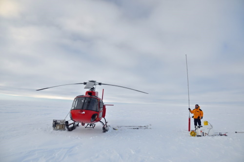
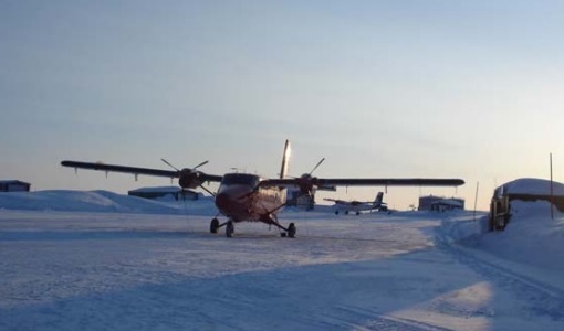
CryoVEx/ICESat-2 Spring 2019
The ESA Spring CryoVEx/ICESat-2 campaign 2019 was the first CryoVEx campaign since the launch of NASA ICESat-2 in September 2018, and aimed at cross-validating ESA CryoSat-2 and NASA ICESat-2 missions over sea ice and land ice in the Arctic.
Data - Campaigns (Open)
CryoVEx KAREN 2017
The CryoVEx-KAREN 2017 Campaign in the Arctic had the goal to collect unique measurements to help us better understand how sea ice is changing.
Data - Campaigns (Open)
CryoVEx KAREN 2016 Fall
The CryoVEx-KAREN 2016 Fall Campaign in Ilulissat, Greenland had the goal to collect unique measurements to help us better understand how snow and ice on the Greenland ice sheet is changing over time, and help ESA design future space missions to monitor the changing climate in our polar regions.
Data - Campaigns (Open)
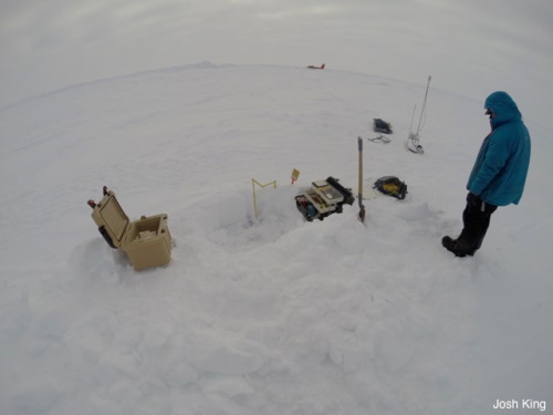
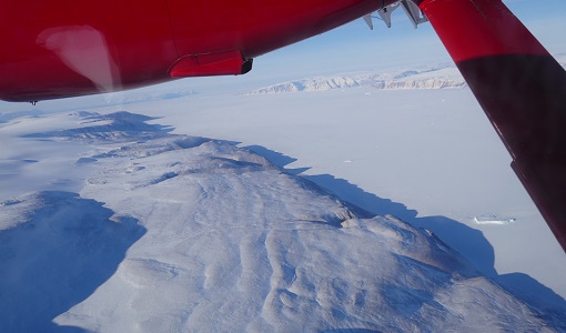
CryoVEx/KAREN Antarctica 2017/18
ESA’s CryoVEx/Karen 2017‐18 campaign took place in Antarctica in from Dec 2017 to Jan 2018. The campaign was composed of an airborne and in‐situ campaign and acquired extensive data sets of scanning lidar, Ku‐ and Ka‐band nadir‐looking radar, and auxiliary imagery for validation of the ESA CryoSat‐2 satellite (Ku‐band radar altimetry) and the French‐Indian AltiKa mission (Ka‐band radar altimetry).
Data - Campaigns (Open)
CryoVEx ICESat-2 Summer 2019
The ESA CryoVEx/ICESat‐2 summer campaign 2019 is an add‐on to the campaign carried out in the spring 2019, which did not cover all the flights that were planned due to weather obstacles.
Data - Campaigns (Open)
CryoVEx ASIRAS 2014
The CryoVEx 2014 airborne campaign was conducted as two separate operational periods. The sea ice activities covering large parts of the western Arctic Ocean were planned to take place early in the season to make sure the weather was stable.
Data - Campaigns (Open)
CryoVEx 2016 Spring
The CryoVEx 2016 campaign was primarily carried out to follow up on a recommendation given within ESA CryoVal Land Ice project (2014-2015), where it was found that the traditional under-flights of the CryoSat-2 satellite were inadequate.
Data - Campaigns (Open)
CryoVEx AEM
CryoVEX 2014 performed measurements over the Beaufort Sea and Arctic Ocean north of Canada (Ellesmere Island) and Greenland. Airborne surveys and ground‐based snow and ice measurements were performed.
Data - Campaigns (Open)
CryoVEx 2012
In continuation of the CryoVEx campaign in 2011, ESA initiated a second Arctic post-launch campaign in 2012 to further calibrate and validate CryoSat data products.
Data - Campaigns (Open)
CryoVEx 2011
The aims of the CryoSat Validation Experiment (CryoVEx) 2011 was to study the snow and ice characteristics of Arctic sea ice and its snow cover.
Data - Campaigns (Open)
CryoVEx 2010
CryoVEx 2010 was the first CryoSat post-launch campaign to take place. It was set up as a test campaign for the upgraded ASIRAS system.
Data - Campaigns (Open)
CryoVEx 2008
The ESA CryoSat Validation Experiment, CryoVEx 2008 was carried out in April and May 2008.
