- Campaigns
- CryoVEx 2016 Spring
CryoVEx 2016 Spring
Overview
What was the purpose of CryoVEx 2016 (Spring)?
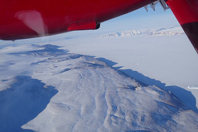
The 2016 airborne campaign was conducted from 4 to 16 April 2016, with the ESA airborne Ku-band interferometric radar (ASIRAS), coincident airborne laser scanner (ALS) and vertical photography. It was partly funded by the ESA CryoSat-2 Validation Experiment (CryoVEx) and partly by EU FP7 project on Ice, Climate, Economics – Arctic Research on Change (ICE-ARC). As the same aircraft and instrument installation were used for both campaigns this report includes both the CryoVEx and ICE-ARC campaign data.
The ESA CryoVEx 2016 campaign was primarily carried out to follow up on a recommendation given within the ESA CryoVal Land Ice project (2014-2015), where it was found that the traditional under-flights of the CryoSat-2 satellite were inadequate. This is primarily due to uncertainties in the radar-echo location (POCA) due to topography. To account for this effect, the 2016 ESA CryoVEx airborne campaign was aimed at flying dense grids of parallel lines at Austfonna ice cap along CryoSat ground tracks, to cover a broad range of possible POCA locations from different retrackers (CryoVal-LI D4).
The ICE-ARC campaign was mainly used to repeat some previously flown sea ice flights into the Wandel Sea and the Fram Strait, which had partly failed in 2015 due to problems with the ALS logging system. The opportunity was taken to make the first Sentinel-3A under-flight over sea ice in Fram Strait.
What was the outcome of CryoVEx 2016 (Spring)?
The CryoVEx/ICE-ARC 2016 campaign was a success and the processed data is of high quality. Preliminary comparisons between CryoSat and ALS data at Austfonna ice cap, proves the concept of using a gridded ALS data set of lines parallel to CryoSat ground tracks in areas with varying topography. The first direct comparisons of Sentinel-3A and ALS also showed consistent results.
Download the CryoVEx/ICE-ARC 2016 Final Report
| Data Coverage (Year) | March and April 2016 |
| Geographic Site | Arctic |
| Field of Application | Sea-land ice radar altimetry and laser scanner |
| Data Size | 2.18 GB |
Digital Object Identifier: https://doi.org/10.5270/esa-muth9td - CryoVEx 2016 (Spring): "Airborne field campaign with ASIRAS radar and laser scanner over Austfonna, Fram Strait and the Wandel Sea "
Data
The campaign data is available online via FTPS upon submission of a data access request. An active EO Sign In account is required to submit the request.
The data can be downloaded via an FTP client (e.g., FileZilla or WinSCP) using the option "Implicit FTP over TLS".
Data from the campaign are also available to download from the CS2EO portal.
For further information about the EO Sign In Service you can visit TellUs
Should you need support please contact EOHelp