- All Categories (41539)
- Data (101)
- News (189)
- Missions (25)
- Events (62)
- Tools (8)
- Activities (11)
- Campaigns (25)
- Documents (41118)
CAMPAIGNS
Learn about the ground-based, ship-borne, balloon-borne, and airborne campaigns and small satellite field experiments that validate orbiting ESA EO satellites and support future mission development.
Campaign
2019PhotoProxy 2019
The Photosynthetic-Proxy Experiment campaign address relevant open aspects that are related to the quantitative assessment of vegetation photosynthesis and vegetation stress from space.
Campaign
2019FLEXSense 2019
The FLEXSense 2019 campaign activities were undertaken in Germany and Italy with the goal of providing a complete set of high-resolution experimental data, including all relevant elements required for the preparation of the FLEX satellite mission.
Campaign
2019 - 2021SnowLab-NG
The overall objective of the SnowLab-NG activity was to provide a comprehensive multi-frequency, multi-polarisation, multi-temporal dataset and active and passive microwave measurements over snow-covered grounds.
Campaign
 2020
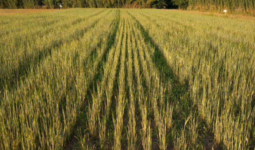
2020HydroSoil
The main objective of HydroSoil was to demonstrate the retrieval of soil moisture and vegetation parameters in an agricultural field under controlled conditions using a ground-based fully-polarimetric SAR instrument (GB-PolSAR).
Campaign
 2019
2019SARSense 2019
The SARSense campaign in the Jülich area (Germany) in summer 2019 was performed to support the ESA Copernicus high priority mission ROSE-L.
Campaign
 2018 - 2019
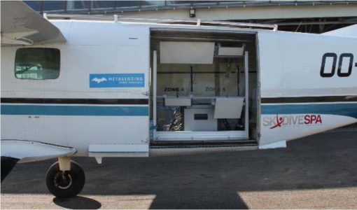
FIRMOS
In preparation of the Earth Explorer 9 FORUM mission, a new facility named FIRMOS (Far-Infrared Radiation Mobile Observation System) has been developed for field applications from both ground-based and airborne platforms to check with real measurements the sounding capability provided by FIR observations.
Campaign
 2019
2019SARSimHT
The main objective of “SARSimHT – Airborne SAR experiment to simulate Hydroterra data” was to demonstrate the image formation process of Hydroterra through the exploitation of a repeat-pass hyper-temporal airborne SAR image stack acquired over short time intervals representative of the Hydroterra mission.
Campaign
 2018
2018BelSAR 2018
The BelSAR project intended to carry out an airborne campaign for SAR bistatic interferometric measurements at L-band and full polarisation, over a test site in Belgium.
Campaign
 2015 - 2016
AfriScat
AfriScat campaign, a follow on to TropiSCAT campaign, was to acquire long-term P-Band radar data in an African tropical forest.
Campaign
 2015 - 2016
AROMAT-II
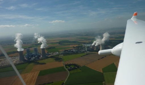
This campaign covers the fields of atmospheric composition: NO2, SO2, aerosols, over Romania (Bucharest and Turceni) and Germany (Berlin).
Campaign
 2015
2015AfriSAR 2015
During the AfriSAR 2015 campaign, shared between ONERA (dry season, July 2015) and DLR (wet season 2016), Pol-InSAR and TomoSAR airborne data set were collected over four test sites over Africa, therefore covering different forest structures.
Campaign
 2014
2014COMEX
The COMEX campaign supports the mission definition of CarbonSat and HyspIRI by providing representative airborne remote sensing data ‐ MAMAP for CarbonSat.
Campaign
 2013
2013FLEX-US
The primary goal of the 2013 joint ESA/NASA airborne campaign was to record an unprecedented FLEX-like dataset containing maps of sun-induced fluorescence, hyperspectral reflectance, surface temperature, and canopy structure.
Campaign
 2012
2012C-MAPExp
The C‐MAPExp campaign was planned and executed to support the demonstration of CarbonSat capabilities.
Campaign
 2010
2010BioSAR 2010
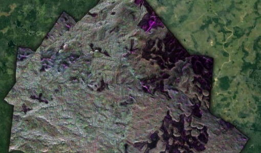
The BioSAR-3 (BioSAR 2010) campaign was specifically planned and implemented to investigate possibilities for a future spaceborne P-band polarimetric and interferometric SAR with a life-time of multiple years.
Campaign
 2005 - 2010
CoSMOS 2005, 2007, 2008, 2010
The Campaign for Validating the Operation of SMOS (coSMOS) was designed to acquire SMOS-like data so that the algorithms were fine-tuned and properly validated before the launch of SMOS mission in 2007.
Campaign
 2009
2009AgriSAR 2009
The AgriSAR 2009 campaign was defined to leverage the RADARSAT-2 mission to better understand and demonstrate the potential for GMES land monitoring user services, particularly in agriculture.
Campaign
 2008
2008BioSAR 2008
The main objective of BioSAR-2 (BioSAR 2008) campaign was to record SAR data over boreal forests with topographic effects to investigate the effect on biomass retrieval.
Campaign
 2007
2007CEFLES2
The objective of the CEFLES2 campaigns was to provide key reference data and background knowledge for the preparatory phases of the Sentinel‐2 and FLEX missions.
Campaign
 2007
2007BioSAR 2007
The BioSAR campaign aimed to support geophysical algorithm development, calibration/validation and the simulation of future spaceborne Earth Observation missions.