- All Categories (15519)
- Data (2)
- News (34)
- Missions (34)
- Events (26)
- Tools (4)
- Activities (7)
- Documents (15412)
MISSIONS
Explore the European Space Agency's Earth Observation satellite missions. Learn all about ESA's dedicated Earth Explorers or collaborations with other agencies through the Third Party Missions programme.
Mission - Earth Explorers

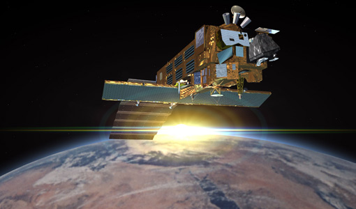
GOCE
Explorer (GOCE) mission mapped Earth's geoid very accurately, opening a window into Earth's interior structure as well as the currents
Mission - Heritage Missions

PALSAR
A small percentage of ALOS-1 PALSAR products processed by the current installed ESA IPF are affected by a known quality issue
Mission - Heritage Missions

PALSAR Processor Releases
The current ALOS-1 PALSAR IPF integrated within the ESA On-The-Fly system is v4.16p9, installed on 24 January 2017.
Mission - Earth Explorers
GOCE Objectives
Thanks to this current, the coastal waters of Europe are 4°C warmer than waters at equivalent latitudes in the north Pacific
Mission - Heritage Missions

ASAR Processor Releases
August 2009 5.03L03 9 October 2009 5.04 17 September 2010 6.00 16 December 2011 6.02 30 April 2012 6.03 3 July 2015 (current
Mission - Heritage Missions

MIPAS Quality Control Reports
Maps are currently available only for a limited part of the mission.
Mission - Heritage Missions

Products Availability L0
The current list of gaps in the AATSR Level 0 dataset is available here.
Mission - Heritage Missions
SCIAMACHY Auxiliary Data
In these cases, default values for the calibration parameters (Leakage current, Pixel-to-Pixel Gain and Etalon, Spectral
Mission - Earth Explorers
EGG
This opened a window into Earth's interior structure, as well as the currents circulating within the depths of its oceans
Mission - Earth Explorers
SSTI ANTEX Data
data were generated from 154 days in 2009 GOCE SSTI-B PCVs data were generated from the available data in 2010-2012 The current
Mission - Heritage Missions
Products Availability L0
Last update on 29 March 2017 - Issue 1.3 Year Total orbits Products available Percentage of availability Products currently
Mission - Heritage Missions
GOCE re-entry dataset
with further dynamical and environmental information such as on-board magnetometer measurements of Earth's magnetic field, currents
Mission - Heritage Missions
AATSR Auxiliary Data
The Fourth Reprocessing is the first to use the FAST processor (v2.0.5) and so there is currently no historical information
Mission - Heritage Missions
PALSAR Quality Control Reports
Find out more Quality Disclaimer A small percentage of ALOS-1 PALSAR products processed by the current installed ESA IPF
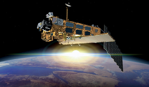
Mission - Earth Explorers
GOCE Overview
height mapped by altimeters and the knowledge of the precise ocean geoid that has improved our understanding of surface currents
Mission - Heritage Missions
SCIAMACHY Quality Control Reports
Maps are currently available only for a limited part of the mission. Read More
Mission - Heritage Missions
Products Availability L1
SCIAMACHY Level 1b products version 7.04-W Number of Orbits Year Planned Available Not recoverable* Failed or Missing Current
Mission - Heritage Missions
AATSR Products Information
Third Reprocessing Dataset Information Third Reprocessing products are currently available on the NEODC archive via CEDA.
Mission - Third Party Missions

ALOS-1 Mission Objectives
Oceanography and coastal zone-related research (oil spill, high-resolution DEM) Coastal zones, sea surface wind, wave height, wave current
Mission - Heritage Missions
ASAR Products Information
Higher level products (Level 2) can then be derived from L1 products; however, this is currently only done with Wave mode