earth online
Missions
Back
Missions
Explore Missions
Earth Explorers
Heritage Missions
Third Party Missions
Data
Back
Data
Explore Data
All Data
Open Data
Announcement of Opportunity
Project Proposal
Sample Data
Dashboard
Tools
Back
Tools
Explore Tools
Analysis Tools
Processing Tools
Visualisation Tools
Catalogues
Apps
News & Events
Back
News & Events
Explore News & Events
All News
Data Release News
Maintenance News
Operational News
All Events
Events Updates
Workshop
Conference
Learn & Discover
Back
Learn & Discover
Explore Learn & Discover
Data Application Articles
Spotlight on EO Community
Gallery
FAQ
Success Stories
Infographics
Quality Reports Advanced Search
SEE ALL
CryoSat
CryoSat
Mission
CryoSat Overview
CryoSat Objectives
CRYO2ICE
Instruments
SIRAL
Explore SIRAL
SIRAL Overview
Geographical Mode Mask
SIRAL Cal/Val
Data
Data Description
Download Data
Data Tools
Data Quality Reports
Data Unavailability Periods
Product Anomalies
Instrument Processing Facilities
Data Samples
Special Datasets
Special Datasets Overview
Roll Campaigns
STR Mispointing Angles Dataset
Ground Tracks
News
All news
Data release news
Maintenance news
Operational news
Success Stories
FAQ
All FAQs
General
Data Access
Data Offer
Data Quality
CRYOSAT IN 3D
More
CryoSat
Data
Data Tools
Data Tools
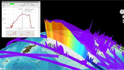
A number of tools are available for visualising, processing and analysing CryoSat data.
VtCryoSat is a tool designed to simplify browsing and downloading CryoSat products through an interactive, graphical web interface.
find out more
CS2EO Platform is used to visualise and download CryoSat-2, ICESat-2, CryoVEx, Operation IceBridge data and their spatial intersections for a given time window.
find out more
Tweet
Share
People also search for
Data
News
Missions
Events
Tools and toolboxes
Activities
Campaigns
Learn & Discover