- CryoSat
- Mission
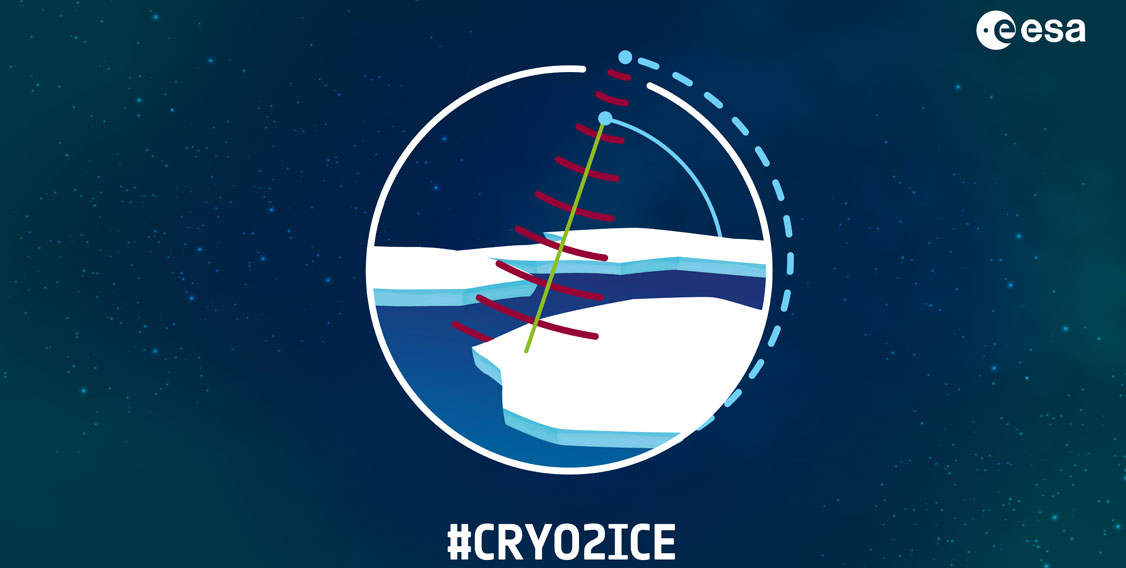
- CRYO2ICE
About CRYO2ICE
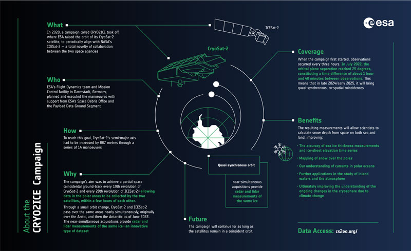
In 2020, ESA changed the orbit of its CryoSat-2 satellite to periodically align with NASA's ICESat-2. This provided radar and lidar measurements of the same ice, at nearly the same time. The campaign, dubbed #CRYO2ICE, was the first of its kind.
The data resulting from the campaign will allow scientists to measure snow depth from space on both sea and land, improving the accuracy of sea ice thickness measurements and ice-sheet elevation time series. The measurements will also help map snow over the poles and advance our understanding of currents in polar oceans, with further applications expected in the study of inland waters and the atmosphere.
The orbit of the CryoSat-2 and ICESat-2 satellites is naturally growing closing together over time, resulting in shorter times between observations of the same area. This unprecedented period of overlap between the two satellites allows the CRYO2ICE campaign to continue acquiring data from the near-synchronous satellites.
In June 2022, the orbit of CryoSat-2 changed again, to maximise the number of coincident orbits between the two satellites over the Antarctic.
Facts and Figures
Full name: CryoSat-2/ICESat-2 Resonance Campaign
Collaboration between: ESA and NASA
Objectives: Through a small orbit change, CryoSat-2 and ICESat-2 passed over the same areas nearly simultaneously, providing radar and lidar measurements of the same ice.
Scientific impact: The resulting measurements will allow scientists to calculate snow depth from space on both sea and land, improving the accuracy of sea ice thickness measurements and ice-sheet elevation time series. The new data will also help map snow over the poles and advance our understanding of currents in polar oceans and is expected to have further applications in the study of inland waters and the atmosphere.
Campaign start date: 16 July 2020
Orbit change: Approximately 900 metres
Who: ESA's Flight Dynamics team and Mission Control at ESOC in Darmstadt, Germany, planned and executed the manoeuvres with support from the ESA Space Debris Office (SDO) and the Payload Data Ground Segment (PDGS).
Instrument impact: CryoSat-2's SAR Interferometric Radar Altimeter (SIRAL) was put in standby for a few hours before and during manoeuvres. It did not significantly impact CryoSat-2 overall data collection.
CryoSat-2/ICESat-2 Resonance: CryoSat-2 and ICESat-2 passed over coincident polar areas at approximately the same time every 19 orbits, roughly every 31 hours.
CRYO2ICE Infographic
Resources
Find additional information about the CRYO2ICE campaign through mission documentation, presentations and technical papers.
Find up-to-date information about the status of CryoSat SIRAL data:
- Download CryoSat Orbit Raising Campaign QA4EO Data Quality Control Summary
- Details about all periods of planned and unplanned unavailability of SIRAL data
- Daily data quality results available in CryoSat Daily Performance Reports
Visualise and download the CryoSat-2/ICESat-2 spatial intersections for a given time window with the CRYO2ICE Coincident Observations Explorer.
Articles
Articles about the CRYO2ICE campaign: