 Asset Publisher
Satellite Planning for Floods in Thailand, October 2010Envisat satellite planning for floods in Thailand during October 2010. 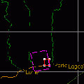
Satellite Planning for Flood in Benin, October 2010Envisat satellite planning for flooding in Benin during October 2010. 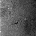
Satellite Planning for Toxic Flood disaster in Hungary, October 2010Envisat and ERS-2 satellite planning and images of the toxic flood in Kolontar, Hungary, which occurred in October 2010. 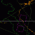
Satellite Planning for Floods in Vietnam, October 2010Envisat satellite planning for the floods that struck Vietnam in October 2010. 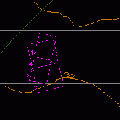
Satellite Planning for Landslide in Mexico, September 2010Envisat satellite planning for a landslide in Mexico that occurred in September 2010. 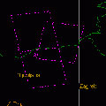
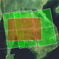
Satellite Planning for Floods in Slovenia, September 2010Envisat satellite planning for floods in Slovenia, during September 2010. 
Satellite Planning for Flood and Hurricane Karl in Mexico, September 2010Envisat satellite planning for Hurricane Karl's impact on Mexico in September 2010 and the subsequent flooding. 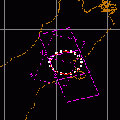
Satellite Planning for Earthquake in New Zealand, September 2010Envisat satellite planning for a 7.0 magnitude earthquake that struck New Zealand in September 2010. 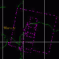
Satellite Planning for Flood in Nigeria, September 2010Envisat satellite planning for the a flood in Nigeria in September 2010. 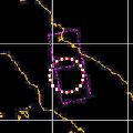
Satellite Planning for Sinabung Volcano (Sumatra), August 2010Envisat satellite planning for the eruption of Sinabung Volcano in Sumatra during August 2010. 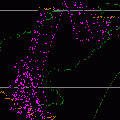
Satellite Planning for Flood in Pakistan, August 2010Envisat satellite planning for flooding in Pakistan during August 2010. 
Satellite Planning for Flood in China, July 2010Envisat satellite planning for floods in China during July 2010. 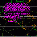
Satellite Planning for Gulf of Mexico Oil Spill, April 2010Envisat and ERS-2 satellite planning for an oil spill in the Gulf of Mexico following an accident at an oil platform in April 2010. 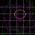
Satellite Planning for China Earthquake, April 2010Envisat satellite planning for a 6.9 magnitude earthquake that struck China in April 2010. 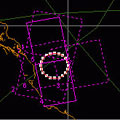
Satellite Planning for Saudi Arabia Earthquake, May 2009Envisat satellite planning for a 5.7 magnitude earthquake that struck Saudi Arabia in May 2009. |
||