Back to flooding in Europe
This SAR strip, composed of 5 images, was acquired by ERS-2 on the 12 July 1997. Two further images acquired by the satellite on 15 July 1997 cover an area adjacent to the ones acquired on 12 July.
Click on the thumbnail images to view the full size versions.
 |
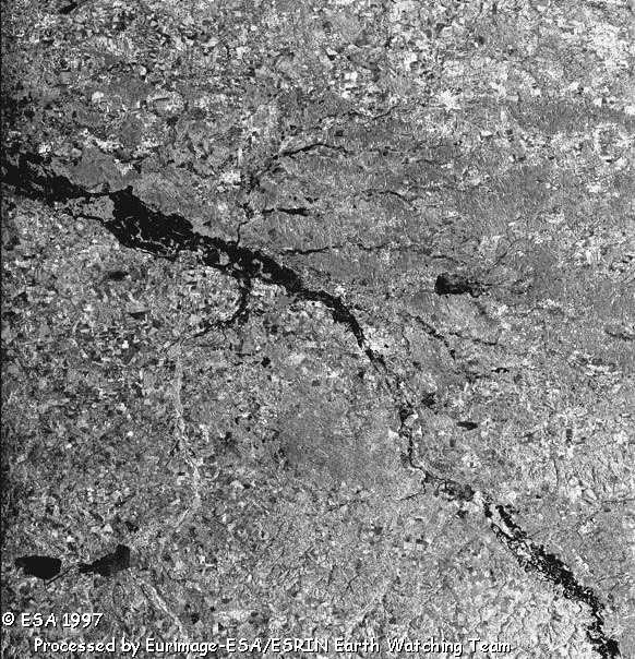
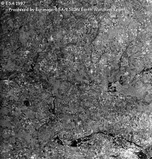
Poland, South east of Pozen
In the upper centre of the image lies the town of Kalisz on the Prosna river. Some flooded areas along the river (represented by darker areas) are visible in the lower part of the image. Near the left border the lake of Jeziorsko on the Warta river is clearly visible. |
 |
South Poland
The large town of Opole (on the Odra river) is located in the center of the image. All the areas along the river are evidently flooded. The state boundary with the Czech Republic is located at the bottom of the image. The two lakes along the Nysa Klodzka river are visible at the bottom left of the picture. |
 |
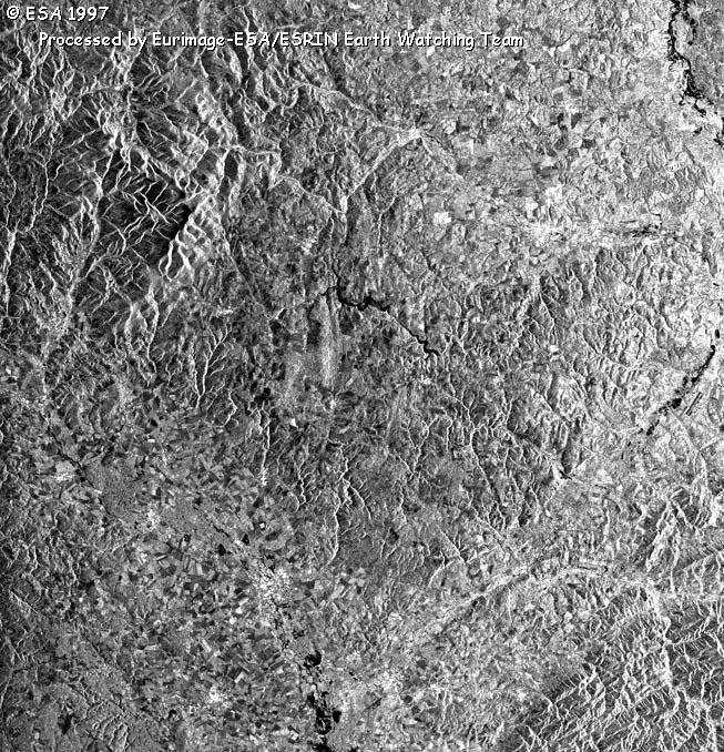
Czech Republic
In the upper right of the image the Odra river is visible just north of the town of Ostrava, revealing some flooding. Further South, along the Odra river, more areas covered by water are visible (near the right border of the image). The valley of the Becva river seems to be unaffected (bottom-right of the image) while, at the bottom-centre, a large area covered by water is clearly evident: it is the Morava river (the town of Prostejov is just North of the dark area). |
 |
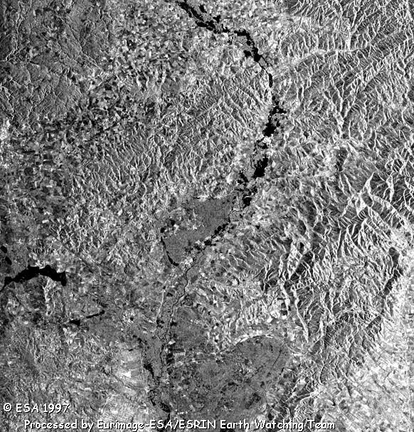
Czech Republic
This image covering the Morava river valley, shows the large zones along the river covered by water. Many towns, such as Zlin, are visible just close to large flooded areas. At the left edge of the image the town of Brno is partially visible. Some other smaller areas covered by water are visible near the Svitava and Dyje river confluence with the Morava river. |
 |
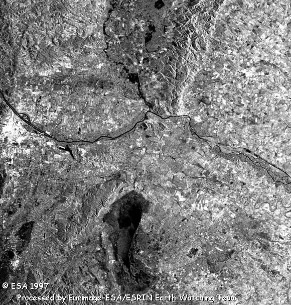
Czech Republic and Austria
This is the last image of this strip: the Morava river reaches the Danube near the town of Bratislava (centre of the image). Wien (edge to the left) is clearly visible as a white dotted area with the dark area below showing a flood. Water is visible along the Morava river but not along the Danube. The large dark area (between the middle and the bottom) is the Neusiedler See. |
 |
Poland
This image covers the second part of the Odra river (the image nearly covers the bottom right quarter of the Landsat image of the 15 July): the town of Wroclaw (bottom right corner) is located near a large flooded area (at the right edge) of the river. Other flooded areas are visible along the river up to the town of Glogow (left edge - centre). |
 |
Poland - Czech Republic
Only some flooding near the town of Wroclaw (upper right border) is detectable in this image. The image covers all the Polish territory, but the lower left part of the image is Czech Republic. |
|
Technical Information of original images |
|
Satellite/Sensor: |
ERS-2 SAR |
|
Acq. Date: |
12 and 15 July 1997 |
|
Orbit: |
12 July: 11642 - Frames: 2565-2637
15 July: 11685 - Frames 2565-2583 |
|
Acquired by: |
Fucino (Italy) |
 Flood in Europe: Czech Republic, Poland, Germany (1997) - Eastern Part, ERS-2