Minimize Tropical Storm Alberto (Florida) - June 2006

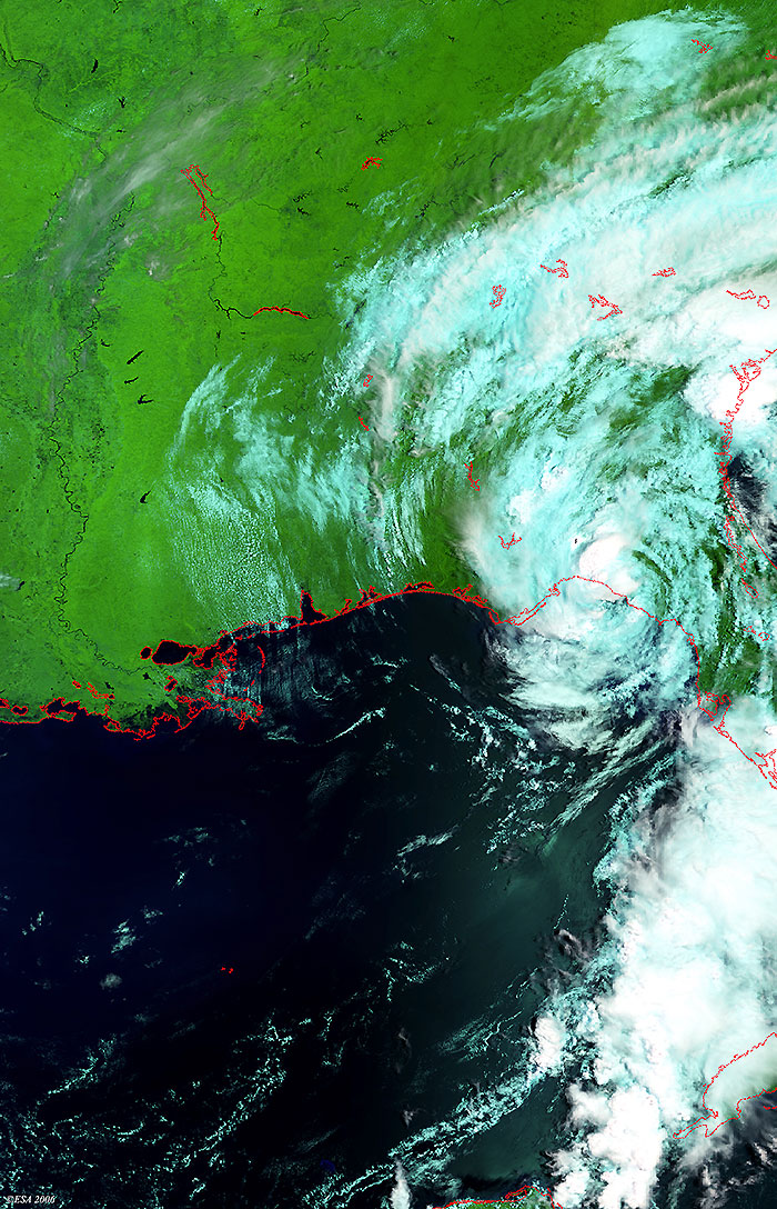
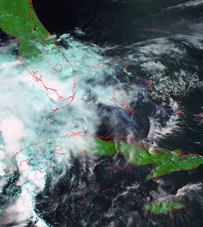
These Medium Resolution Spectrometer (MERIS) images acquired on 14, 13 and 11 June 2006 over the State of Florida, show Tropical Storm Alberto during its evolution. The coastlines have been highlighted in red to define their locations.

View large image [JPG 449 KB]
Technical Information
Product: MERIS_RR_1P (1200 metre resolution)
Satellite: Envisat
Instrument: Medium Resolution Imaging Spectrometer (MERIS)
Date of acquisition: 15:14:22 - 14 Jun 2006
Orbit: 22424
Orbit direction: Descending
Band combination: 11, 14, 3 (RGB)
View large image [JPG 282 KB]
Technical Information
Product: MERIS_RR_1P (1200 metre resolution)
Satellite: Envisat
Instrument: Medium Resolution Imaging Spectrometer (MERIS)
Date of acquisition: 13 Jun 2006
Orbit: 22410
Orbit direction: Descending
Band combination: 11, 14, 3 (RGB)
View large image [JPG 187 KB]
Technical Information
Product: MERIS_RR_1P (1200 metre resolution)
Satellite: Envisat
Instrument: Medium Resolution Imaging Spectrometer (MERIS)
Date of acquisition: 15:08:40 - 11 Jun 2006
Orbit: 22381
Orbit direction: Descending
Band combination: 11, 14, 3 (RGB)
Map of area

Back to top