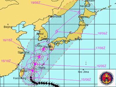
JAPAN, Sept 15, 2006 (From Bloomberg) - Typhoon Shanshan started to turn toward the north after gathering strength overnight and is forecast to pass to the west of Japan's Okinawa by tomorrow, the U.S. Navy Joint Typhoon Warning Center said. Shanshan, a Category 3 storm with maximum sustained winds of 184 kilometers an hour, was located 483 kilometers southeast of Taipei in Taiwan and 644 kilometers south-southwest of Naha in Okinawa at 9 a.m. Japan time today, the U.S. weather agency said on its Web site. Shanshan's winds are gusting to 230 kilometers per hour. Shanshan, the 14th-named storm of the Pacific cyclone season, is moving northwest at 13 kilometers an hour and is forecast to swing to a more northerly track that will take it past Okinawa, and between Japan's Kyushu island and the Korean peninsula within two days. The typhoon is forecast to strengthen to Category 4 by tomorrow with winds of 212 kilometers per hour. Japan's weather agency issued warnings for heavy waves around the southern islands of Okinawa. Maximum wave heights in the vicinity of the storm's center are 11 meters, the U.S. typhoon center said. Taiwan's Central Weather Bureau maintained a sea alert for the island's eastern areas. The bureau dropped a warning for heavy rains and thunderstorms in northern and eastern Taiwan, according to the latest advisory posted on its Web site.
TAIPEI, Sept 14, 2006 (From AFP) - Taiwan's Central Weather Bureau issued an alert Thursday as Tyhoon Shanshan approached bringing with it the threat of strong winds and torrential rain. The center of Shanshan, which is a Chinese woman's name, was 470 kilometers east-southeast of Taiwan's southernmost tip Oluanpi at 17:30 pm (0930 GMT), the bureau said. With a radius of 200 kilometers, the typhoon was moving west-northwest at a speed of 10 kilometers an hour and packing winds gusting up to 144 kilometers per hour. Residents in eastern and northeastern Taiwan were urged to take precautions against the downpours and powerful winds and avoid activities near the sea. Those in mountainous regions were told to watch out for mudslides. In July, Tropical Storm Bilis killed three people on the island while Typhoon Kaemi injured four people. Both storms claimed hundreds of lives on the Chinese mainland.
|
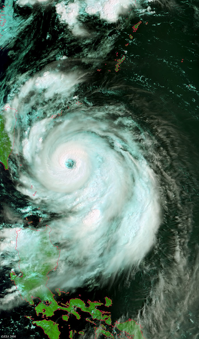
Envisat view of Typhoon Shanshan |
This Medium Resolution Imaging Spectrometer (MERIS) image was acquired in near real time over South-eastern Taiwan, where Typhoon Shanshan (middle image) approached the coasts. The coastlines have been highlighted in red to define their location.
Back to top
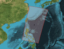
 Typhoon Shanshan (Taiwan) - September 2006