TAIPEI, Aug 4 (From AFP) - Taiwan battened down Thursday for the approach of Typhoon Matsa, as weathermen said it could hit the north of the island and unleash torrential rain and strong winds. The weather bureau urged residents to heighten their vigilance for the storm which could hit later Thursday. In the flood-prone capital residents piled sandbags around office and residential buildings. The city government demanded motorists remove cars from riverside parking lots. Agricultural authorities urged residents in some mountainous areas to leave home for fear of landslides. Residents stored water in the northern county of Taoyuan where water supplies have been hit repeatedly by typhoons in the past. A civilian air raid slated for Friday was postponed. Thousands of fishing boats took shelter in ports amid reports that a 40-tonne fishing boat ran aground off Taitung in the southeast and broke apart after it was pounded by high seas. Matsa, the name of a fish in Laotian, was 290 kilometers east-southeast of the northeastern city of Ilan at 3:00 pm, the Central Weather Bureau said. With a radius of 250 kilometers, it was moving north-northwest at 14 kilometers per hour and could hit the island late Thursday, it said. In August last year Typhoon Aere claimed 24 lives when strong winds and downpours touched off mudslides.
|
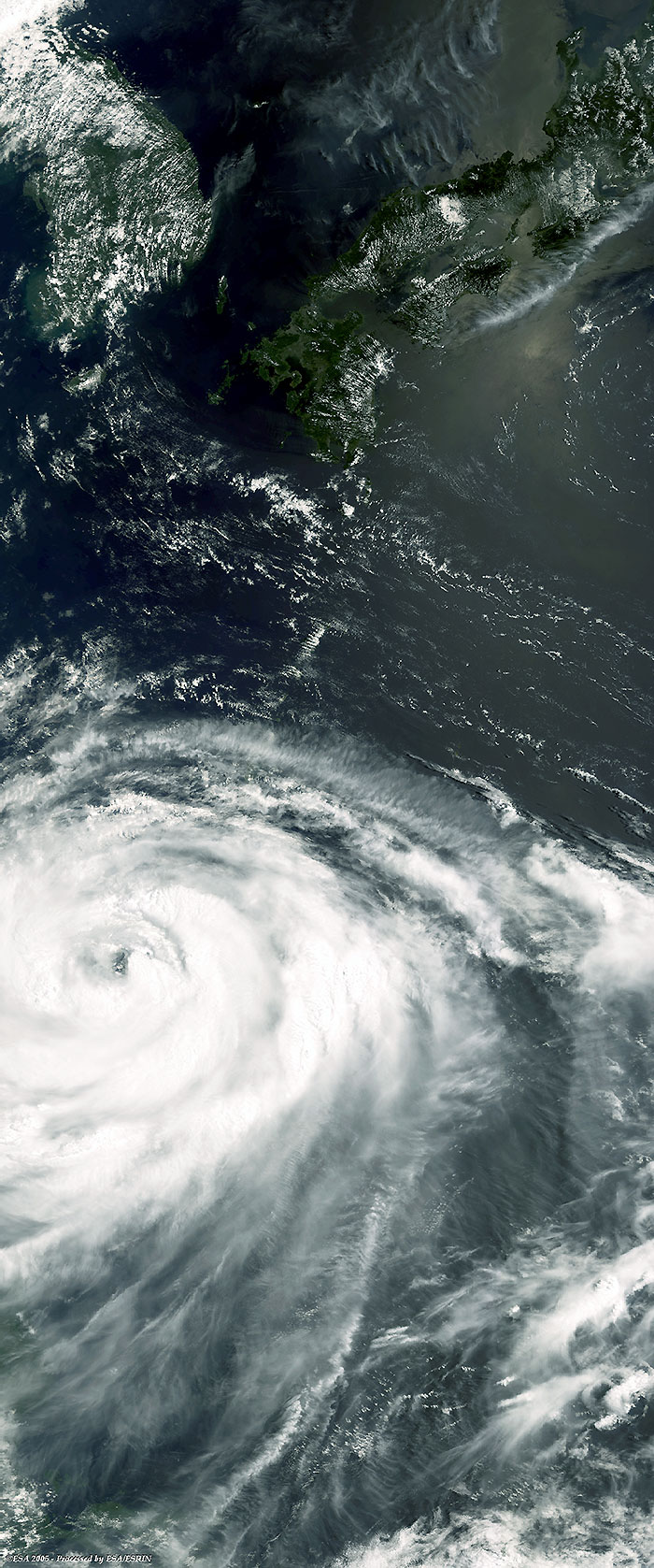
Envisat event timeline - 04 August 2005 |
This Medium Resolution Imaging Spectrometer (MERIS) Level 1 image was acquired in near real time over the south coast of South Korea and the Island of Japan, where Typhoon Matsa is due to hit after Taiwan.
|
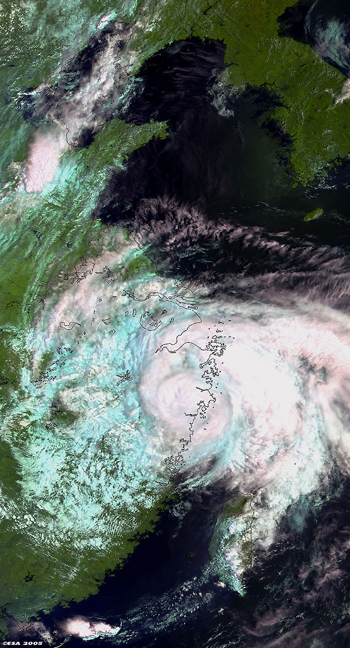
Envisat event timeline - 06 August 2005 |
This Medium Resolution Imaging Spectrometer (MERIS) Level 1 image, was acquired on 06 August 2005 over the China coasts, as Typhoon Matsa made landfall.
|
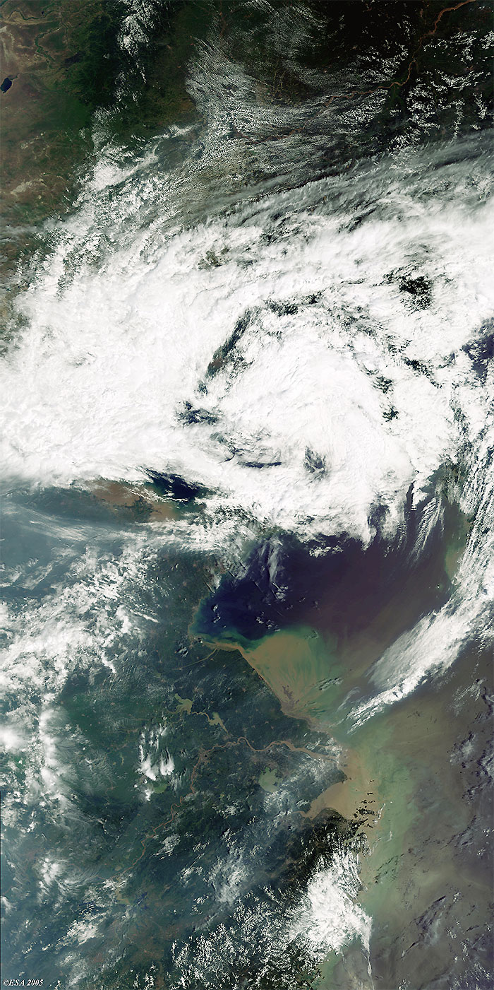
Envisat event timeline - 09 August 2005 |
This latest Medium Resolution Imaging Spectrometer (MERIS) Level 1 image, in near real time over China, shows Typhoon Matsa as it moves further inland and loses strength.
 Typhoon Matsa (Taiwan/China) - August 2005