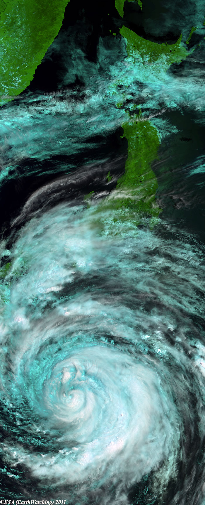
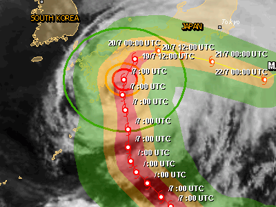
TOKYO, July 19, 2011 (From AFP) - Japan braced for heavy rain and fierce wind as strong typhoon Ma-On churned towards the country on Tuesday, prompting workers at the crippled Fukushima Daiichi nuclear plant to take safety measures. Ma-On, packing gusts of up to 198 kilometres (120 miles) per hour, will make landfall over southwestern Shikoku on Tuesday night and move up the main Honshu island that includes Tokyo through Wednesday morning. Rainfall of up to 80 centimetres (32 inches) on the Shikoku main island was expected in the next 24 hours, the Japan Meteorological Agency warned. While the typhoon is not forecast to hit the region that is home to the stricken plant, the agency said torrential rain is feared in the disaster-ravaged northeast through Thursday. Emergency teams have been working to stabilise the Fukushima plant since the March 11 tsunami triggered reactor meltdowns. Operator Tokyo Electric Power Co. (TEPCO) said it was taking measures ahead of the typhoon to protect the damaged facility, where the outer structures of reactors one, three and four were blown off or damaged by explosions and fires. As of 0500 GMT, Ma-On was 40 kilometres south-southeast of Shikoku island's southern tip, 700 kilometres southwest of Tokyo. The March 11 disaster sparked the worst nuclear accident since Chernobyl, with radiation leaks forcing tens of thousands to evacuate from a 20-kilometre no-go zone around the plant.
|
Envisat views of Typhoon Ma-On |
|
EOLI map for MERIS images |
Back to top
 Typhoon Ma-On (Japan) - July 2011