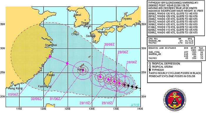
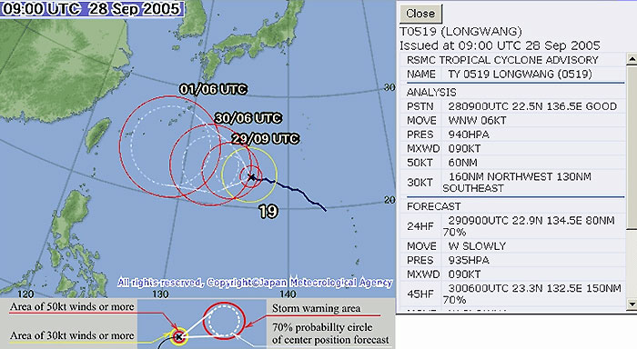
TAIPEI, Oct 2 (From AFP) - Typhoon Longwang pounded Taiwan Sunday, leaving 34 people injured, disrupting air traffic, destroying power lines and uprooting trees. The typhoon made landfall on the eastern part of the island early Sunday. Most of the injuries were the result of broken glass and flying debris, said the National Fire Agency, which is coordinating rescue operations. All domestic and international flights were cancelled but international flights were expected to resume later Sunday, airport officials said. Strong winds knocked down power lines, cutting off electricity to around 210,000 homes, but power was expected to be restored by the end of the day, the Taiwan Power Company said. A cargo ship with 16 crew on board ran aground off eastern city of Hualien after it lost power in rough seas but the crew were not said to be in danger. The Central Weather Bureau said the typhoon, which weakened after hitting the island, was moving west-northwest at 18 kilometers per hour with a radius of 200 kilometers towards China's Fujian province. Weathermen urged residents to continue taking precautions against the heavy rains and powerful winds while those in mountainous regions were told to watch out for landlides. Three people were killed and 59 injured when Typhoon Talim pounded the island last month, forcing financial markets, offices and schools to close. In August last year, Typhoon Aere claimed 24 lives when strong winds and heavy rains triggered mudslides, which buried an entire village in the mountains in northern Hsinchu county.
|
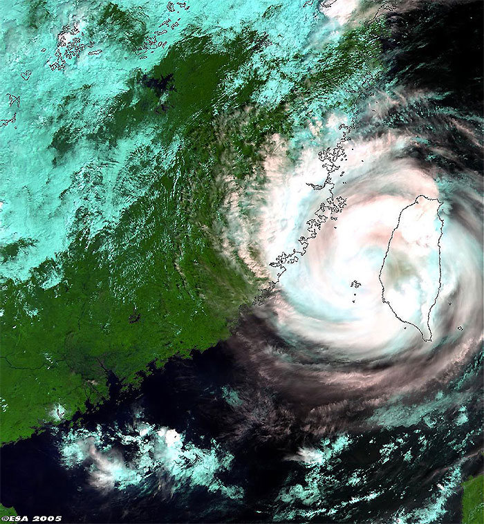
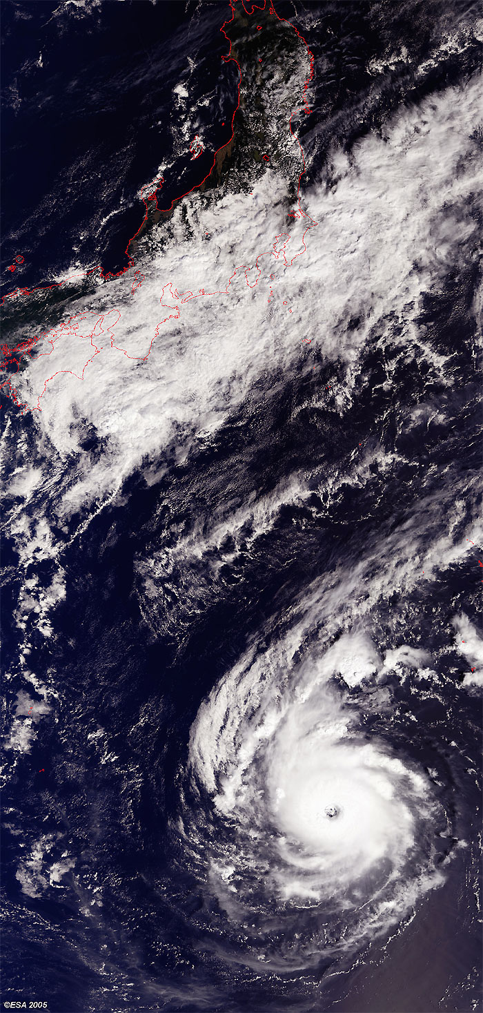
Envisat views of Typhoon Longwang |
This Medium Resolution Imaging Spectrometer (MERIS) image was acquired over Taiwan where Typhoon Longwang continues its presence over east Asia. The image shows in blue; low clouds, in reddish/pink; high clouds only and in white; high and low clouds. The coastlines have been highlighted to define their locations.
This second Medium Resolution Imaging Spectrometer (MERIS) image was acquired over the Pacific Ocean where Typhoon Longwang was developing east-southeast of Okinawa. The coastlines have been highlighted red to define their locations.
Back to top
 Typhoon Longwang (Taiwan) - October 2005