Minimize Typhoon Krosa (Taiwan/China) - October 2007

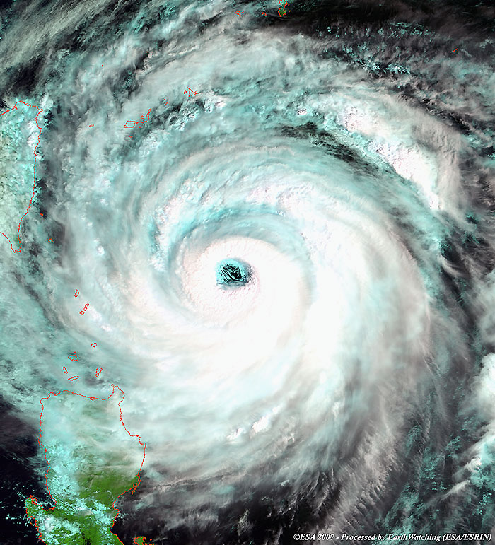
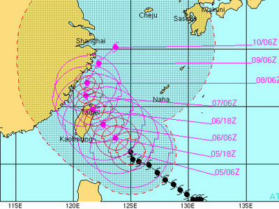
5 October 2007 (from AFP) - With a radius of 300 kilometres, Krosa, meaning crane in the Khmer language, was 440 kilometres east-southeast of the southernmost tip of Taiwan at 1:15 pm, the central weather bureau said. Packing winds gusting up to 184 kilometres per hour, it was moving northwest at a speed of 14 kilometres an hour.

The weather bureau estimated Krosa's impact would be strongest between late Saturday and early Sunday (6 and 7 October 2007). It could dump up to 1,100 millimetres of rain in northern and eastern mountain regions. Hundreds of fishing boats sought shelter at northern ports and residents in low-lying areas were warned about possible mudslides and floods.

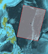
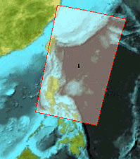
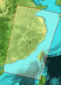
Envisat views of Typhoon Krosa

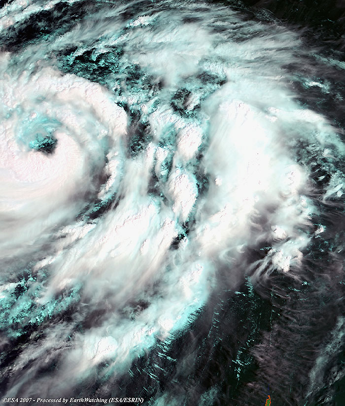
Typhoon Krosa over the Pacific Ocean.

View large image [JPG 164 KB] and corresponding swath [GIF 14 KB]
Technical Information
Product: MERIS_RR_1P (1200 metre resolution)
Satellite: Envisat
Instrument: Medium Resolution Imaging Spectrometer (MERIS)
Date of acquisition: 03 Oct 2007
Orbit: 29229
Orbit direction: Descending
Band combination: 11, 14, 3 (RGB)

Krosa approaching the coast of Taiwan (northeast of Luzon Island) on 05 October.

View large image [JPG 158 KB] and corresponding swath [JPG 15 KB]
Technical Information
Product: MERIS_FR_1P (300 metre resolution)
Satellite: Envisat
Instrument: Medium Resolution Imaging Spectrometer (MERIS)
Date of acquisition: 05 Oct 2007
Orbit: 29258
Orbit direction: Descending
Band combination: 11, 14, 3 (RGB)

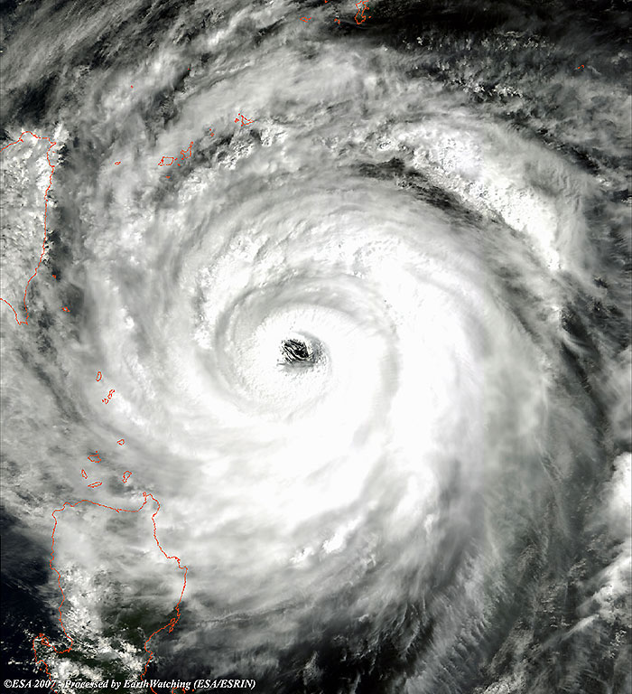
This image shows the same area as the above image, but in a different band combination to offer an alternative view.

View large image [JPG 132 KB] and corresponding swath [JPG 15 KB]
Technical Information
Product: MERIS_FR_1P (300 metre resolution)
Satellite: Envisat
Instrument: Medium Resolution Imaging Spectrometer (MERIS)
Date of acquisition: 05 Oct 2007
Orbit: 29258
Orbit direction: Descending
Band combination: 7, 5, 2 (RGB)

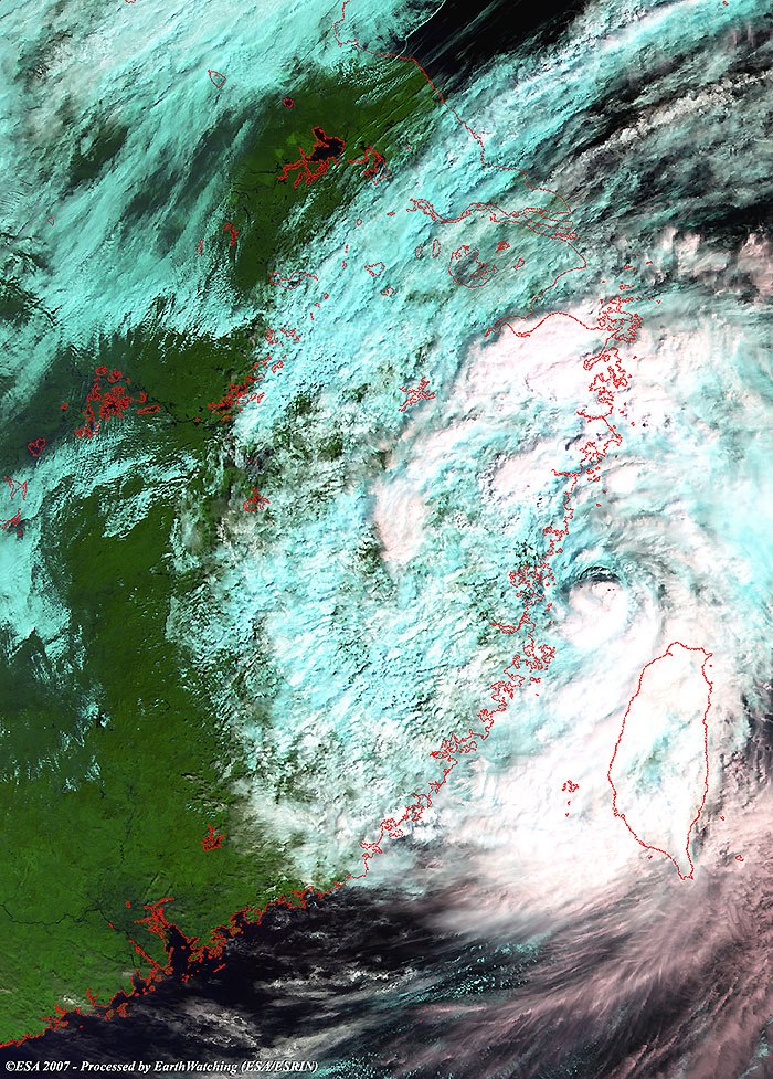
Krosa approaching Fujian province on 07 October.

View large image [JPG 335 KB and corresponding swath [JPG 16 KB]
Technical Information
Product: MERIS_FR_1P (300 metre resolution)
Satellite: Envisat
Instrument: Medium Resolution Imaging Spectrometer (MERIS)
Date of acquisition: 07 Oct 2007
Orbit: 29287
Orbit direction: Descending
Band combination: 11, 14, 3 (RGB)
NOAA advisory
Map of area

Back to top