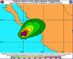
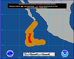
MIAMI, Oct 23, 2006 (From AFP) - Hurricane Paul swirled toward Mexico's Pacific Coast Monday with winds of 150 kilometers (90 miles) per hour, threatening the tourist-packed tip of Baja California and the mainland to the east, forecasters said. The US National Hurricane Center issued a hurricane watch for southern Baja California. Residents should brace for possible landfall Tuesday night or Wednesday morning, but the most likely track has the hurricane slamming ashore Wednesday near the Mexico mainland port city of Mazatlan. At 2359 GMT Monday, the eye of Hurricane Paul was 645 kilometers south-southwest of the Baja California resort of Cabo San Lucas and moving north-northwest at 10 kilometers per hour, the hurricane center said. An increase in forward speed is expected over the next 24 hours. The storm packed maximum sustained winds of 150 kilometers per hour, with higher gusts, according to data compiled by a US Air Force hurricane hunter plane, making it a category one storm on the five-level Saffir-Simpson scale. The hurricane center said the storm was gradually becoming less organized and was expected to lose force over the next 24 hours. The US State Department warned US citizens in the hurricane's path late Monday to head to higher ground or identify shelter, adding that flights into the main area airports could be suspended at any time.
|
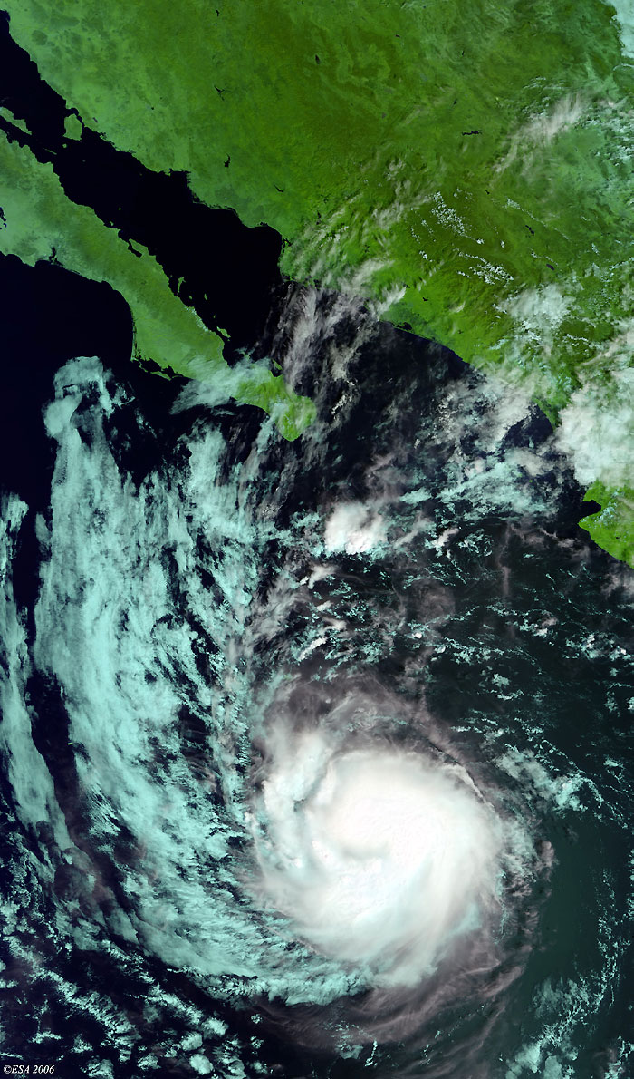
Envisat view of Hurricane Paul |
This Medium Resolution Imaging Spectrometer (MERIS) image was acquired on 22 October 2006 and shows Hurricane Paul off the coast of Mexico.
Back to top
 Hurricane Paul (Mexico) - October 2006