NEW ORLEANS, Louisiana, 15 Sep (From CNN) - New Orleans' mayor urged the Big Easy's half-million residents to evacuate, and residents of low-lying Gulf Coast communities were ordered to leave Tuesday as Hurricane Ivan moved toward the northern Gulf Coast with 140 mph winds. Forecasters said Ivan could hit land anywhere from the western Florida Panhandle to the south eastern Louisiana coast as a major hurricane early Thursday. In New Orleans, Mayor Ray Nagin said there was a 22 percent chance his city would take a direct hit from Ivan.
Since most of the city lies below sea level, surrounded by levees along the Mississippi River, the result would be a catastrophe, he said. "If we get a storm like Ivan to hit us directly or to become really close to us, then we could have a situation where we have 12 to 18 feet of water throughout the city," Nagin said. Residents began following his advice Tuesday afternoon, with bumper-to-bumper traffic lining the causeway over Lake Pontchartrain to the north. If people can't get out of New Orleans, Nagin said, they should do a "vertical evacuation." "Basically, go to hotels and high-rise buildings in the city," he explained. At 2 a.m. EDT, Ivan was centred 265 miles south-southeast of the mouth of the Mississippi River. The Category 4 storm was moving toward the north-northwest near 12 mph with a gradual turn to the north expected on Wednesday. Hurricane-force winds extended outward up to 105 miles from the centre, while tropical storm-force winds stretched 260 miles outward.
Hurricane warnings were posted from Grand Isle, Louisiana, to Apalachicola, Florida, and a hurricane watch extended westward from Grand Isle to Morgan City, Louisiana. A tropical storm warning is in effect from Intra coastal City, Louisiana, to west of Grand Isle and from east of Apalachicola to Yankeetown, Florida. "This is not only a very, very powerful hurricane, but it's a very large hurricane," said Max Mayfield, director of the National Hurricane Centre in Miami. "It's indeed going to impact a very large area. "The predictions for New Orleans are "not the worst-case scenario for New Orleans, but it's getting close," Mayfield said. The worst damage would be east of the hurricane's eye, as high winds drive high waves onshore.
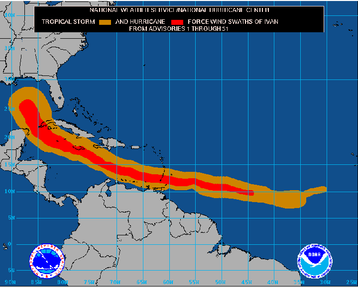
This map shows how the size of the storm has changed, and the areas potentially affected so far by sustained winds of tropical storm force (in orange) and hurricane force (in red). The display is based on the wind radii contained in the set of Forecast/Advisories indicated at the top of the figure. Users are reminded that the Forecast/Advisory wind radii represent the maximum possible extent of a given wind speed within particular quadrants around the tropical cyclone. As a result, not all locations falling within the orange or red swaths will have experienced sustained tropical storm or hurricane force winds, respectively.
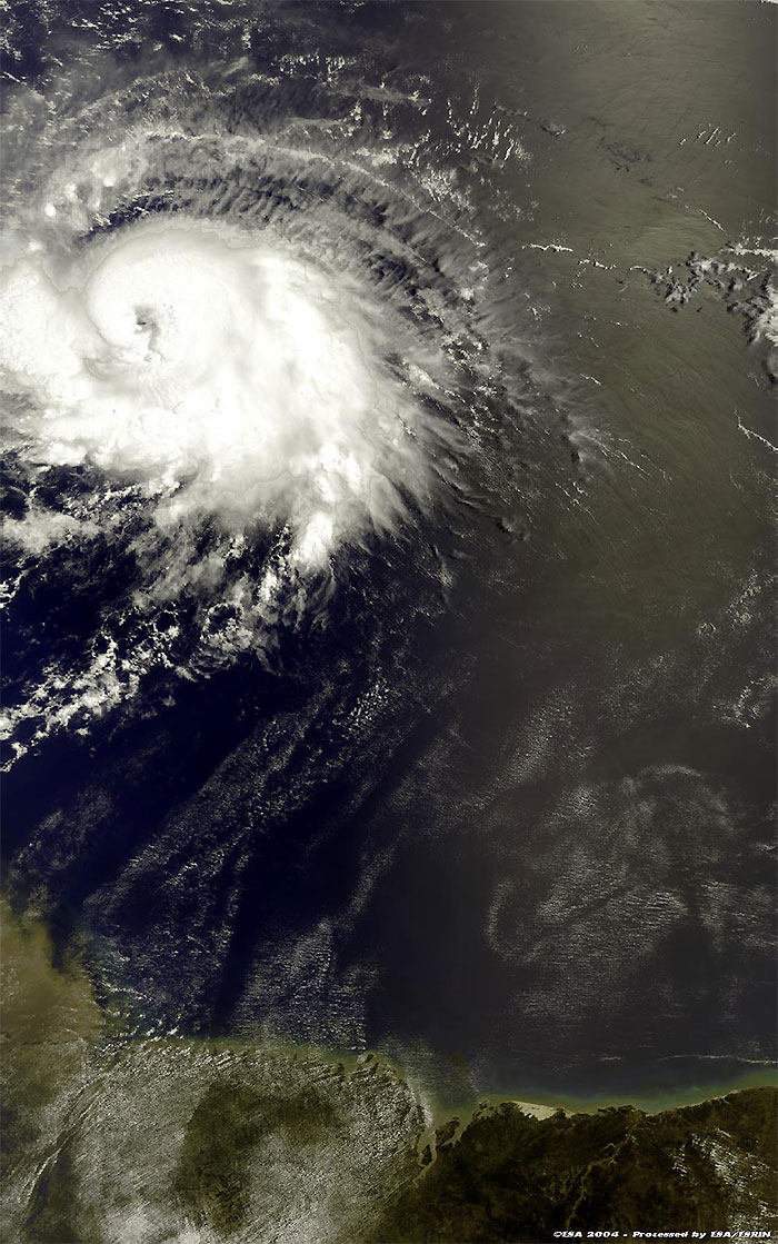
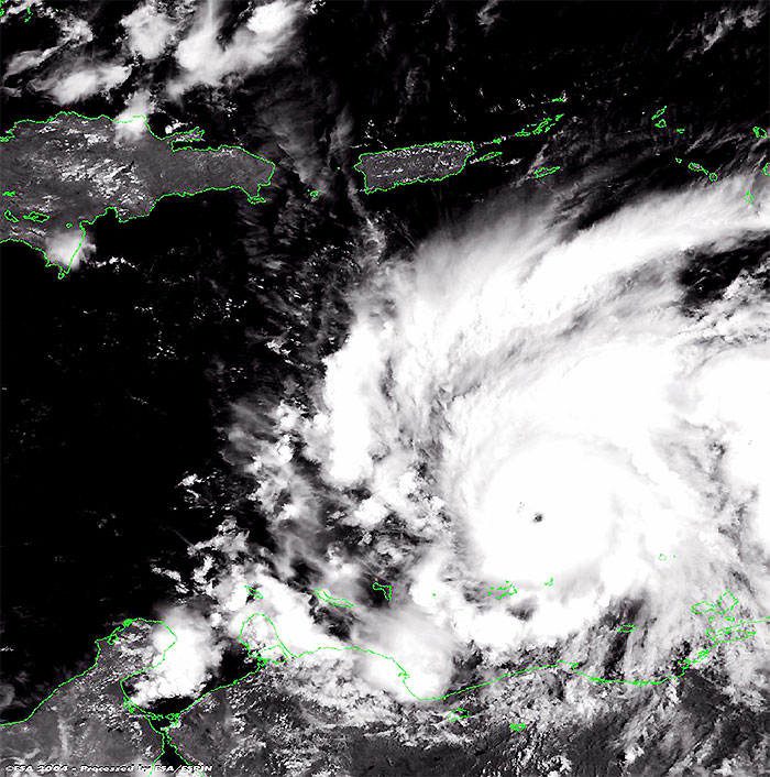
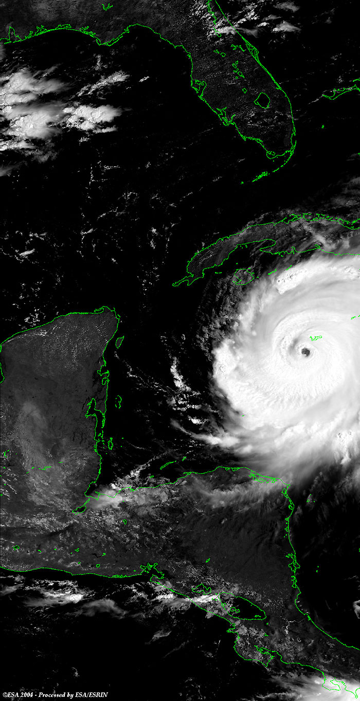
These Medium Resolution Imaging Spectrometer (MERIS) images, acquired on 05, 08, 12 and 15 September 2004 over the Caribbean Sea, show Hurricane Ivan, during the evolution phases.
This Medium Resolution Imaging Spectrometer (MERIS) image was acquired on 05 September 2004 over the Caribbean Sea, and shows Hurricane Ivan (centre border right image), in the beginning phases.
This Medium Resolution Imaging Spectrometer (MERIS) image, acquired on 08 September 2004 over the Caribbean Sea, shows Hurricane Ivan (centre border left image), off the Jamaican coasts.
This Medium Resolution Imaging Spectrometer (MERIS) image, acquired on 12 September 2004 over the Caribbean Sea, shows Hurricane Ivan (centre border left image), hitting Jamaica, and moving towards Cuba. The different colour of the coastline is due to radiance value, during the processing.
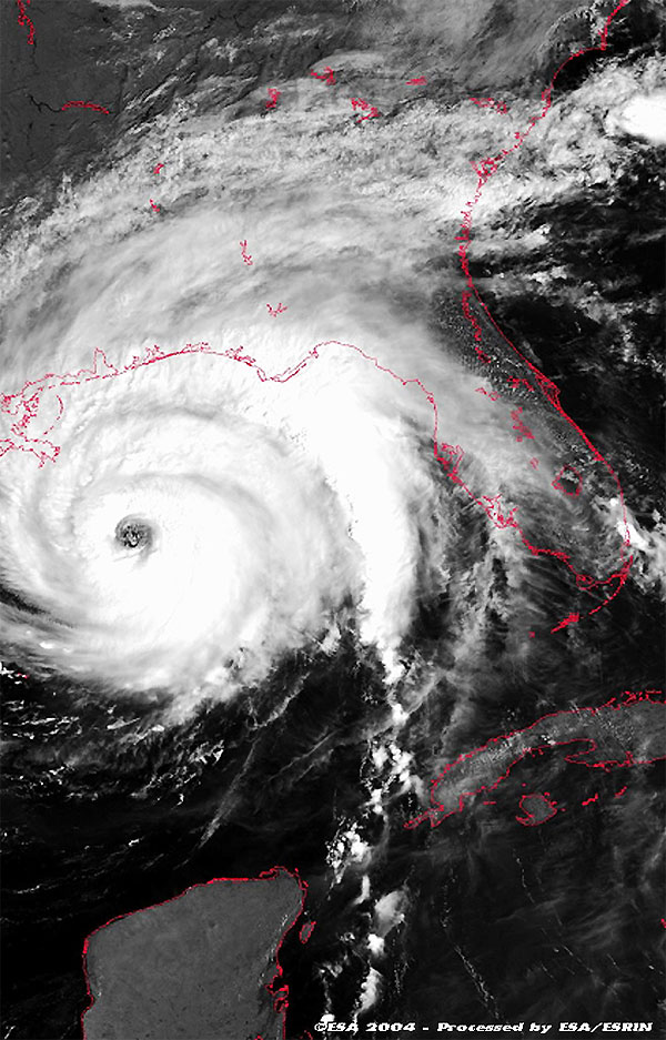
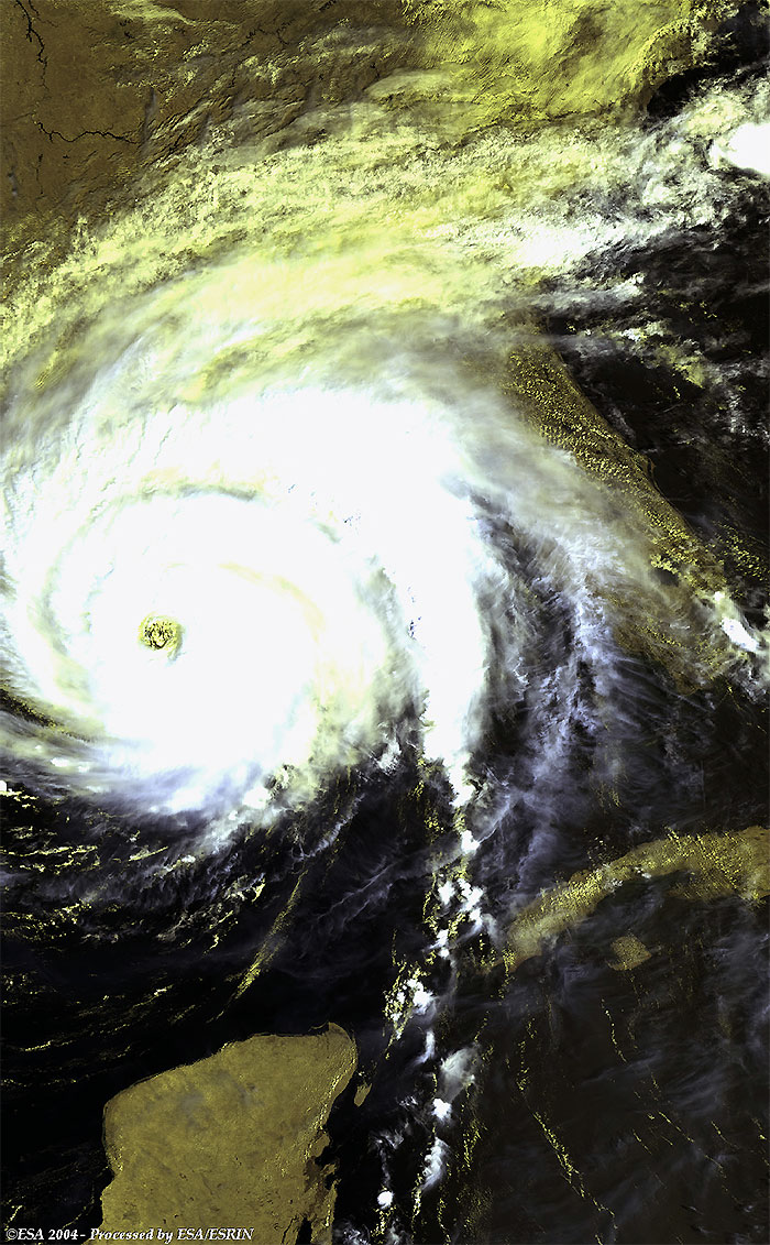
These two Medium Resolution Imaging Spectrometer (MERIS) images, acquired on 15 September 2004 over the Gulf of Mexico, show Hurricane Ivan (centre border right image), off the coast of Louisiana and the city of New Orleans.
 Hurricane Ivan (Caribbean Sea) - September 2004