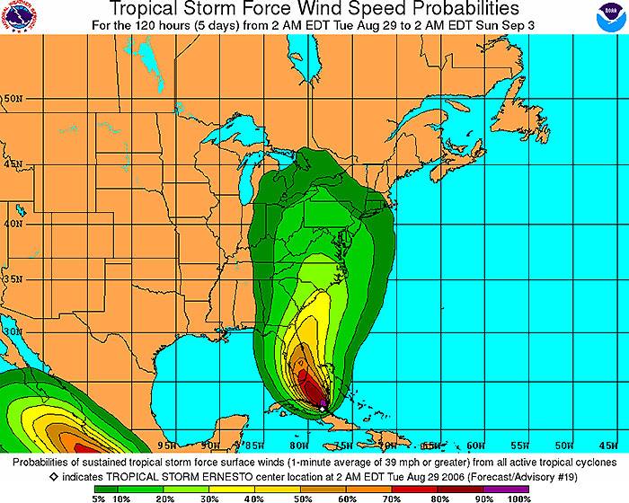
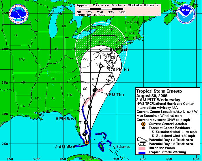
MIAMI, Florida, August 30, 2006 (From CNN) - A soggy Tropical Storm Ernesto was drenching south Florida early Wednesday after making landfall, and forecasters further scaled back warnings even as officials cautioned Floridians not to let their guard down simply because the storm had failed to strengthen as expected. At 2 a.m. ET, Ernesto was about 50 miles south-southwest of Miami, after coming ashore more than two hours earlier at Plantation Key, the National Hurricane Center said. The storm was moving north-northwest at near 7 mph. "A turn to the north with an increase in forward speed is expected later today," forecasters said. "On the forecast track, the center of Ernesto is expected to remain over the Florida Peninsula for the next day or so." Ernesto's top winds remained near 45 mph. The storm was expected to weaken as it moved over land, and Ernesto could become a tropical depression on Wednesday, the NHC said. A tropical storm warning remained in effect from Bonita Beach on Florida's west coast, southward around the peninsula and northward to Altamaha Sound, Georgia. The warning included all of the Florida Keys and Lake Okeechobee, forecasters said. A hurricane watch remained in effect from Altamaha Sound north to Cape Fear, North Carolina, out of concern Ernesto would restrengthen after it crossed the peninsula and entered the Atlantic. Authorities warned that although Ernesto is no longer a hurricane, it still will bring significant rain and the prospect of flooding. "We should not lose people in a tropical storm if people will at least take some safety precautions," said Craig Fugate, the state's emergency management director. Earlier, forecasters had warned the storm might intensify as it neared landfall, but Hurricane Center Director Max Mayfield said the storm showed "no signs of any significant strengthening at all." But with the storm projected to skip across southeast Florida and back into the Atlantic Ocean, forecasters Tuesday afternoon extended storm watches northward into the Carolinas. "If it holds together as it moves off the Florida peninsula, by tomorrow night if it's out in the Atlantic far enough, it certainly does have the chance to strengthen back to a strong storm or possibly even a hurricane," Mayfield said. Officials in Monroe County, which includes Key West, ordered tourists to evacuate Sunday. But residents were told only to take shelter indoors as Ernesto neared the area. Florida Gov. Jeb Bush said people in south Florida can expect power outages and some flooding, but he said there is no need to hoard fuel as the storm nears. Drivers have been waiting in long lines to fill up their gas tanks, but Bush said the state has "abundant" fuel supplies. He urged Floridians to follow basic safety precautions in the storm's aftermath, when most deaths typically occur. "Don't go outside if you don't have to for a period of time," Bush said. "Don't drive into flooded areas. Don't allow your kids to play in flooded streets, because there could be utility lines down. All the things that common sense would suggest to do, we hope that you will do that." Ernesto could dump 3 to 10 inches of rain over the southern end of the state, forecasters said. Tropical storm-force winds of at least 39 mph extended up to 105 miles from the storm's center, and isolated tornadoes were possible over southern Florida and the Keys overnight, forecasters said.
|
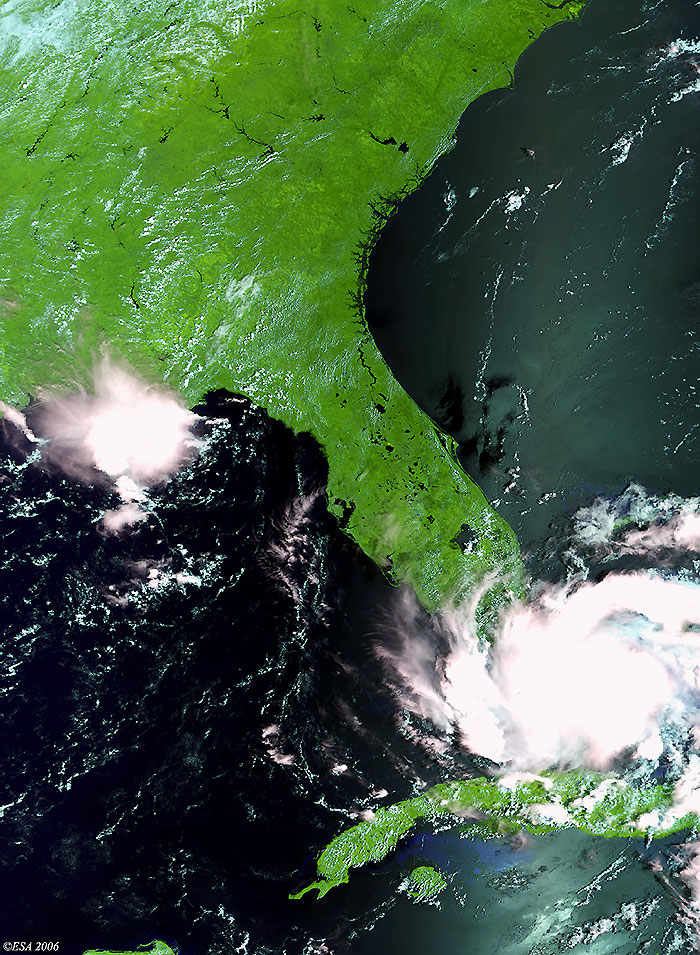
Envisat view of Hurricane Ernesto |
Back to top
 Hurricane Ernesto (Florida) - August 2006