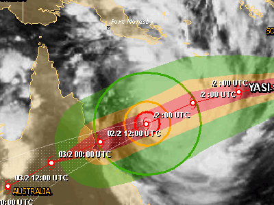
INNISFAIL, Feb 3, 2011 (From AFP) - Severe Tropical Cyclone Yasi, a top-category storm, hit the Australian coast early Thursday, the weather bureau said, packing destructive winds which were expected to rage for hours. "The large destructive core of Cyclone Yasi is starting to cross the coast between Innisfail and Cardwell, with a dangerous storm tide and battering waves to the south of the cyclone centre," the Bureau of Meteorology said in a statement. Still a top-level category five storm as it made landfall, Yasi touched down near the popular tourist spot of Mission Beach shortly before midnight local time bringing howling winds and "extremely dangerous" tidal surges. Coastal settlements would be buffeted by gusts of up to 290 kilometres (175 miles) per hour and the bureau said the "very destructive core" would take four hours to pass.
Destructive and damaging winds of between 125 and 90 kilometres per hour would persist through Thursday as far west as Mount Isa, some 900 kilometres from the coast, it added. Downpours of up to 700 millimetres (27.5 inches) were also forecast across the key agriculture and tourism region. The first category five storm to hit the region since 1918, Yasi is expected to be one of the worst cyclones in Australia's history. Queensland is still reeling after January's devastating floods swamped scores of towns and killed more than 30 people in Australia's most expensive natural disaster on record.
|
Event Timeline |
|
01 February 2011 |
|
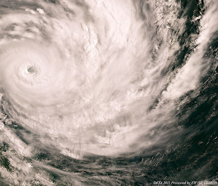
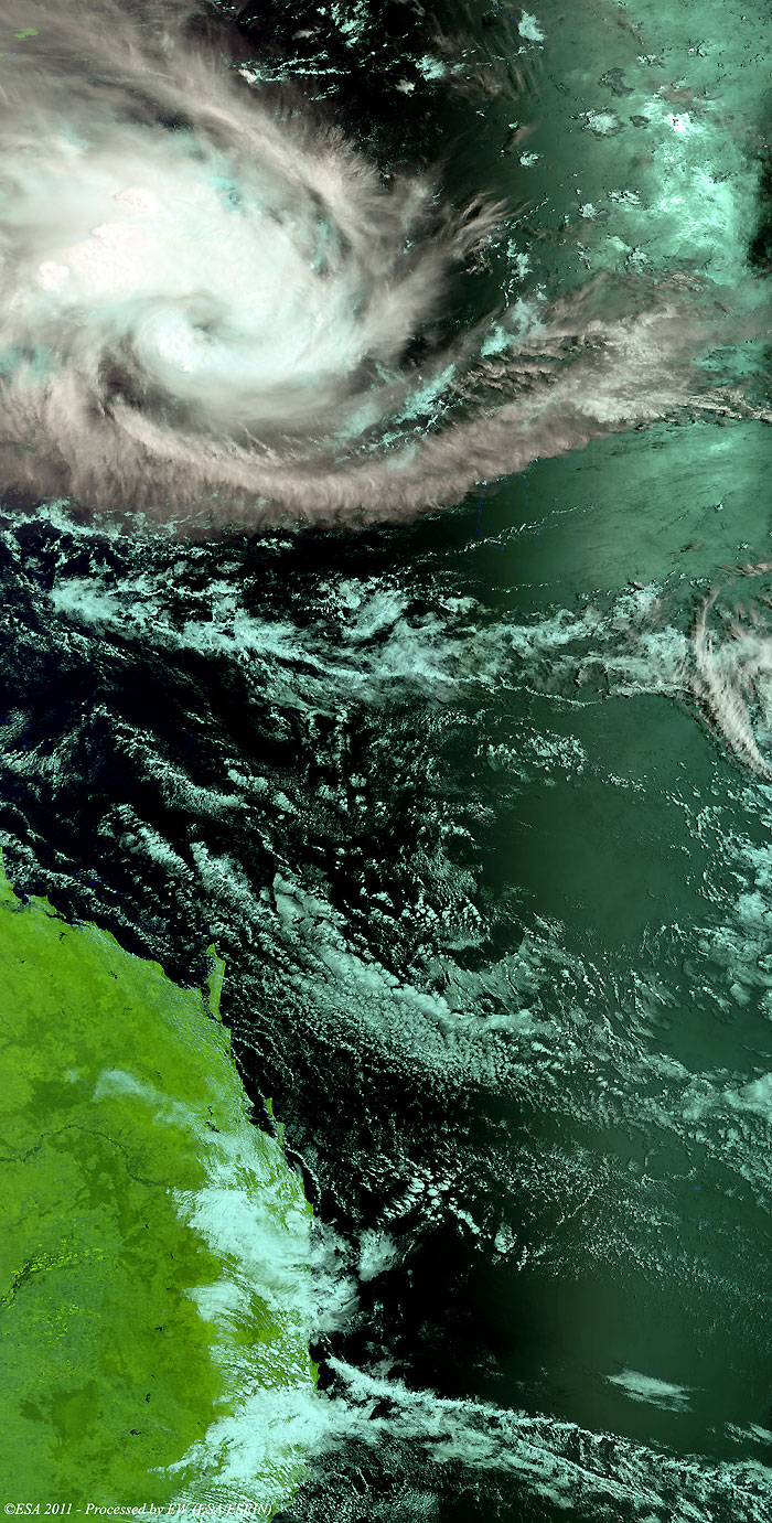
Cyclone Yasi approaching the north-east coasts of Australia. |
|
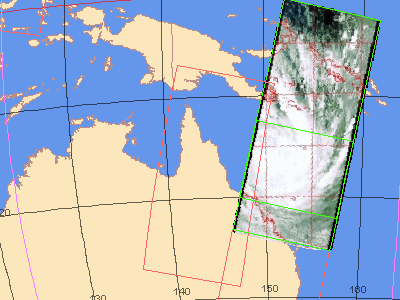
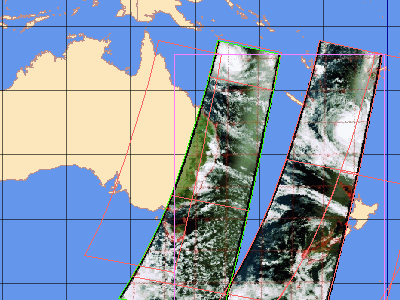
EOLI map of the MERIS FR image |
This image shows Cyclone Yasi approaching the north-east coasts of Austraila.
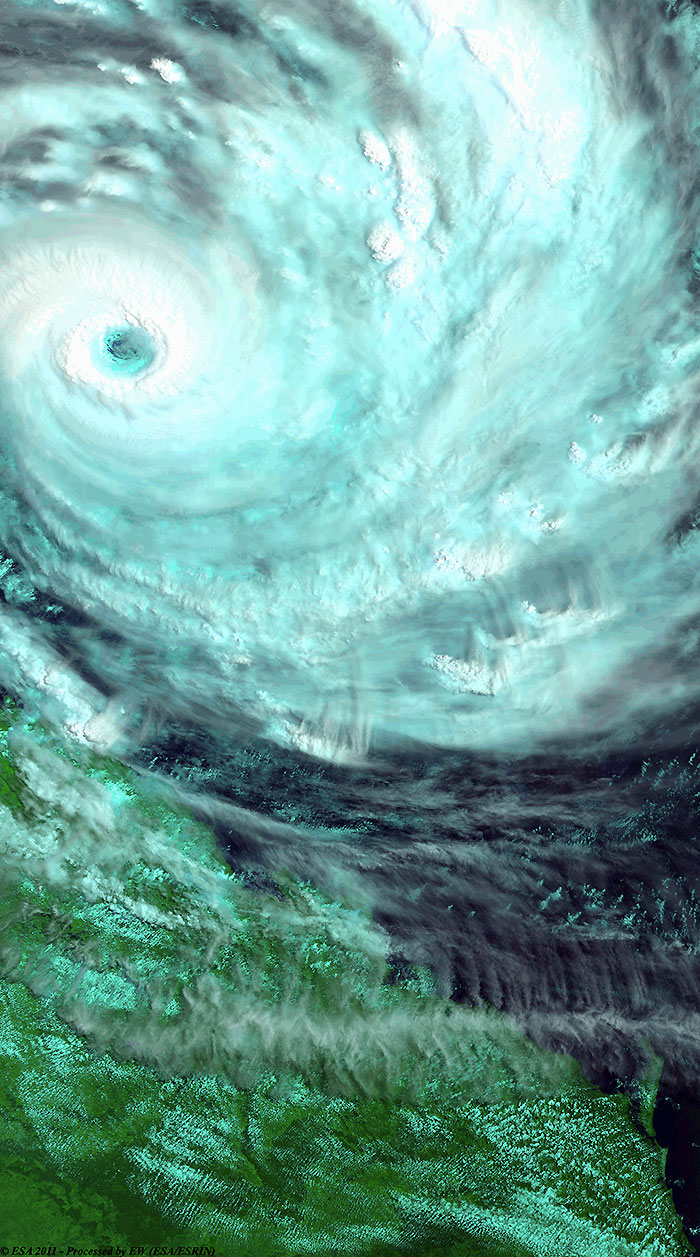
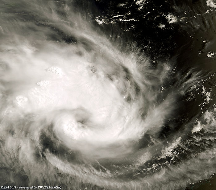
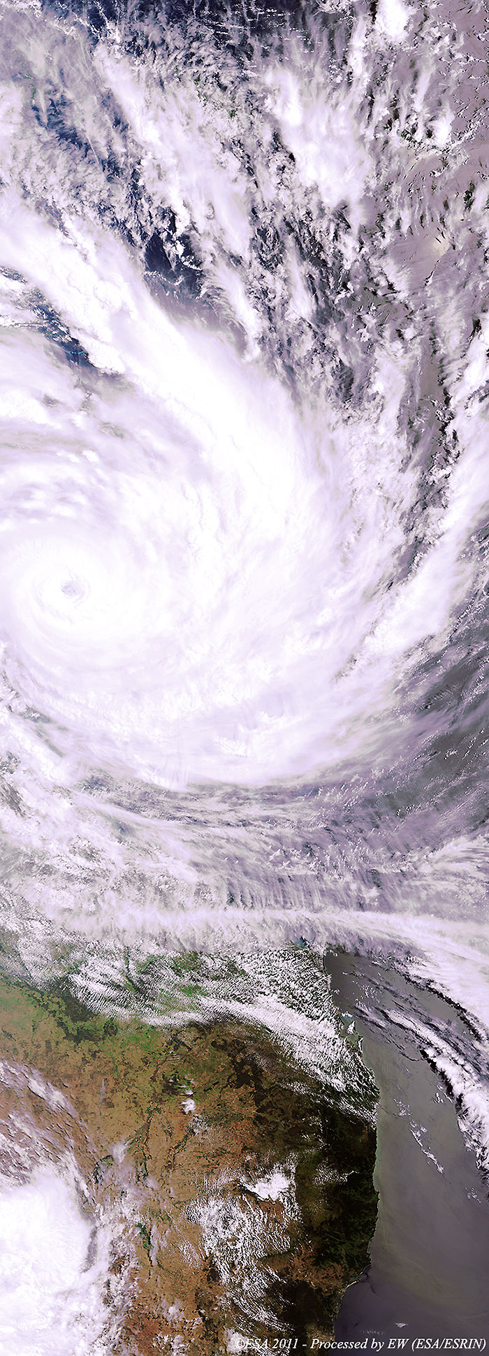
Cyclone Yasi over Coral Sea (Pacific Ocean)
Cyclone Yasi over the Pacific Ocean.
|
EOLI map of the MERIS RR image |
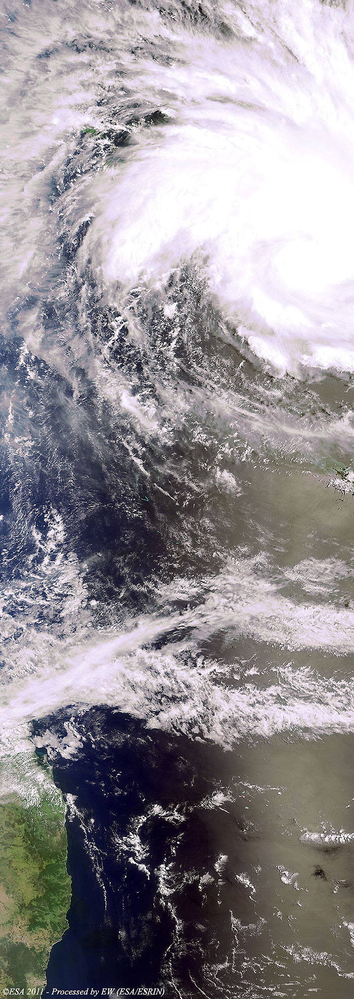
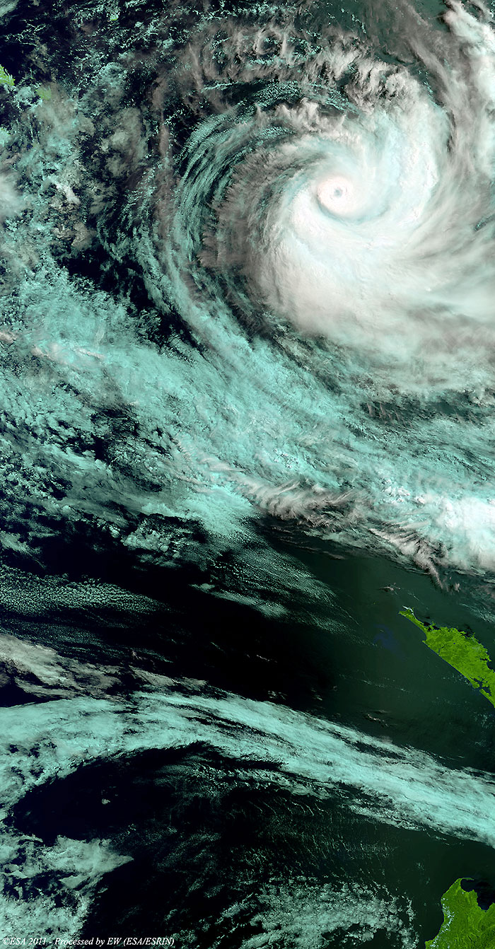
This image shows Cyclone Yasi over the Pacific Ocean before approaching the north-east costs of Australia.
Back to top
 Cyclone Yasi (Australia) - February 2011
