SYDNEY, April 19, 2006 (From AFP) - Tropical Cyclone Monica battered northeastern Australia's Cape York peninsula Wednesday after making landfall near the remote Aboriginal community of Lockhart River, the weather bureau said. The storm brought torrential rain and strong winds to the area 1,875 kilometres north of Brisbane and forced residents to take shelter in secure buildings. Weather forecaster Manfred Greitschus said the storm was about 35 kilometres southeast of Lockhart River and moving west at about 18 kilometres an hour. "It's just crossing the coast at the moment," he told AFP.
"We've had wind gusts to date of about 100 kilometres an hour near Lockhart River," he said, adding that winds were expected to reach more than 200 kilometres an hour. Greitschus said the storm, rated a category three on a scale where five is the maximum, was expected to abate during the evening. "It's still a category three but it's expected to weaken over the next 12 hours," he said.
|
Envisat views of Cyclone Monica |
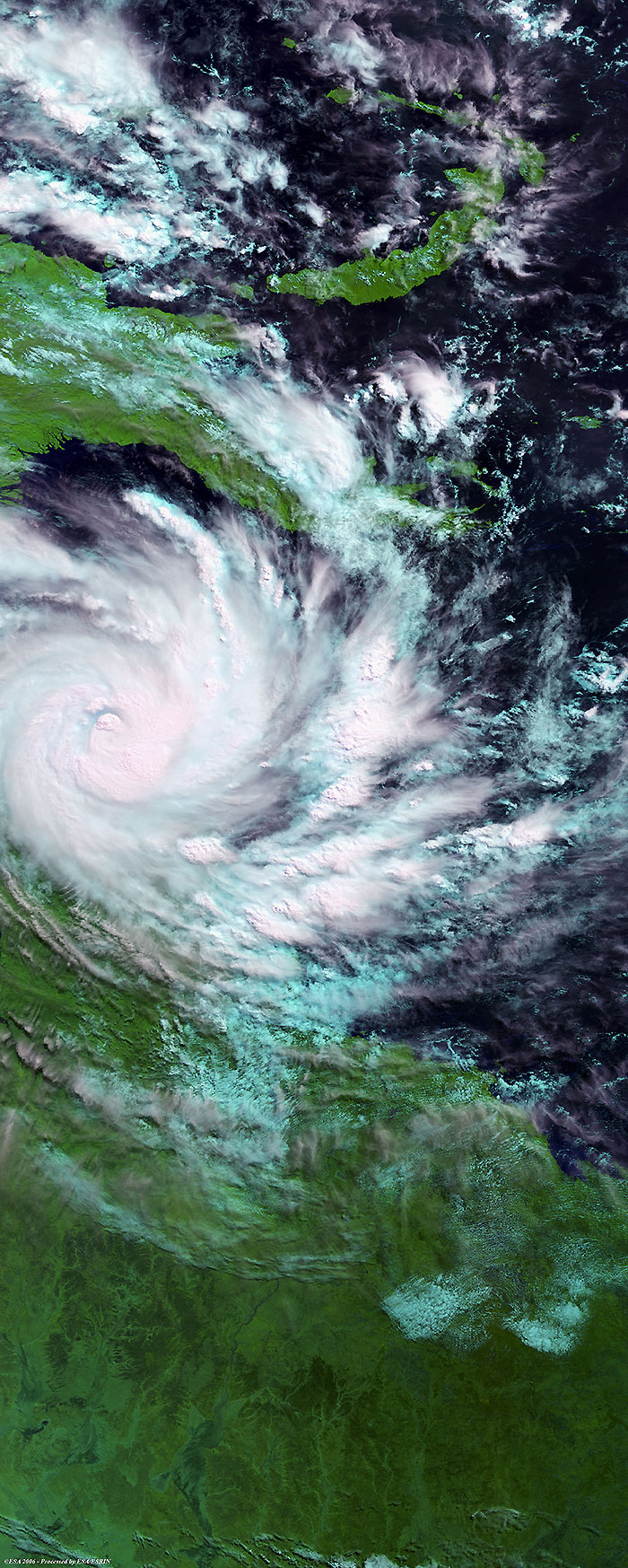
This Medium Resolution Imaging Spectrometer (MERIS) image was acquired on 18 April 2006 and shows tropical Cyclone Monica (middle left image) battering northeastern Australia's Cape York peninsula.
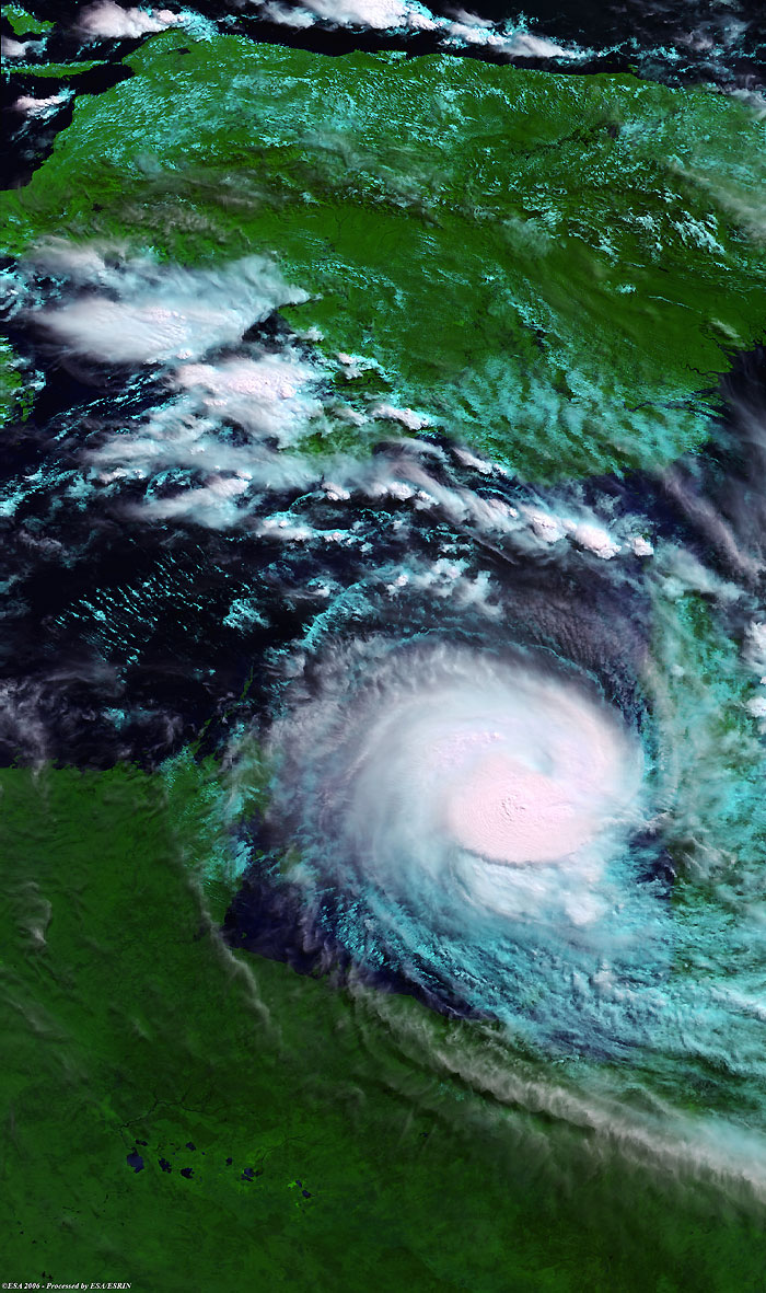
This Medium Resolution Imaging Spectrometer (MERIS) image was acquired on 21 April 2006 and shows tropical Cyclone Monica (middle right image) battering northeastern Australia as it moves into the Carpentaria Gulf.
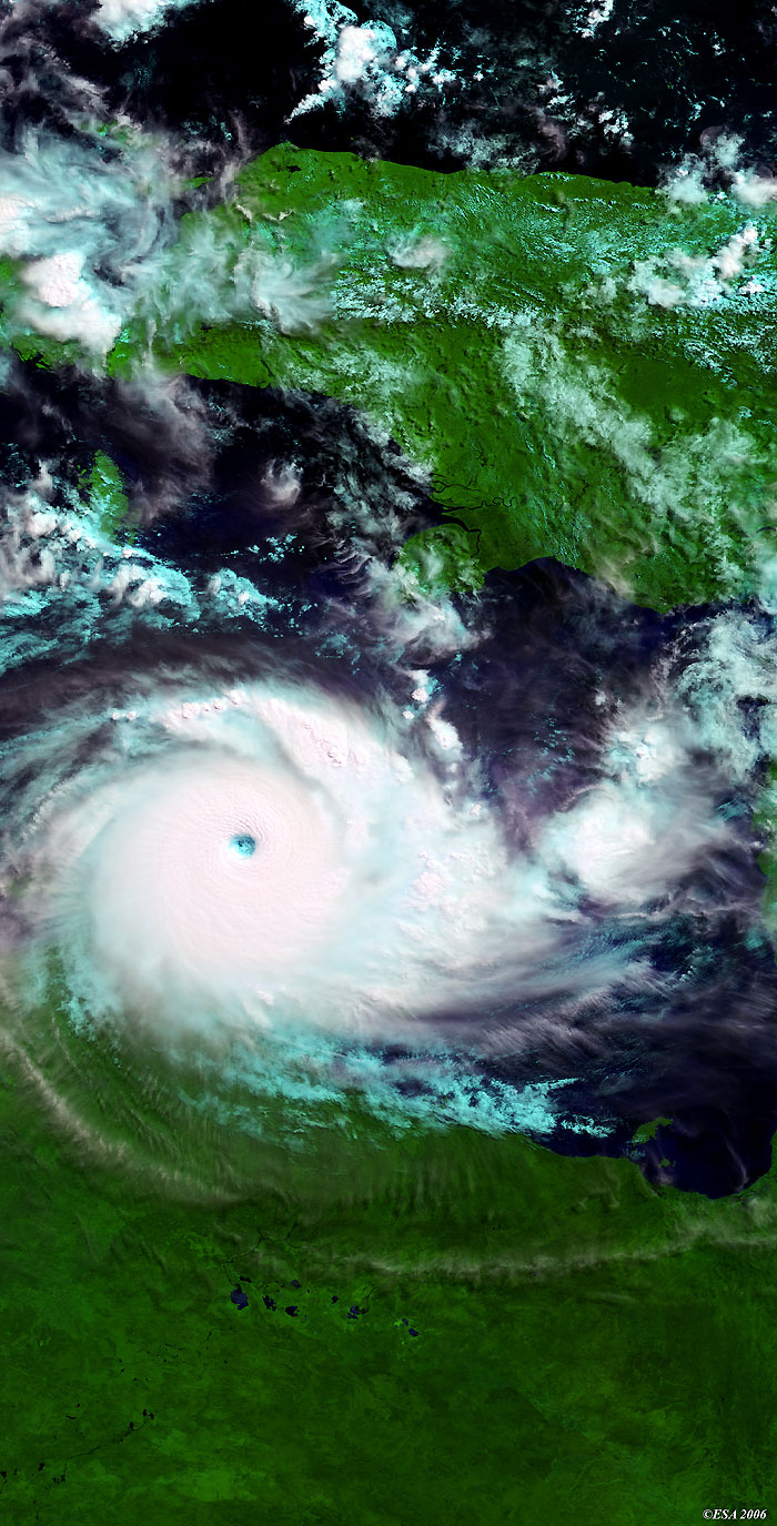
This Medium Resolution Imaging Spectrometer (MERIS) image acquired on 24 April 2006 shows the latest image of tropical Cyclone Monica (middle left image) that battered Arnhem Land, an historical region and Aboriginal reserve, in the north-eastern Northern Territory of Australia.
Back to top
 Cyclone Monica (Australia) - April 2006