Minimize Cyclone Gonu (Arabian Sea) - June 2007

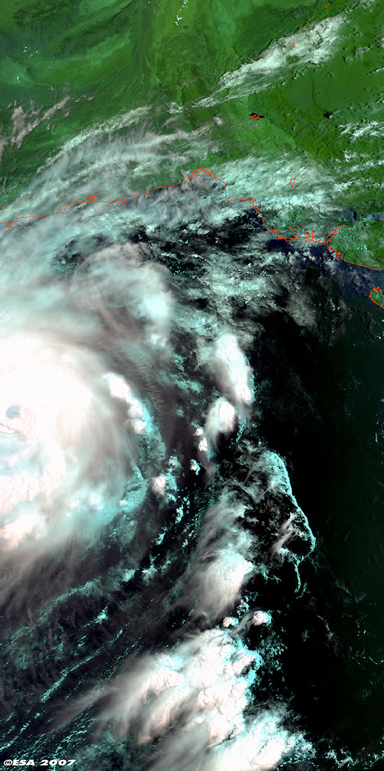
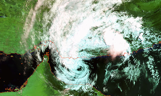
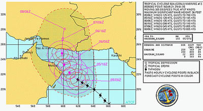
5 June 2007 (from AFP) - Cyclone Gonu is advancing towards the oil-producing state of Oman, packing winds of up to 260 kilometres an hour.

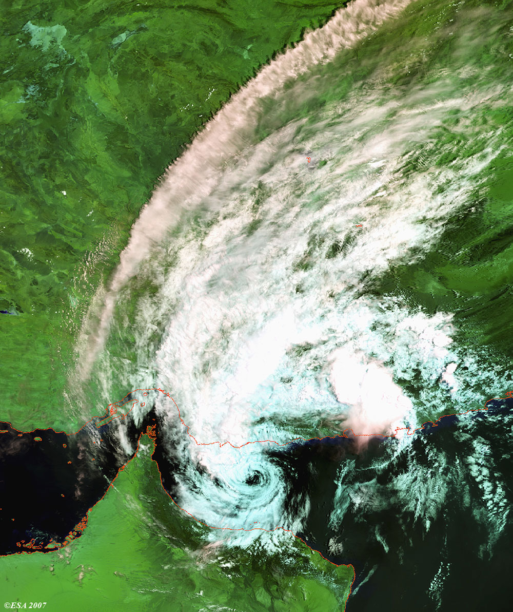
Envisat views of Cyclone Gonu

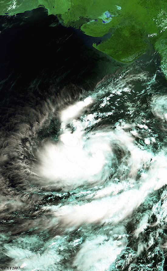
Cyclone Gonu over the Arabian Sea, approaching the Gulf of Oman. MERIS reduced resolution image.

View large image [JPG 151 KB] and corresponding swath [JPG 40 KB]
Technical Information
Product: MERIS_RR_1P (1200 metre resolution)
Satellite: Envisat
Instrument: Medium Resolution Imaging Spectrometer (MERIS)
Date of acquisition: 02 Jun 2007
Orbit: 27471
Orbit direction: Descending
Band combination: 7, 5, 2 (RGB)

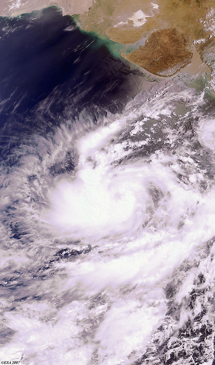
This image was taken by Envisat on the same orbit as the above image, but this image was produced as Full Resolution rather than Reduced.

View large image [JPG 234 KB] and corresponding swath [JPG 40 KB]
Technical Information
Product: MERIS_FR_1P (300 metre resolution)
Satellite: Envisat
Instrument: Medium Resolution Imaging Spectrometer (MERIS)
Date of acquisition: 02 Jun 2007
Orbit: 27471
Orbit direction: Descending
Band combination: 7, 5, 2 (RGB)

Gonu is expected to make landfall in Oman within 24 hours. Oman has evacuated 7,000 people from coastal areas. Residents of the island of Masirah in the Arabian Sea as well as of Oman's eastern coastline have sought refuge on higher ground.

View large image [JPG 171 KB]
Technical Information
Product: MERIS_FR_1P (300 metre resolution)
Satellite: Envisat
Instrument: Medium Resolution Imaging Spectrometer (MERIS)
Date of acquisition: 05 Jun 2007
Orbit: 27514
Orbit direction: Descending
Band combination: 11, 14, 3 (RGB)
View large image [JPG 149 KB]
Technical Information
Product: MERIS_RR_1P (1200 metre resolution)
Satellite: Envisat
Instrument: Medium Resolution Imaging Spectrometer (MERIS)
Date of acquisition: 07 Jun 2007
Orbit: 27543
Orbit direction: Descending
Band combination: 11, 14, 3 (RGB)
NOAA advisory
Map of area

Back to top