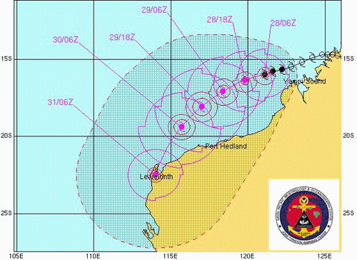
SYDNEY, March 28, 2006 (From AFP) - Australia was bracing for its second top-category superstorm in a week Tuesday as tropical cyclone Glenda headed toward the western coast. The storm was becoming more powerful and was likely to reach category five status as it hits the Pilbara mining area in the next few days, said Noel Puzey from the bureau of meteorology. Emergency workers in the sparsely-populated region urged residents to batten down in order to avoid a repeat of the devastation tropical cyclone Larry wrought on the other side of Australia last week. Larry tore into Queensland's northeastern coast, destroying buildings, wiping out crops and leaving a damage bill expected to amount to a billion dollars over the next several years. It has since dissipated but the remnants of yet another tropical cyclone, Wati, have provided an unwanted headache for lifesavers along Australia's entire east coast. Wati has whipped up massive surf along the coast, with swells of four metres on tourist beaches such as Sydney's Bondi. Authorities have warned people to stay out of the water but have been forced to recue dozens of surfers determined to test their big wave riding skills in the rare conditions.
|
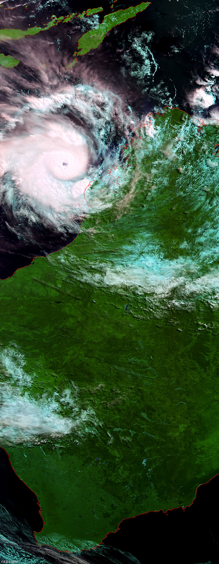
Envisat view of Cyclone Glenda |
This Medium Resolution Imaging Spectrometer (MERIS) image was acquired in near real time along the western coast of Australia and shows Cyclone Glenda during its evolution. The coastlines have been highlighted in red to define their locations.
Back to top
 Cyclone Glenda (Australia) - March 2006