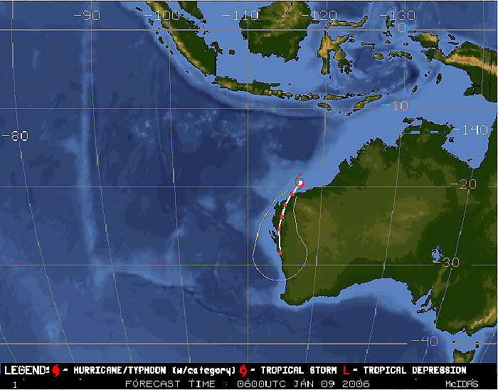
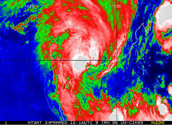
SYDNEY, Jan 9 (from AFP) - More than 1,500 people were evacuated and ports and oil production platforms were closed Monday as Western Australia's Pilbara region braced for the arrival of Tropical Cyclone Clare, officials said. The State Emergency Service (SES) issued a red alert for the towns of Karratha, Dampier, Roebourne, Wickham and Point Samson on the northwest coast, warning of a significant storm surge and local flooding. The cyclone was expected to hit the coast between Dampier and Karratha on Monday night, forcing the closure of ports, Karratha airport and some mining operations. Strong winds and heavy rain had begun battering several communities as the storm approached. "We've been looking at gusts around the 80-knot mark, which is roughly 150 to 160 kilometres an hour, being reported from the Dampier area," said weather bureau spokesman Neil Bennett. The system is expected to intensify as it approaches the coast and storm tides are expected. SES spokeswoman Neta Gill said 1,500 people had been moved out of low-lying homes at Karratha. "It is a just a precaution because the cyclone looks like crossing at high tide later today and a storm surge is expected," she said. Dampier port harbourmaster Vic Justice said the harbour had been cleared of boats but the port would be back in operation by the end of the week. "All of the terminals in the port of Dampier were cleared, the vessels all put to sea and they've gone well seaward, clear of the path of the cyclone," he told national radio. Karratha's port had also been shut, said weather bureau spokesman Bennett.
"Obviously with these systems you have not only the strong winds but also a storm tide that could lead to flooding, which would be a problem inland for the mining industry," he said. "And the strong winds and the height of waves would affect oil and gas operations. The bureau said destructive winds were likely when the system crossed the coast, possibly reaching 220 kilometres an hour if the system intensified. The Pilbara region is home to offshore oil and gas operations as well as iron ore, salt and nickel mining. BHP Billiton, Santos and Chevron had all closed down offshore oil rigs, and the closure of the ports at Dampier, Cape Lambert and Port Hedland had stopped the flow of iron ore. A spokeswoman for resources giant BHP Billiton, Samantha Evans, said the company's iron ore and mining operations were proceeding as usual but shipments could not get out.
|
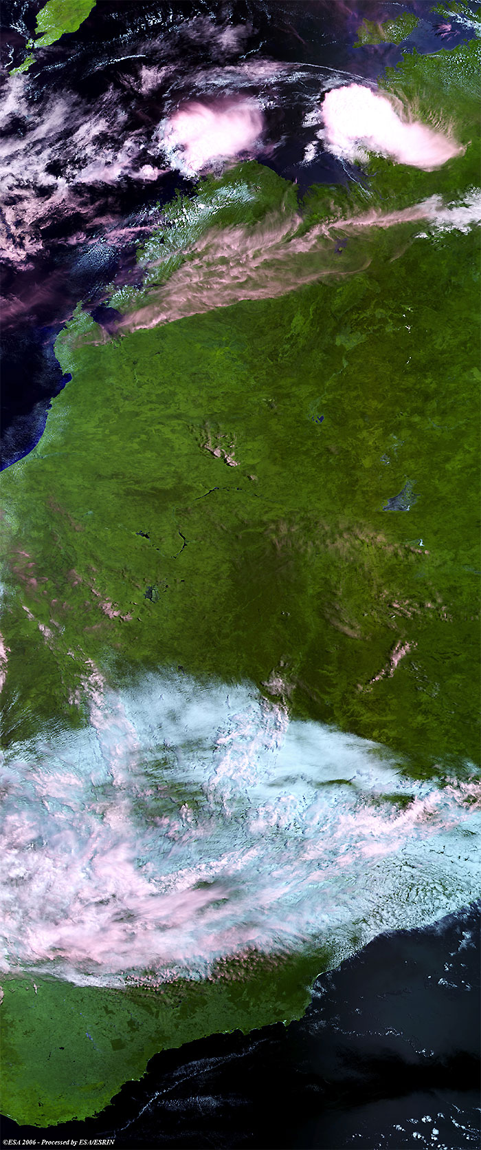
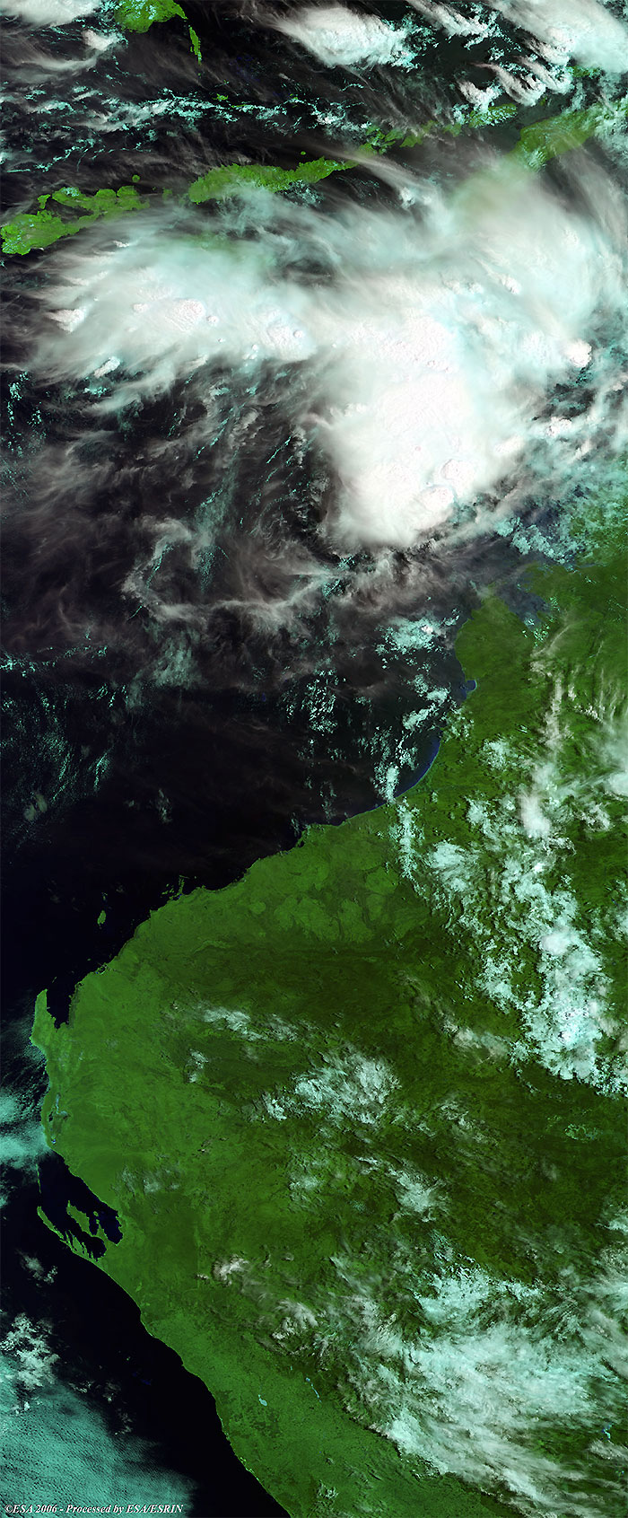
Envisat views of Cyclone Clare |
This Medium Resolution Imaging Spectrometer (MERIS) image was acquired on 11 January 2006 and shows tropical storm Clare (middle lower image) along the South-Western coast of Australia.
This Medium Resolution Imaging Spectrometer (MERIS) image was acquired on 07 January 2006 and shows tropical storm Clare (upper image) along the Western coast of Australia.
Back to top
 Cyclone Clare (Australia) - January 2006