 Sforzellina Glacier (Italian Alps)
The Sforzellina Glacier (also called the hanging Sforzellina glacier), is a small mountain glacier located in High Valtellina valley (Gavia) just north of the Gavia Pass in the Italian Alps, which connects the Valtellina with Val Camonica. The glacier is located in the Group Ortler Alps, in the Lombard region of Stelvio National Park. Facing Northwest, the Sforzellina is a classic example of a cirque glacier; a glacier which forms within a bowl-shaped area in mountains. It is in fact contained within the large cirque located at the base of the horn of the Three Lords (3376 metres above sea level). The portion of the front of the glacier is approximately 2,850 m.

These images acquired over the Sforzellina Glacier in a time window of 28 years by the Landsat 5 and 8 satellites, aim to show the impact of climate change on Italian glaciers and how this glacier in particular has changed. In fact this small glacier is considered to be an "open-air laboratory", which has been used for scientific research into climate change for many decades. The Sforzellina is one of the longest glaciers studied in Italy for the determination of variations in length, or frontal variations. Another aim of these images is to promote the opportunity to download Landsat data through the ESA portals, where images captured every day are made available in near real time to the users and the scientific community. Landsat full resolution data products are freely available for immediate download at: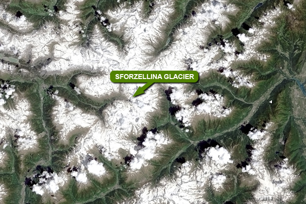 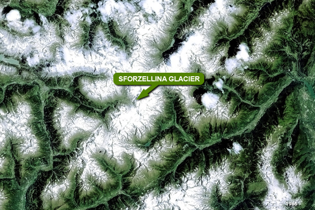 View Landsat 5 TM high resolution image (JPG 6.6 MB) View Landsat 8 OLI high resolution image (JPG 5.3 MB)
|
|||||||||||||||||||||