 Miage Glacier, Italy
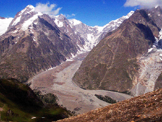
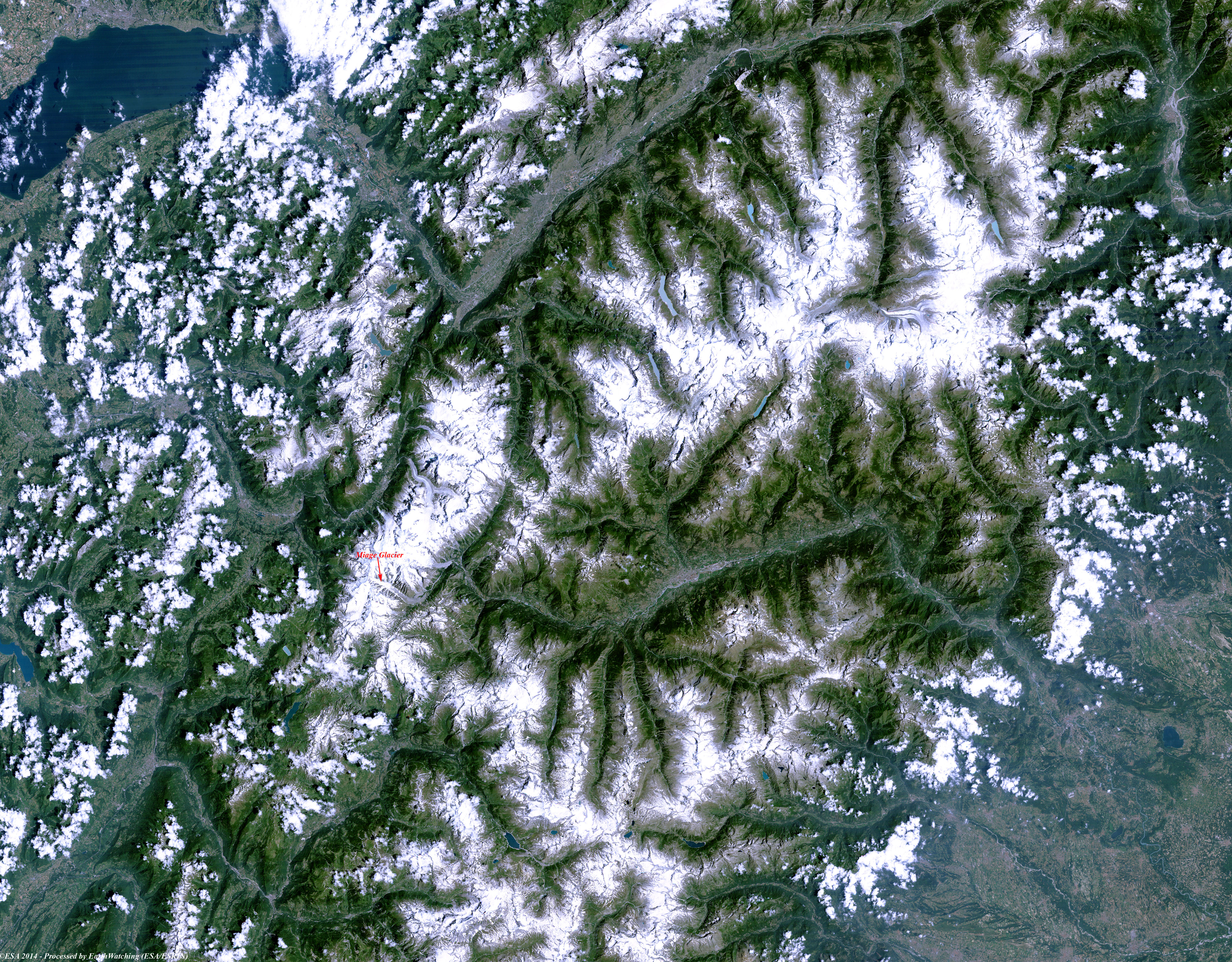
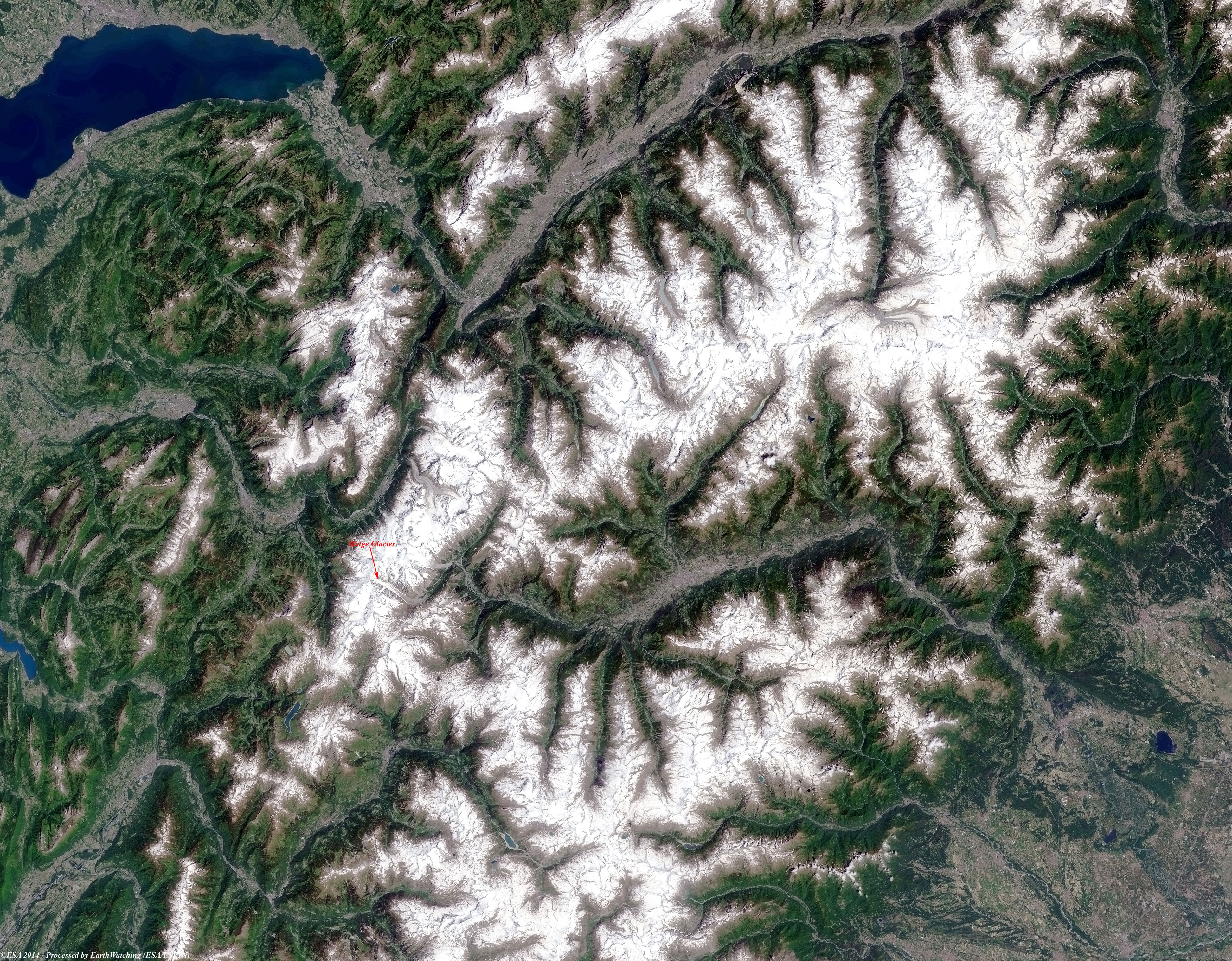
The Miage Glacier is a debris-covered glacier in northwestern Italy. It is situated on the southwest flank of the Mont Blanc massif, flowing from Col de Bionnassay (3,892 m above sea level) into Val Veny. At around 10 km in length, it is Italy's longest glacier and also the largest debris-covered glacier in Europe. Approximately 5 km2 of its total area of ~11 km2 is covered in debris originating primarily in rockfall from surrounding walls and avalanching in accumulation areas of its four tributaries. Debris carried along within the glacier is also being exposed at increased rates due to accelerating thinning of the glacier tongue. The number of sources of supraglacial debris as well as the unusual, mica schist-dominated lithology of the rock walls surrounding the glacier, makes for a varied debris lithology; debris cover becomes continuous at ~2,400 m above mean sea level and remains unbroken to the terminus. Patchy areas can occur, however, where crevasses or moulins occur. Debris thickness generally increases from a few centimetres at 2,400 m to over 1 metre at the terminus at ~1,775 m, although the spatial distribution of thickness is heterogeneous especially on parts of the northern terminal lobe.
The Lake
 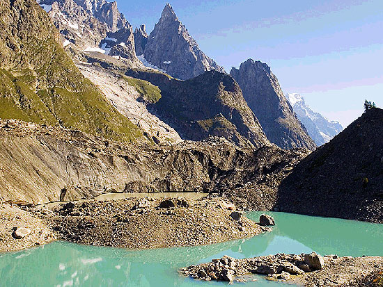
These images acquired over the Miage Glacier in a time window of 26 years by the Landsat 5 and 8 satellites, aim to show the impact of climate change on Italian glaciers and how this particular glacier has changed during this time window. The Miage glacier is a glacier compound that has the top fan shaped by the convergence of several minor tributaries. Grouping together they form the great drain that trails down from 2,500 metres high to 1,800 metres. The upper part of the glacier is crossed by crevasses and towering seracs, the part outside, which are entirely covered with moraine material and divided into three smaller columns flanked by high moraines which have formed small lakes from where the soil can grow small groups of fir and larch. Another aim of these images is to promote the opportunity to download Landsat data through the ESA portals, where images captured every day are made available in near real time to the users and the scientific community. Landsat full resolution data products are freely available for immediate download at: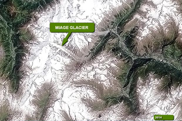 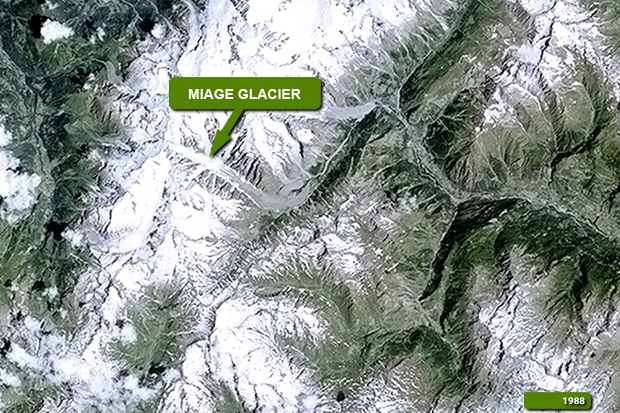 View Landsat 5 TM high resolution image (JPG 4.5 MB) View Landsat 8 OLI high resolution image (JPG 4 MB) View Landsat 8 OLI magnified view of glacier (JPG 171 KB)
|
|||||||||||||||||||||