 Marseille, France
Marseille, also known in English as Marseilles, is the second-largest city in France. The capital of the Bouches-du-Rhône department and Provence-Alpes-Côte d'Azur region, it is located on France's south coast and had a population of 852,516 in 2012, and an area of 241 km2, the third-largest metropolitan area in France after Paris and Lyon. Known to the ancient Greeks and Romans as Massalia, Marseille was the most important trading centre in the region and the main commercial port of the French Republic. Marseille is now France's largest city on the Mediterranean coast and the largest port for commerce, freight and cruise ships. The city was European Capital of Culture, together with Košice, Slovakia, in 2013. It hosted the FIFA World Cup 1998 and the UEFA Euro 2016, and will be the European Capital of Sport in 2017. The city is home to several campuses of Aix-Marseille University and part of one of the largest metropolitan conurbations in France, the Metropolis of Aix-Marseille-Provence. More information is available on Wikipedia.
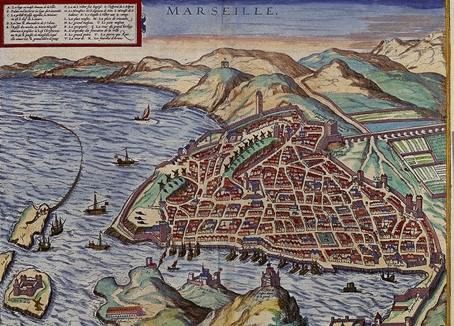
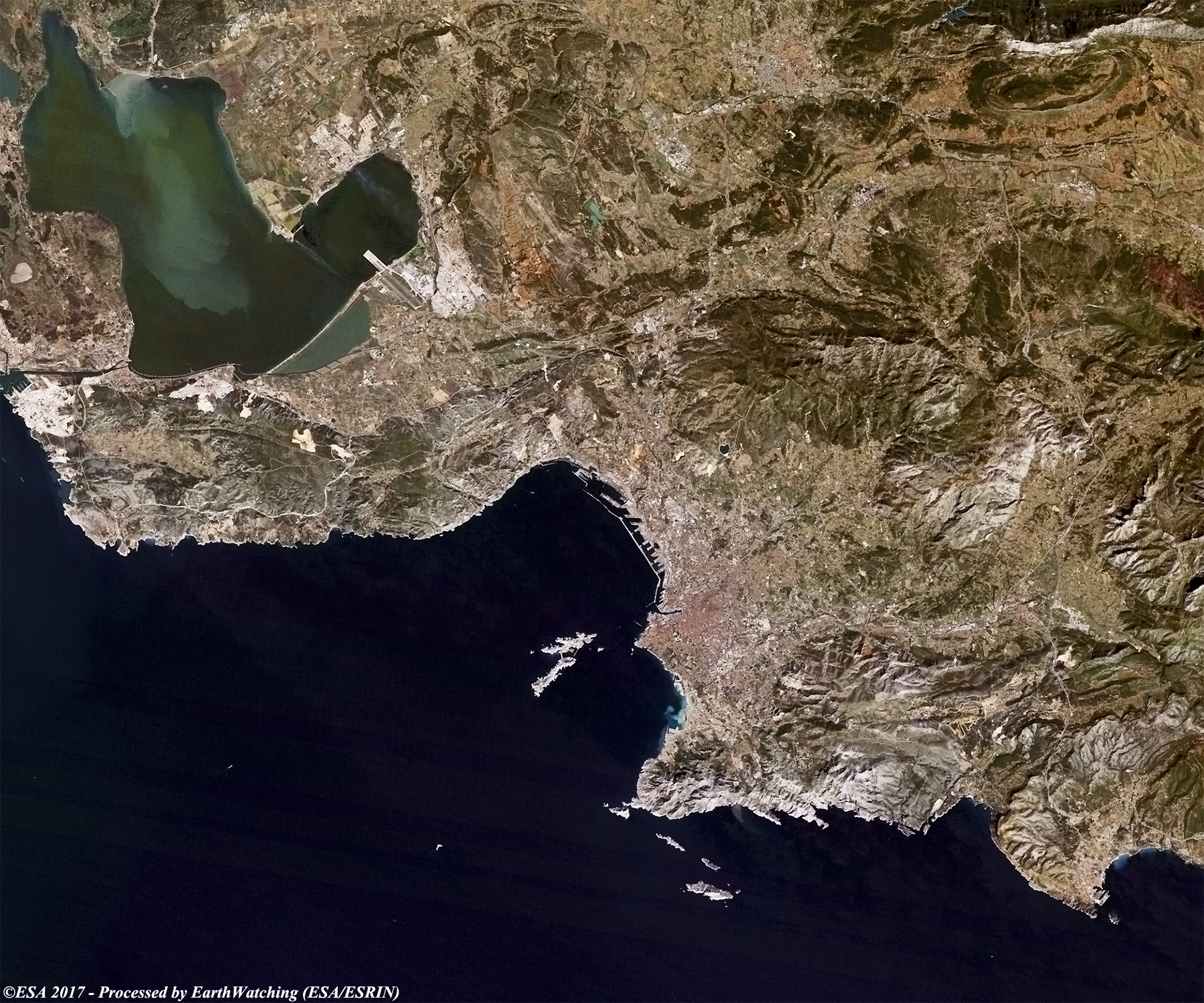
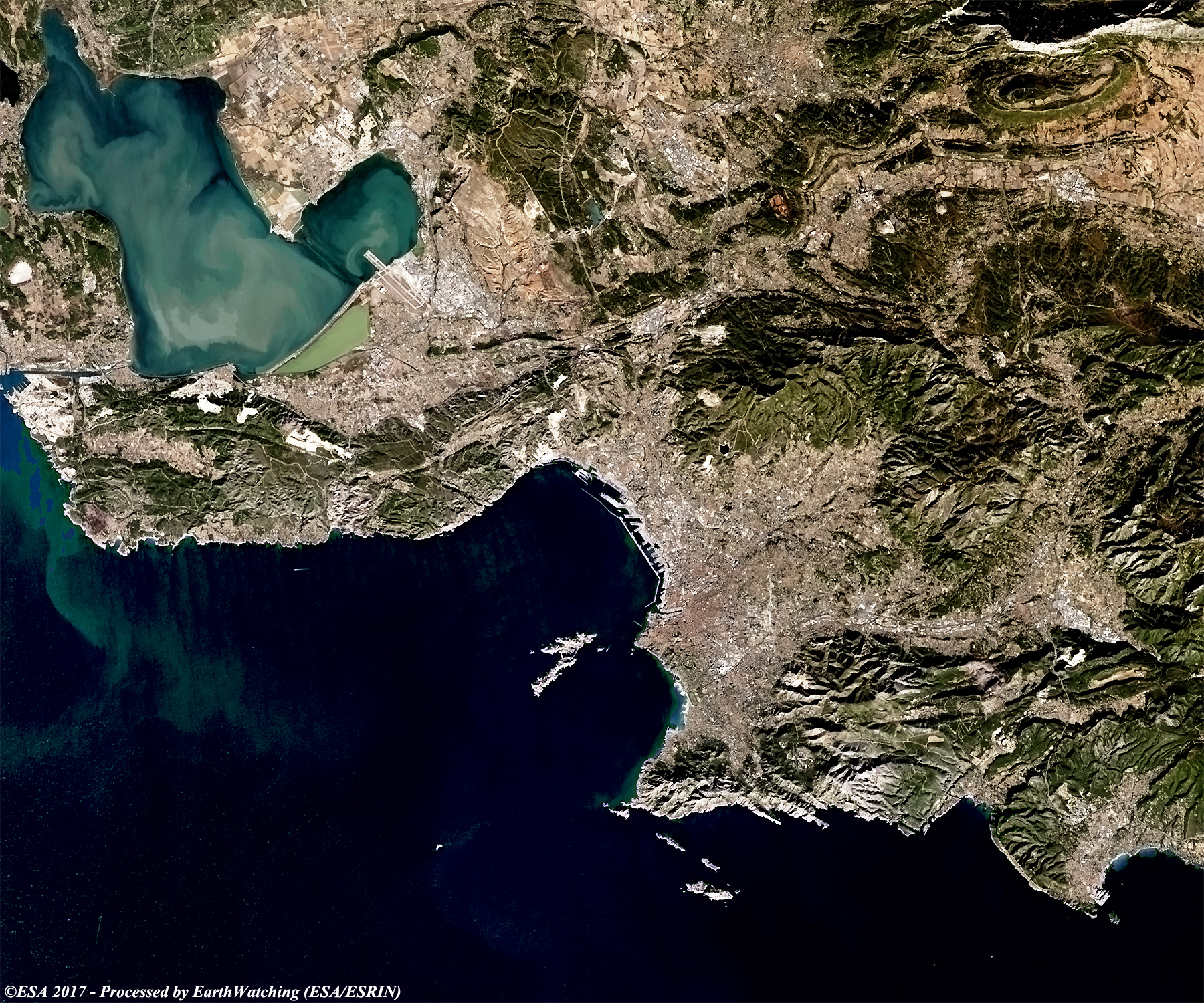
Today we focus our tour over the city of Marseille or Marseilles, which is located in the south of France. It is the capital city of the Bouches-du-Rhône department, on the Gulf of Lion (an arm of the Mediterranean Sea). Being the second-largest city in France, it consists of a major sea port and it is an important commercial and industrial hub. This city is linked by canal to the River Rhône and is served by extensive rail and air transport facilities; the large petroleum port of Fos, chiefly developed in the 1970s, is also nearby. Goods manufactured in the Marseille metropolitan area include iron, steel, chemicals, plastic, metal products, ships, refined petroleum, construction materials, alcohol, and processed food. The city attracts immense foreign investment as an important stock exchange is situated here. The aim of these images acquired by the Landsat family, with a time window (before/after) of 33 years, is to show how significantly Marseille has changed since 1984. The skyline of the city has developed with new areas constructed, particularly on the nothern area where the airport is located. Another aim of these images is to promote the opportunity to download Landsat data through the ESA portals (or third party mission free catalogue), where images captured every day are made available in near real time to the users and the scientific community. Landsat full resolution data products are freely available for immediate download at: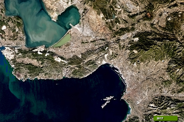 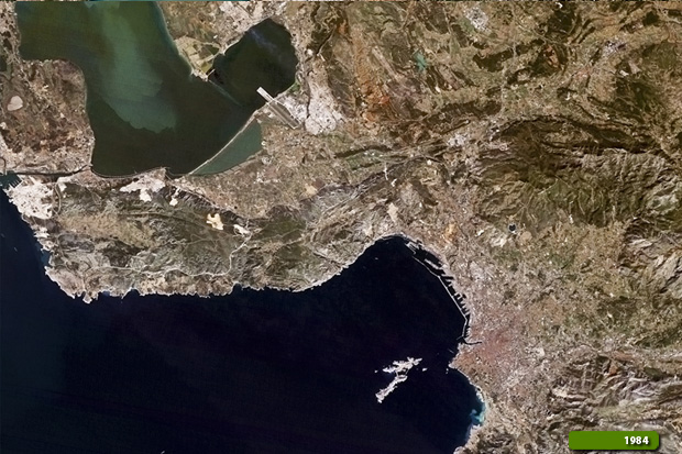 View Landsat 5 TM high resolution image (JPG 2.3 MB) View Landsat 8 OLI high resolution image (JPG 2.9 MB)
|
|||||||||||||||||||||